The powerful Rex Block that dominated Europe over Christmas is finally shifting west, allowing an Arctic cold pool to spread across the continent as the final week of 2025 begins. The Arctic cold blast will rapidly spread across eastern, central, and southern Europe before the New Year, bringing snow and freezing weather. Through early 2026, the pattern flips, getting a new Arctic cold outbreak in Western Europe.
The weather pattern over the Atlantic and Europe is back to progressive and dynamic, as a strong dipole is developing as December ends. These dynamics are forecast to continue into 2026 with more cold in the West and Warmth in the East, including deep snow and excessive rainfall events.
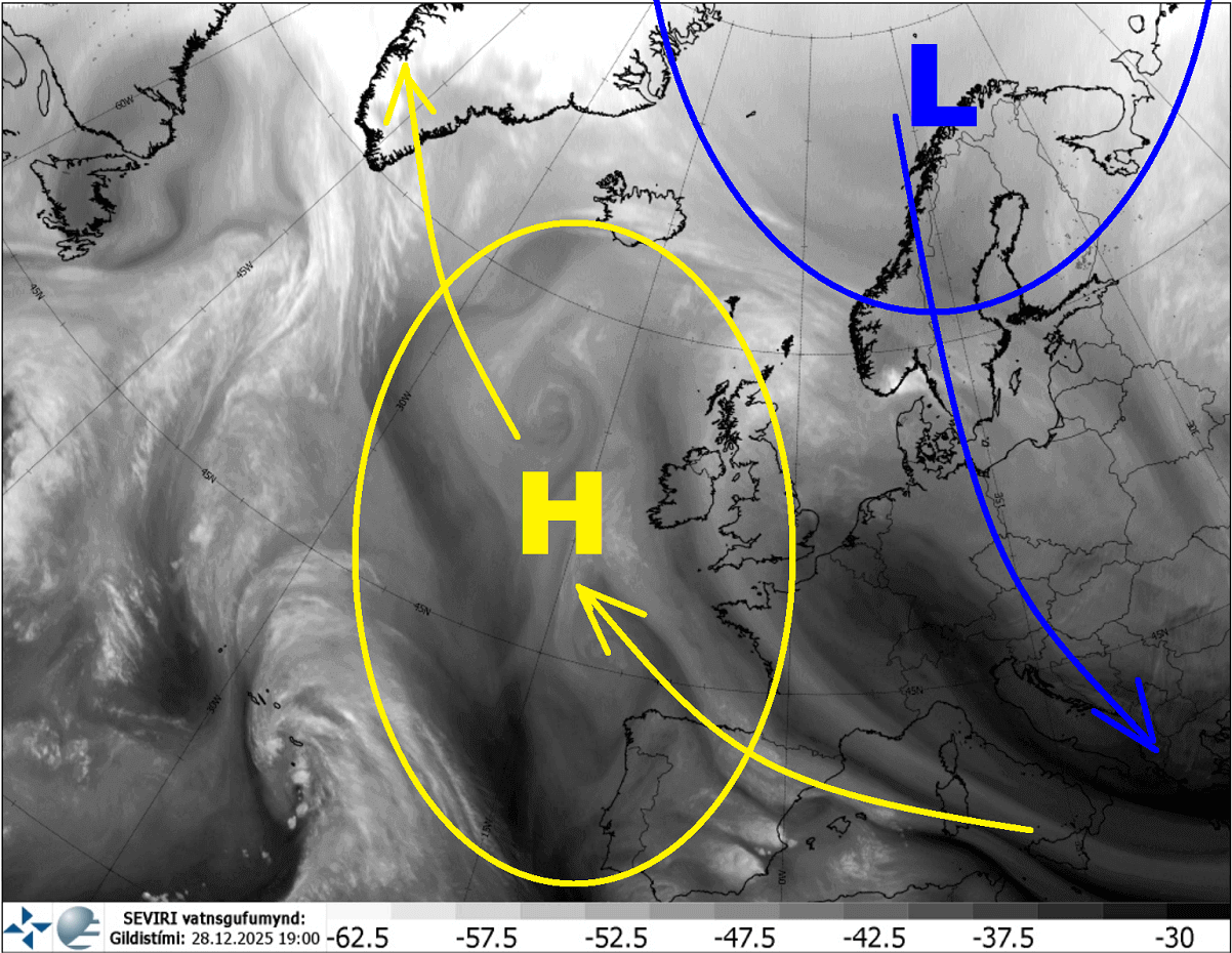
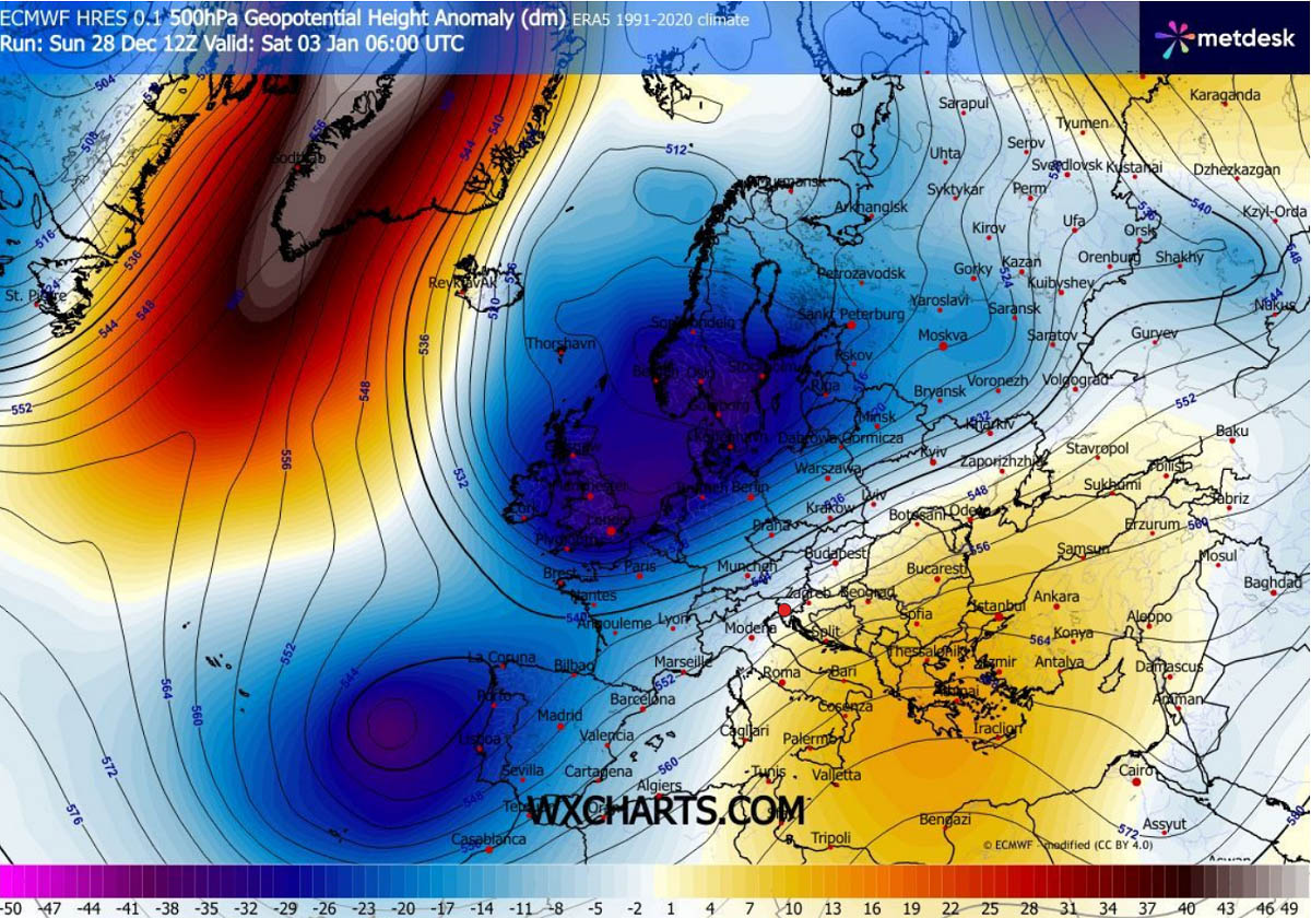
The current weather picture over Europe indicates a significant blocking High over the Atlantic and Western Europe. It is the retrograding Rex Block that dominated the continent last week. The ridge is strengthening towards the north and expanding.
Further north, a deep upper trough with Polar cold intrusion is grazing into Scandinavia and northern Europe. This trough is expanding and deepening, accelerating towards the south in the following days. It will deliver a Polar cold air mass across the eastern two-thirds of the European continent.
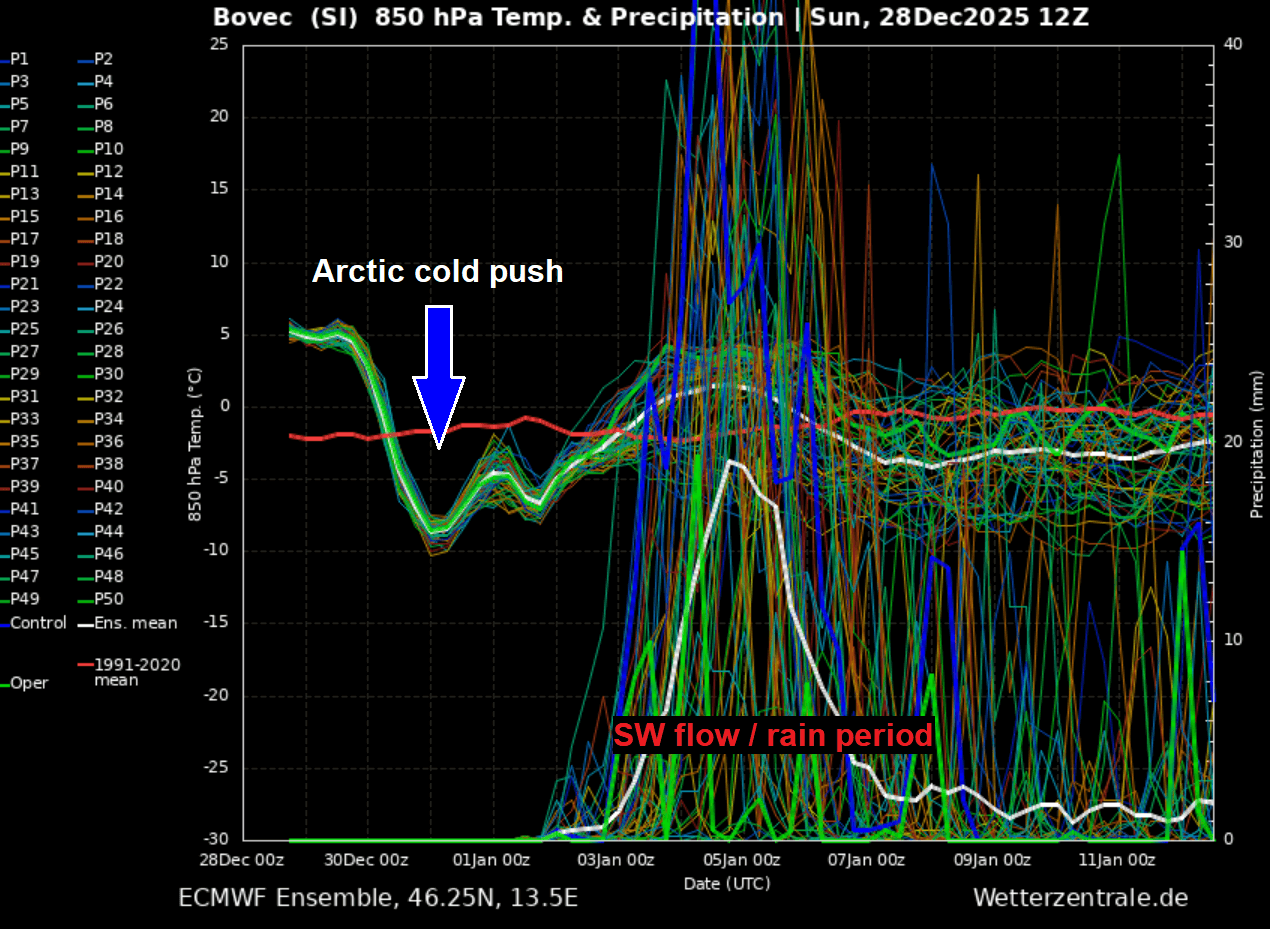
The return of the dynamic pattern is best represented with the meteogram chart. Here, we can see the chart for Bovec, Slovenia, along the southern and eastern Alpine slopes in central Europe. Notice the around 15 °C temperature drop as the Arctic air mass arrives on Monday night, followed by a cold pool throughout the week into the New Year.
Then, as the pattern over Europe flips, the SW flow returns, bringing high moisture from the Mediterranean towards Central Europe, along with higher temperatures again. A long-lasting rain event will likely follow, with deep snow for the higher Alps.
Now, let’s take a quick look at the next 10 days in the GIF animation below. We can see how the activity over Europe is progressive, with patterns flipping back and forth, inducing frontal systems and cold/warm waves across the continent.
While this week will bring much colder weather back to the continent, a westward shift could follow after the following weekend if deep troughing re-emerges over the North Atlantic.
Let’s dig into the details of the pattern evolution as December ends and 2026 starts. At least the wintry dynamics are back!
Textbook dipole weather pattern establishes: Strong blocking High over the Atlantic, deep Low over Europe
As mentioned earlier, the shift of the Rex Block pattern from northern Europe back into the North Atlantic is allowing the Polar trough intrusion to its east. This forms a dipole pattern, with a strong gradient between the High and the Low, meaning we will get a powerful northerly jet stream across Europe.
This brings a much colder Polar air mass towards the south, with an accelerated phase, and the much colder air mass spills across the eastern and central European plains, reaching the Balkan peninsula by Tuesday and continues towards the Black Sea region and Turkey through midweek.
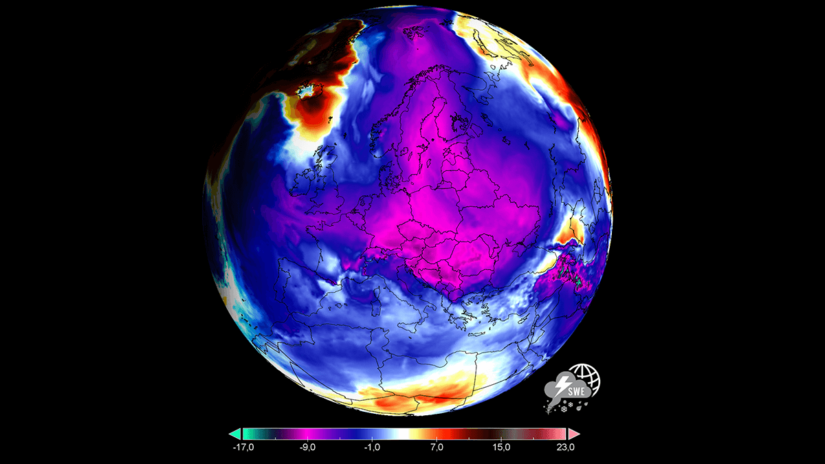
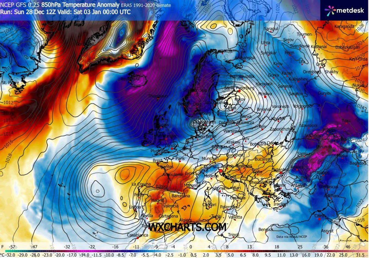
The Polar air mass will be around 12-15 °C colder than normal as it spreads across a large portion of the continent in the coming days.
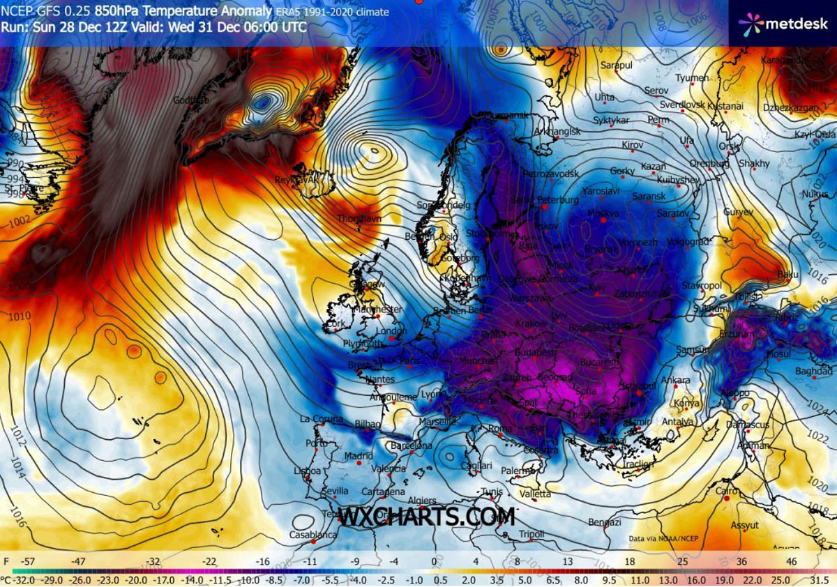
The worst cold will reach Poland, Eastern Germany, the Czech Republic, Slovakia, and Hungary by Monday night, then continue south with a rapidly moving Polar front on Tuesday. Reaching Greece by Tuesday night. The cold pool will also expand across Central Europe towards the West, reaching south-central France and Spain by Wednesday.
At the surface, temperatures are forecast to be around 10-15 °C colder than usual from Tuesday through the New Year on Thursday, meaning morning lows will be near or even below -10 °C in some areas. Also, the daily highs will remain around freezing.

Where the colder air mass will have the most significant effect, and where it will be combined with more moisture, can be clearly seen on the snowfall forecast chart. Notice the new snow will accumulate across Northern and Eastern Europe, partly over the Balkans and the Black Sea region.
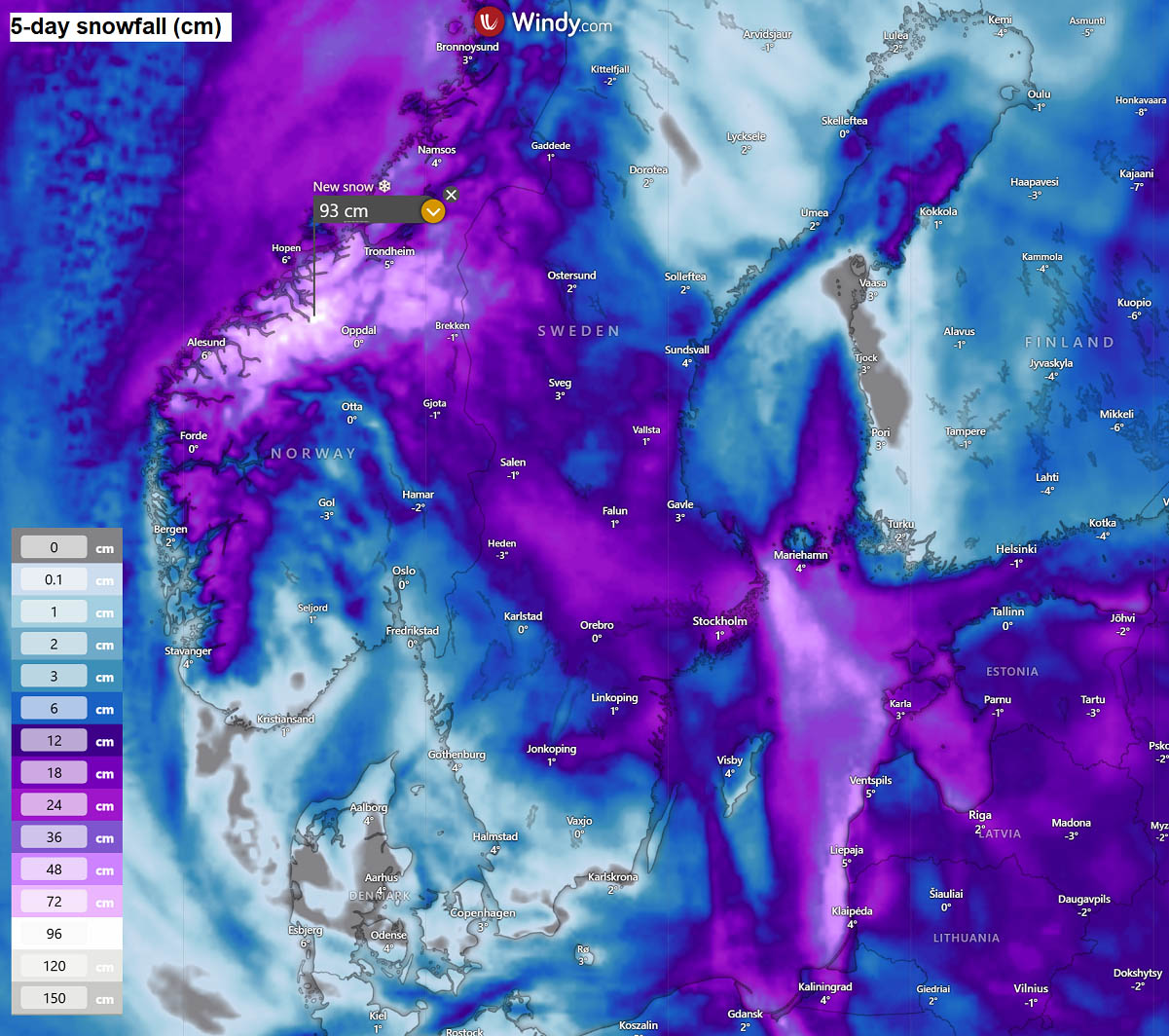
Two areas can be seen with more significant snowfall: Norway and Sweden, and Turkey.
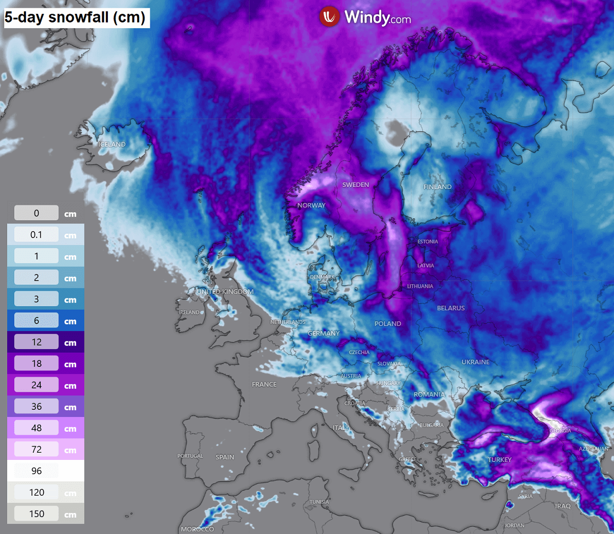
What happens over Norway’s abundant snowfall is related to the persistent northerlies, trapped within the meridional flow between the Low on the East and High on the west. This results in heavy orographic snowfall across much of the higher terrain in both countries.
The heaviest snowfall is likely over Norway, with 75-100 cm of fresh snow possible by Friday. A lot of snow is also expected for the coastal cities, as well as over central Sweden and further east across the Baltic Sea into Lithuania and Latvia.
This is because the Polar air mass will be blowing across the warmer Baltic Sea, resulting in the sea-snow effect, with convective heavy snowfall accumulating downwind inland into the Baltic countries.
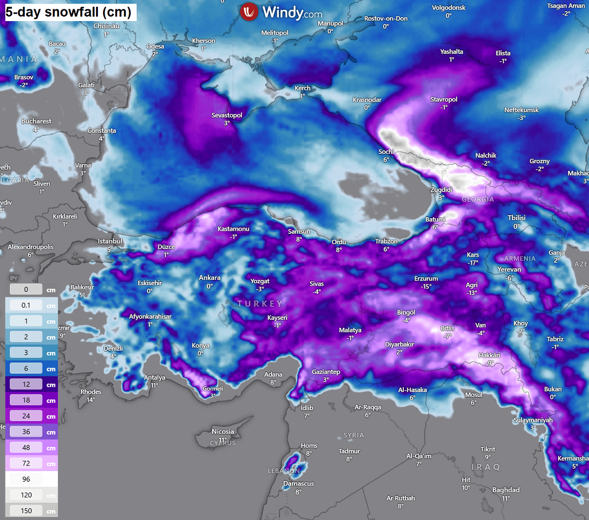
Another focus for an abundant snow pack is the Black Sea and Turkey. Here, the classic effect of warm Black Sea waters comes into play. With Polar air masses blowing across, it usually results in very heavy snowfall in Turkey’s higher terrain.
Some areas should receive more than half a meter of fresh snow by next weekend.
Elsewhere, the snow amount will not be particularly significant, but some small accumulations are possible.
As January 2026 starts, the weather pattern flips around, delivering cold into Western Europe
What is becoming interesting after the New Year is the flip in the weather pattern again. This is what dynamics means after the Polar Vortex split earlier this month: more waves and more rapid weather changes across the continents.
By the following weekend, the North Atlantic ridge remains strong but gradually moves over Greenland, allowing the trough over continental Europe to expand further westward, engulfing Western and Southwestern Europe. So the northeasterly flow establishes on the West, while southwesterlies return on the front-end of the large trough.
This also results in a new ridge taking place from the southern Mediterranean into Southeast Europe.
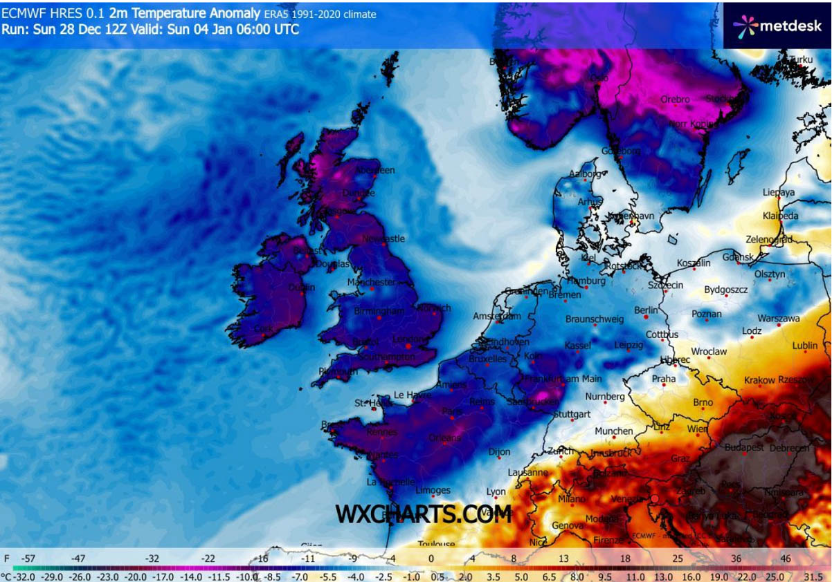
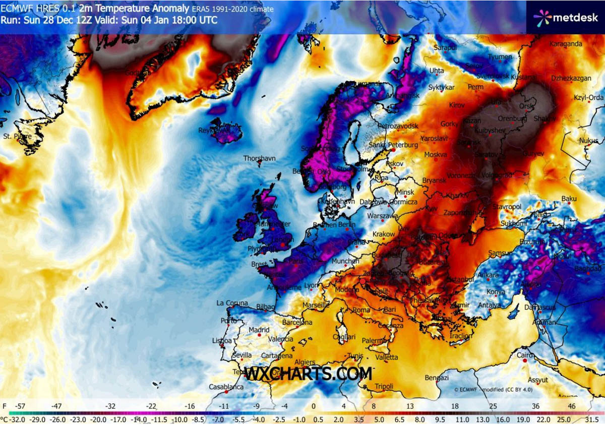
With the strong blocking now over Greenland and a deep Low over Western Europe, the new Polar air mass intrusion is established. This time, further west than early this week. So it spreads across Iceland, the Faroe Islands, the UK, Ireland, and towards Spain and Portugal over the weekend.
Temperatures with this Arctic cold pool will also be frigid, with 12-15 °C below normal for early January. We can also see that the gradual warming occurs over the Mediterranean, with the remnants of the first cold pool over Turkey and Georgia.
At least for a couple of days, the wintry cold spell will spread across Western Europe, including Ireland, the UK, and part of France. Temperatures will be around 10-15 °C below normal, with morning lows from -5 to -10 °C in some areas.
The worst cold is forecast across the UK and Ireland on Sunday, then across western France and northern Spain on Monday.
As the Polar cold arrives from the north, there is minimal moisture ahead of it to support a proper frontal system. Therefore, chances for any significant snowfall are low.
However, some snow will develop with an Arctic cold air mass as it blows across Western Europe, so snow squalls from the seas will move inland, with some accumulations across Scotland, Northern Ireland, and possibly Wales as well.
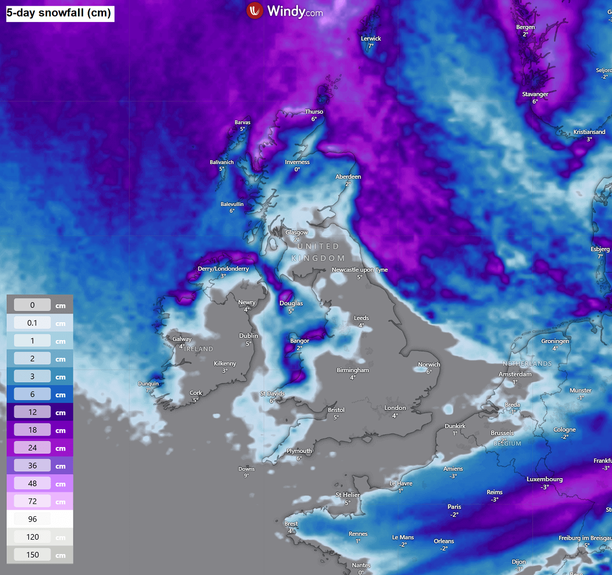
Some fresh snow is also forecast along the Polar front as it moves into France on Saturday, changing rain to snow along the baroclinic zone associated with the cold core of the trough aloft. 5-10 cm of snow could accumulate by Saturday night.
Early January trends hint at further cold in the West, and a return to Warmth and rain in the East
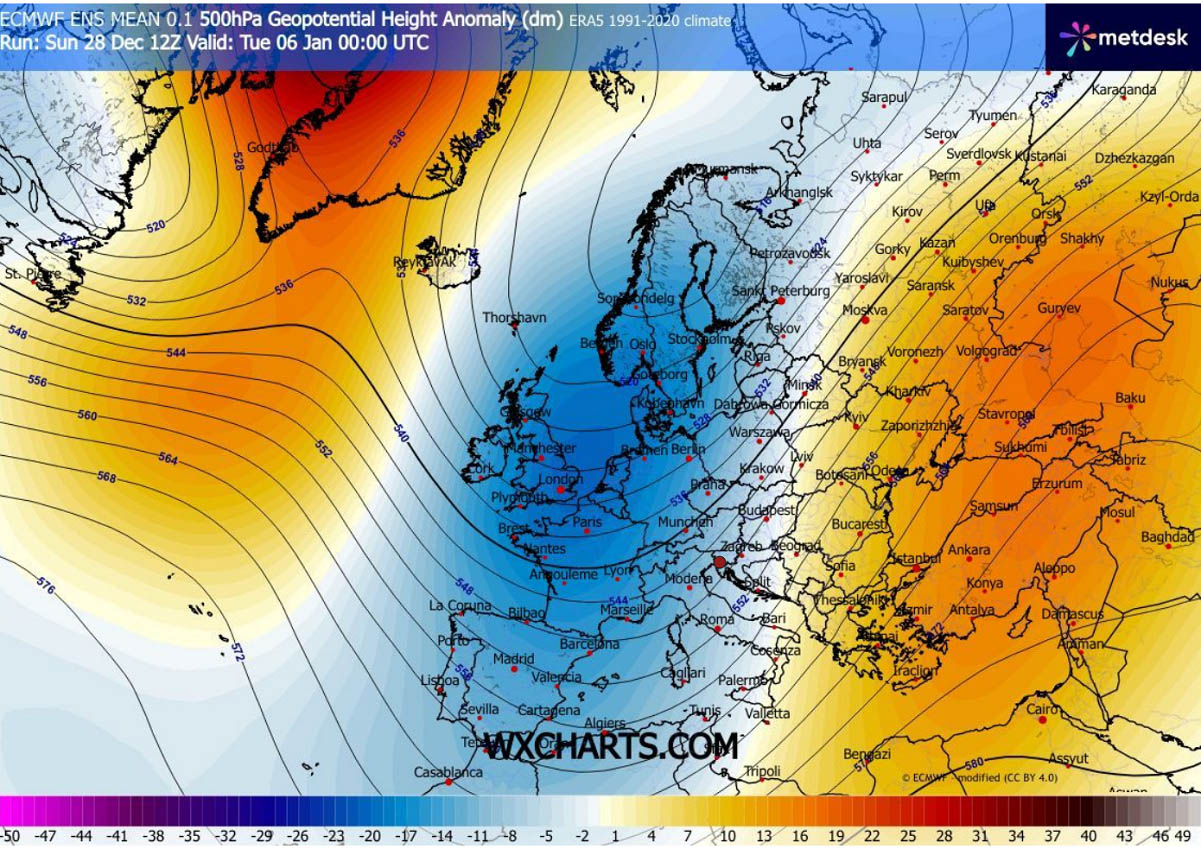
What can be seen in the mid-term trends: this flipped pattern expected for the following weekend is likely to continue into next week. A large, long-wave trough establishes over Europe, keeping the cold on the Atlantic side and warmth over the European continent.
In general, this means that winds will become more zonal again, with persistent southwesterlies across the Mediterranean into Central and Eastern Europe, and the Balkan peninsula.
This delivers a lot of moisture back into the continent.
Here’s a perfect picture that represents this pattern. As the deep wave sits over the western half of Europe, it continues to drag the Polar air mass from the Arctic into the Atlantic and Western Europe, feeding itself with constant cold intrusion from above.
Contrary, ahead of the trough, persistent strong southesterly winds bring a much warmer and moist air mass back into the continent. The temperature contrast across Europe, therefore, becomes significant, with much warmer days from the Mediterranean into the Balkans and Eastern Europe next week.
It remains very cold over Western and Southwestern Europe.
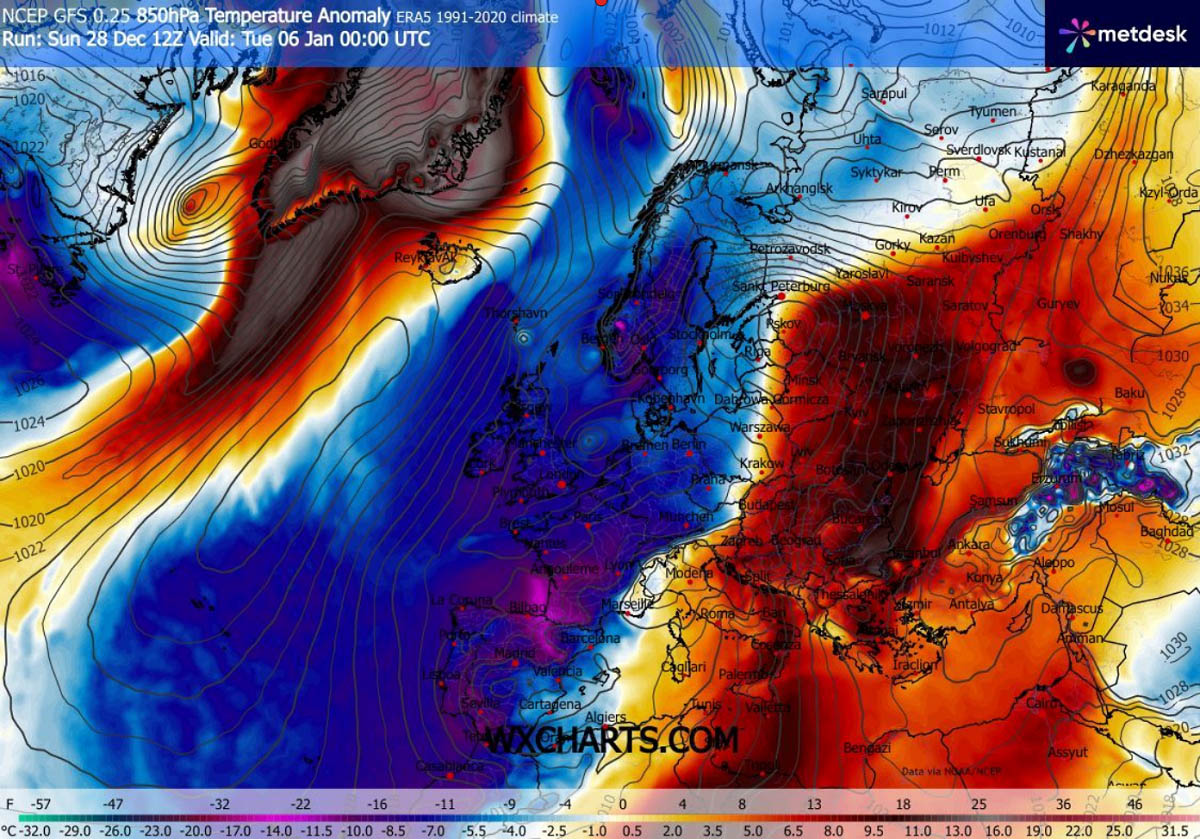
The temperature response on the surface level is similar. We can see that around 6-12 °C colder-than-normal weather persists across Northern and Western Europe, while a much warmer air mass develops over the Balkans and into Eastern Europe.
Temperatures will be around 15 °C above normal in some regions, meaning daily highs will return to the 10-15 °C range locally, even higher when clear skies and downslope dry winds develop in the wake of mountain ranges.
As is typically the case, the persistent southwesterly flow brings a lot of moisture back over the continent, inducing orographic precipitation along the western and southern slopes of the mountain ranges.
This is especially pronounced along the southern Alpine flank, along the western slopes of the Dinaric mountain chain across the Western Balkans and the Apennines in Italy. It could result in 150-300 mm of rain over a week.
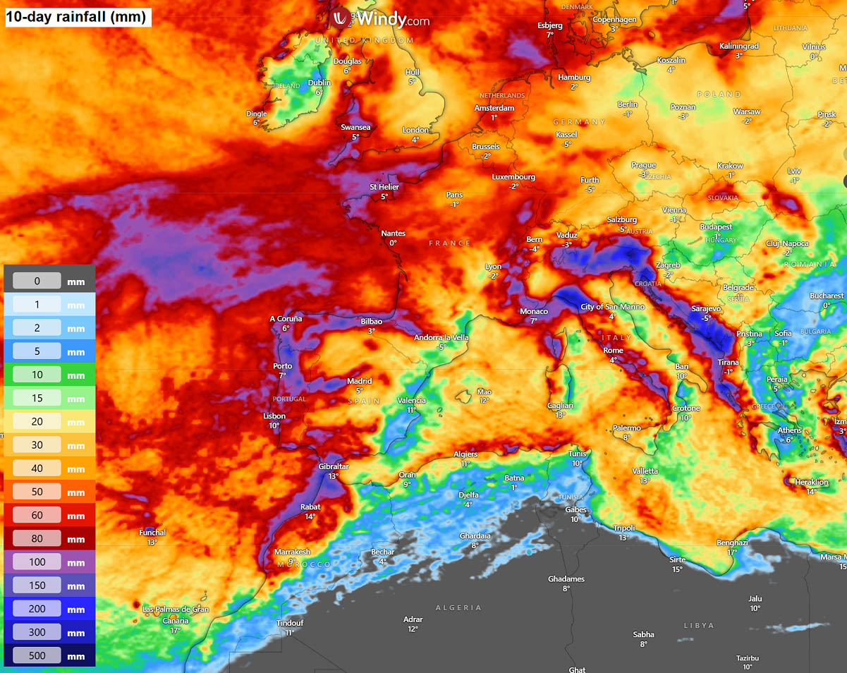
A lot of rain is also forecast across Portugal, parts of Spain, and Morocco, as a deep surface low develops over the following weekend beneath the trough aloft.
We continue to monitor patterns as we head into the New Year closely, so stay tuned for further updates.
Windy and Wxcharts provided images used in this article.
See also:
Christmas 2025 Forecast: Rex Block brings colder air, snow to Central Europe and the Balkans