A strong Stratospheric Warming event occurred two weeks ago, collapsing the Polar Vortex. But we are now seeing a major pattern shift over North America as a result of that event, with a power struggle between Summer and Winter coming in April over the United States and Canada.
We are tracking large-scale pressure changes as the result of the collapse of the Polar Vortex, caused by the rapid rise in temperature and pressure in the stratosphere.
The latest forecasts show a rapid pressure pattern change is coming over North America in April. It will bring unusually cold temperatures to parts of the eastern United States and Canada, and also some Spring Snowfall across the Midwest and the Northeast.
THE GREAT POLAR VORTEX
The best way to understand the Polar Vortex is to see its structure. But in simple terms, it is a name that describes the broad winter and cold weather season circulation over the northern (and southern) hemispheres.
Below is a 3D image example of the Polar Vortex. The vertical scale in the image is enhanced for better visual presentation. But it shows the actual structure of the Polar Vortex, connecting from the stratosphere down to the lower levels and the pressure systems.
The Polar Vortex extends high into the middle and upper layers of the atmosphere. The lowest layer is called the troposphere, where all weather events occur. But above that, we have the stratosphere, a deeper and drier layer.
For this reason, we separate the Polar Vortex into an upper (stratospheric) and a lower (tropospheric) part. They both play their roles differently, so we monitor them separately. But, both parts together form the circulation across the Northern Hemisphere during the colder part of the year (October-March).
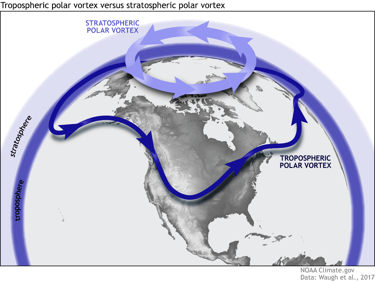
To simplify, all you need to know is that the upper and lower parts of the Polar Vortex are connected. Changes in the upper part can significantly impact the weather anomalies in the lower parts of the atmosphere and the weather at the surface.
For example, a weak Polar Vortex can greatly increase the odds of cold and snow across the central or eastern United States. In nature, that means a heavy disruption of the jet stream and a release of cold air from the polar regions, depending on the month of the year.
To summarize, the main takeaway should be that the Polar Vortex is the entire weather circulation over the Northern Hemisphere and not just one cold/storm event over the Midwest or the northeastern United States.
STRATOSPHERIC WARMING AND COLLAPSE
In mid-March, just two weeks ago, we observed a Sudden Stratospheric Warming event (SSW). As the name suggests, an SSW event is a rapid rise in pressure and temperature in the stratosphere. If strong enough, this event can collapse the Polar Vortex, impacting the weather pattern for the weeks ahead.
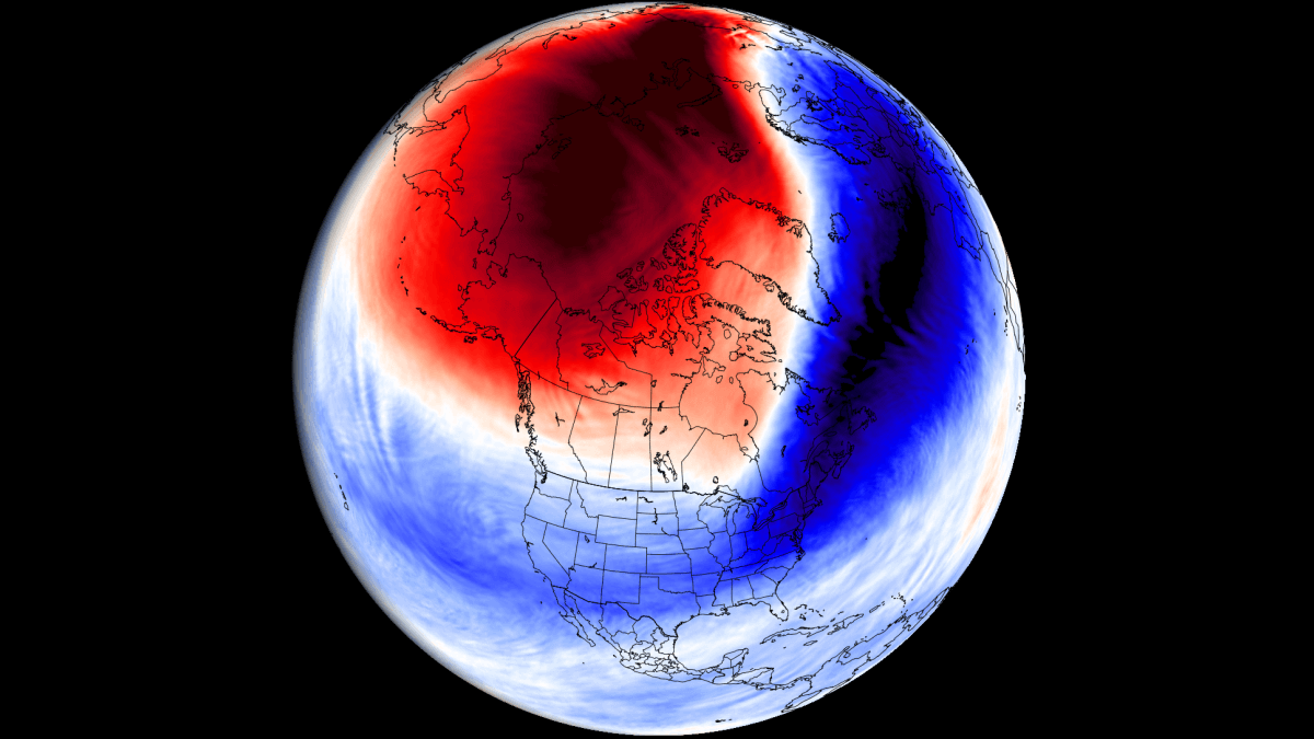
Below is the mid-stratosphere (31km/18.5miles) analysis for mid-March. It shows the stratospheric high-pressure system taking over the polar regions and splitting the Polar Vortex. This is the stratospheric warming even at its peak, with the warming wave completely taking over the mid-stratosphere.
Below is the temperature anomaly for the mid-levels of the stratosphere at 10mb (30km/18.5miles) at the same time. You can see a strong temperature anomaly over the pole with temperatures in the stratosphere being much above the normal for this time of year, indicating a very strong SSW event was unfolding.
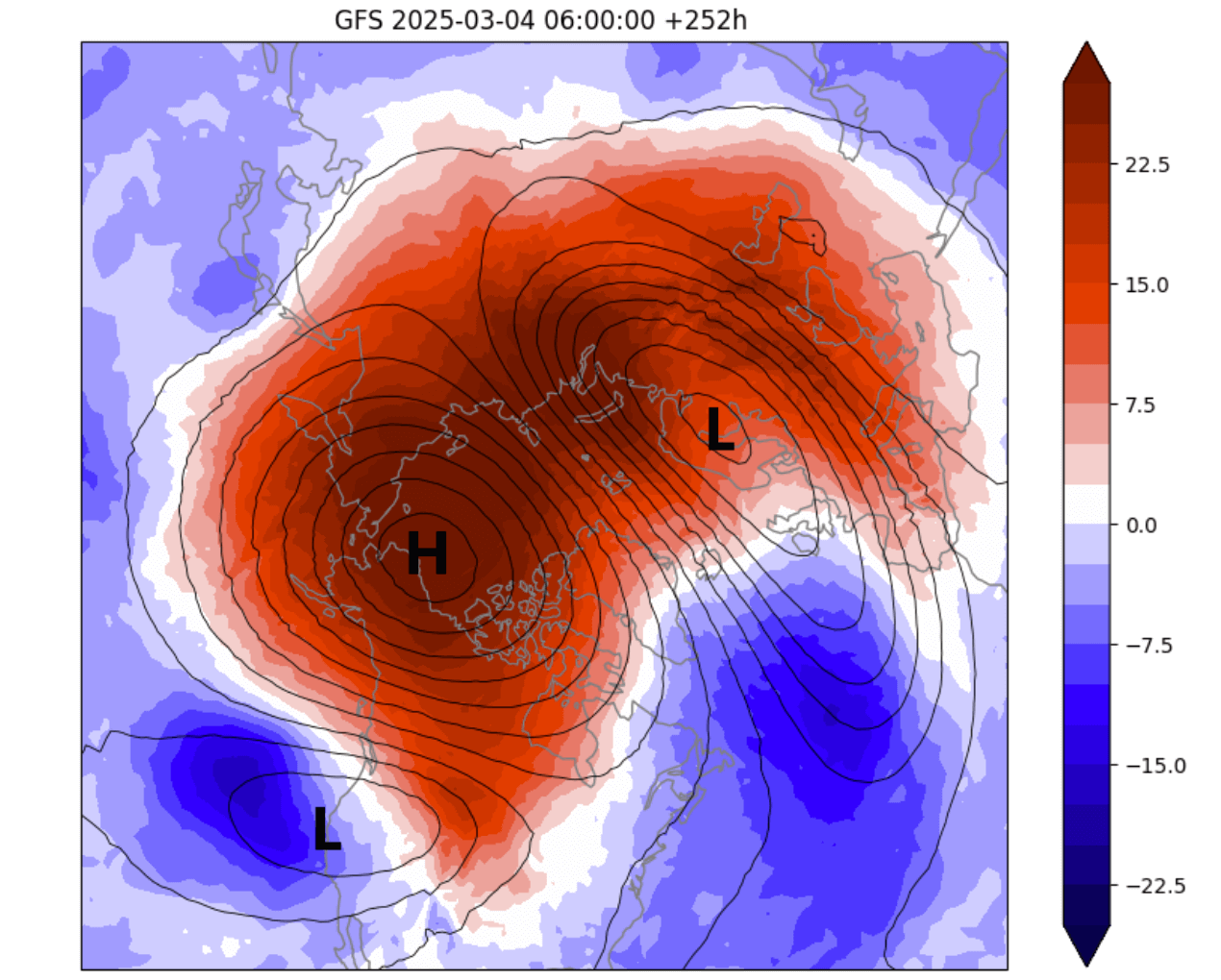
Such a strong, warm anomaly can only be caused by a stratospheric warming event, which was unusually strong for this time of year.
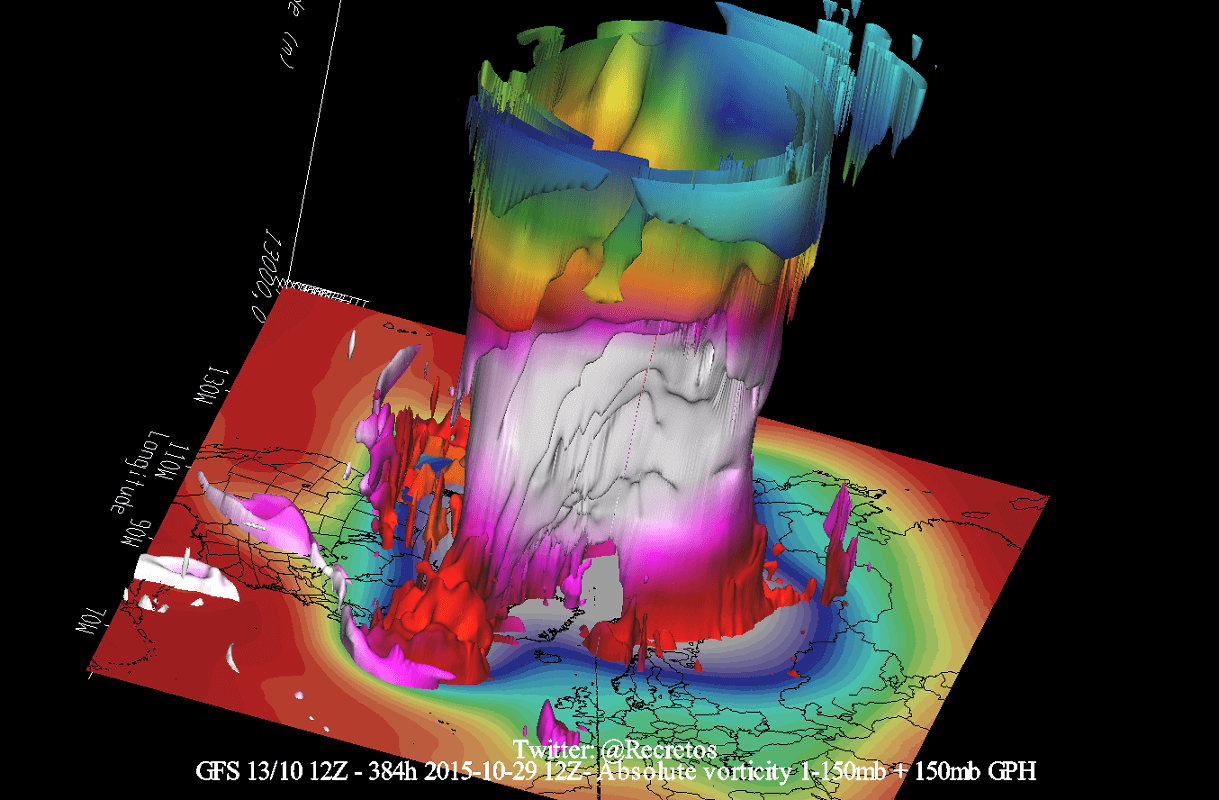
We can better see the collapse and breakdown of the Polar Vortex using a 3D vertical structure analysis below. The image shows a deformed and broken shape of the Polar Vortex. You can also see a “void” in its central area, which is the presence of a high-pressure anomaly and the warming wave that was breaking down the Polar Vortex.
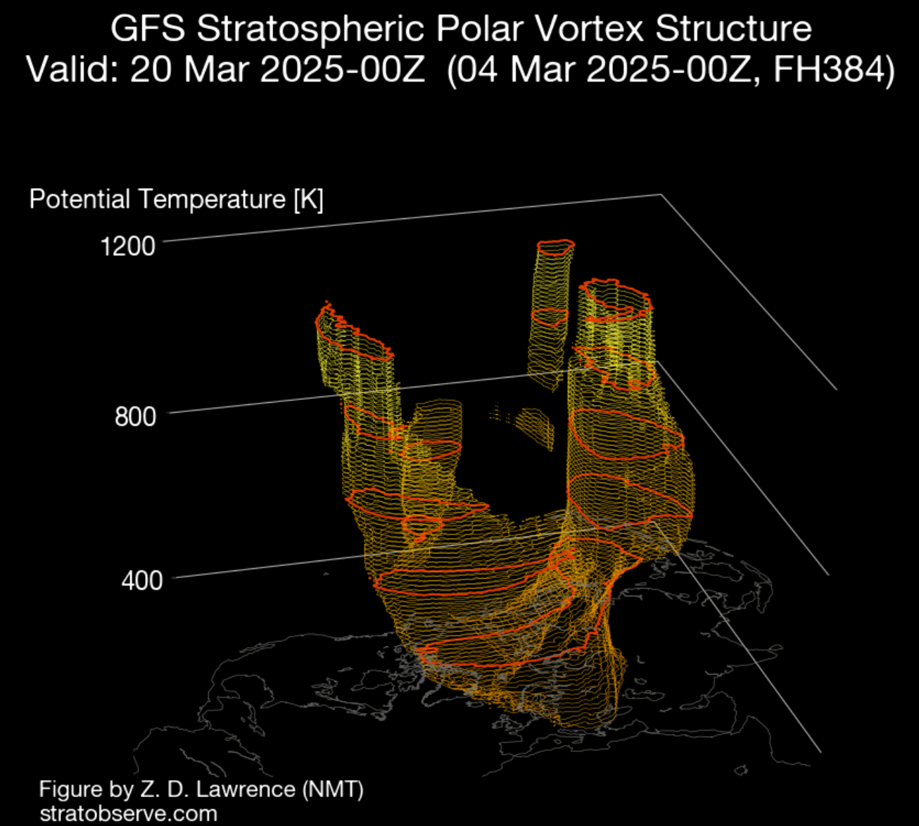
For an even better visualization of how a Polar Vortex collapse looks like, we produced the video below. It shows the full 16-day sequence of the stratospheric Polar Vortex breaking down under the strength of the Stratospheric Warming event.
This brings us to the main question: How can such a strong event in the stratosphere impact the weather below? Before we look at the latest predictions for weather outcomes, we can look at what usually happens during a Polar Vortex collapse.
STRATOSPHERIC WARMING WEATHER IMPACT
We now know that the effects from the Stratosphere have to progress downwards to have an impact. But how do these effects change the weather?
Below is a typical SSW process from a study by Dr. Amy Butler and co-authors. As an SSW occurs, it raises temperature and pressure in the Stratosphere. But, those effects progress downwards over time and reach the lower levels. The image shows the typical downward influence of a stratospheric warming event, bringing high pressure to the polar regions.

To keep it simple, the main impact after an SSW event is a high-pressure system at the surface over the north. A manifestation of a high-pressure system in the lower levels can mean a disruption of weather patterns and strong changes in the jet stream.
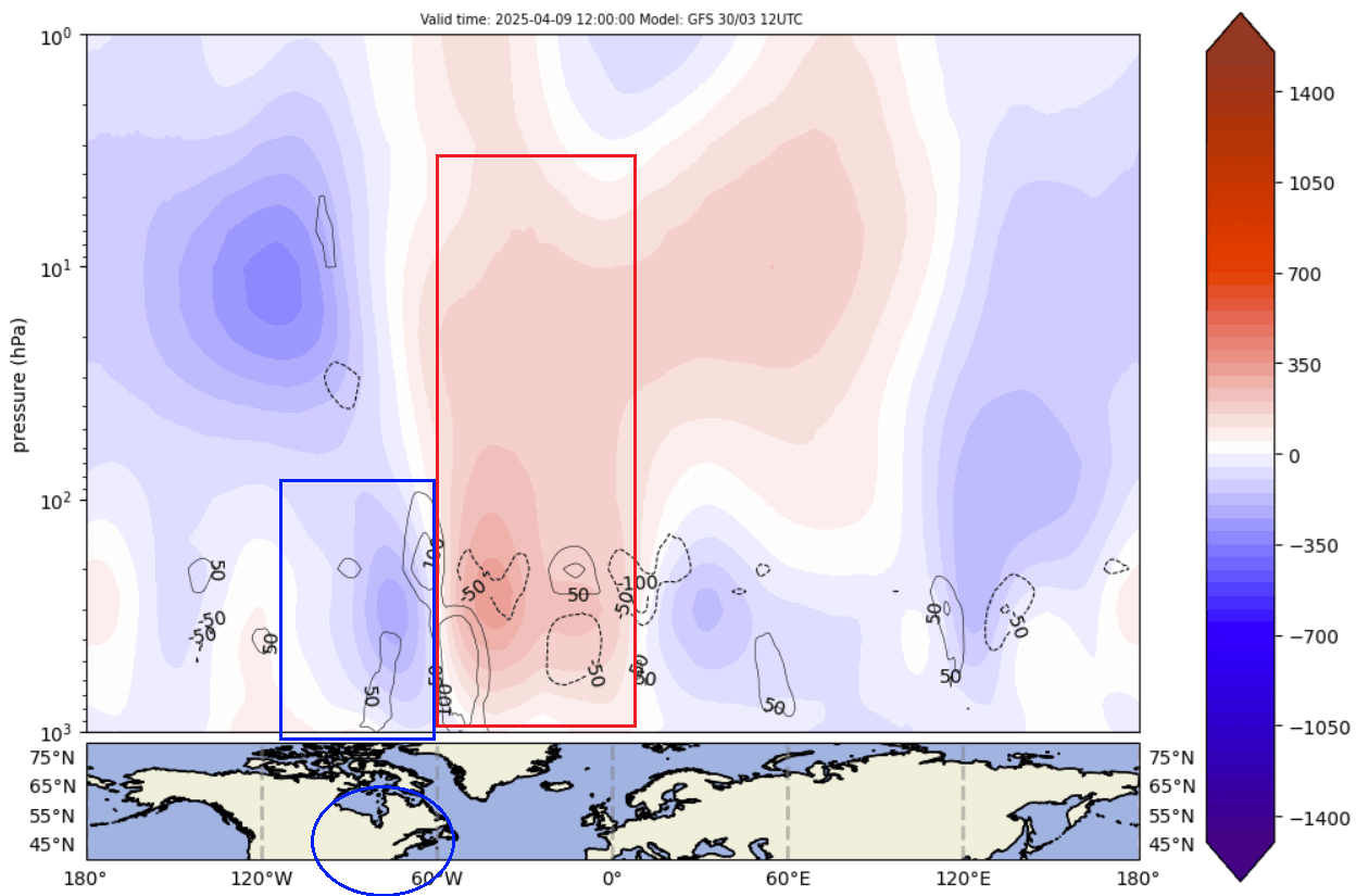
The best way to follow SSW effects development is to look at atmospheric changes over time. Below is an image that shows the pressure anomalies across the atmosphere over time, similar to the example above.
Negative values indicate lower pressure (blue anomalies), and positive values indicate higher pressure (red colors). We have altitude from the ground up to the top of the Stratosphere (~46km/28mi). You can see a strong high-pressure anomaly in the stratosphere from early March all the way into mid-April (in the forecast).
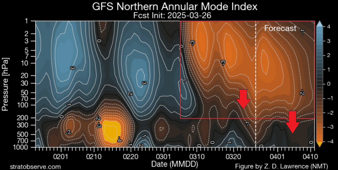
This shows the textbook downward progress of a high-pressure anomaly after a stratospheric warming event. You can see that in the forecast part, the high-pressure anomaly is reaching all the way to the lower levels.
It shows a potential direct connection between the two levels in the first half of April, bringing a drastic change to weather patterns over North America.
FINAL IMPACTS OF THE STRATOSPHERE
Below is the latest pressure anomaly forecast for the next few days. You can see a very interesting pattern, with a deep low-pressure area over the western United States and a high-pressure ridge rising in the eastern United States.
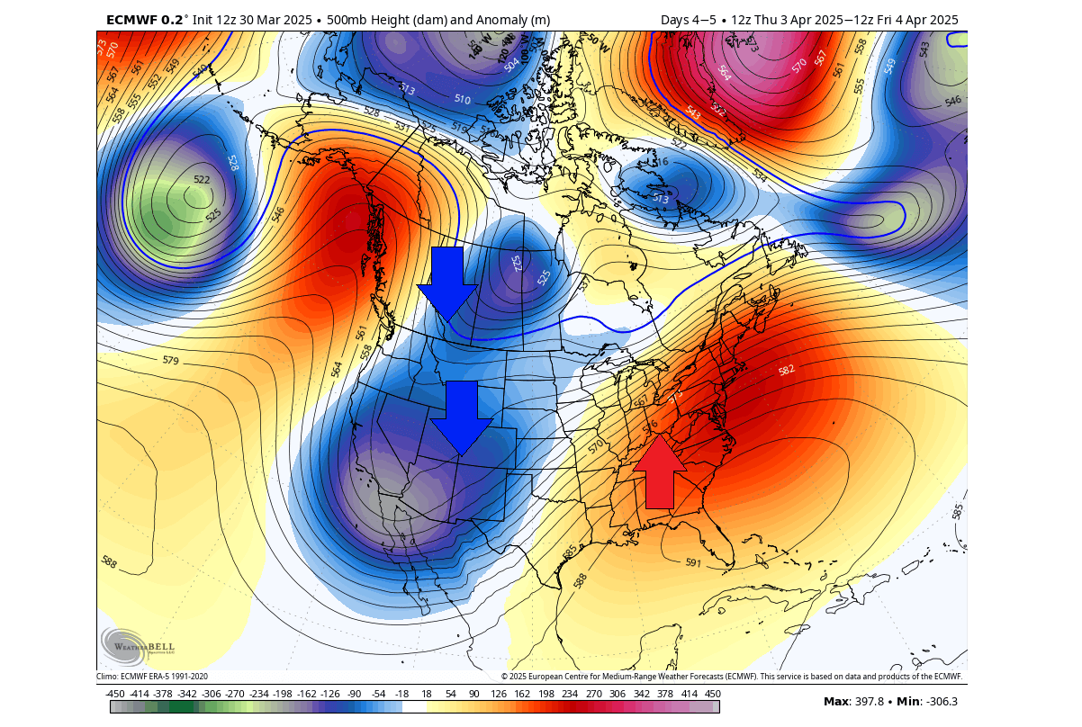
The low-pressure system in the west pulls cooler air down from the north as it spins counterclockwise. That enables below-normal temperatures and a cooler airmass to expand over the west. But a high-pressure ridge brings southerly flow and warmer temperatures.
Looking at the arimass temperature anomaly for the same period, you can see a colder than normal airmass over the southwestern Canada and the whole western half of the United States. At the same time, a much warmer than normal airmass is spreading over the eastern United States.
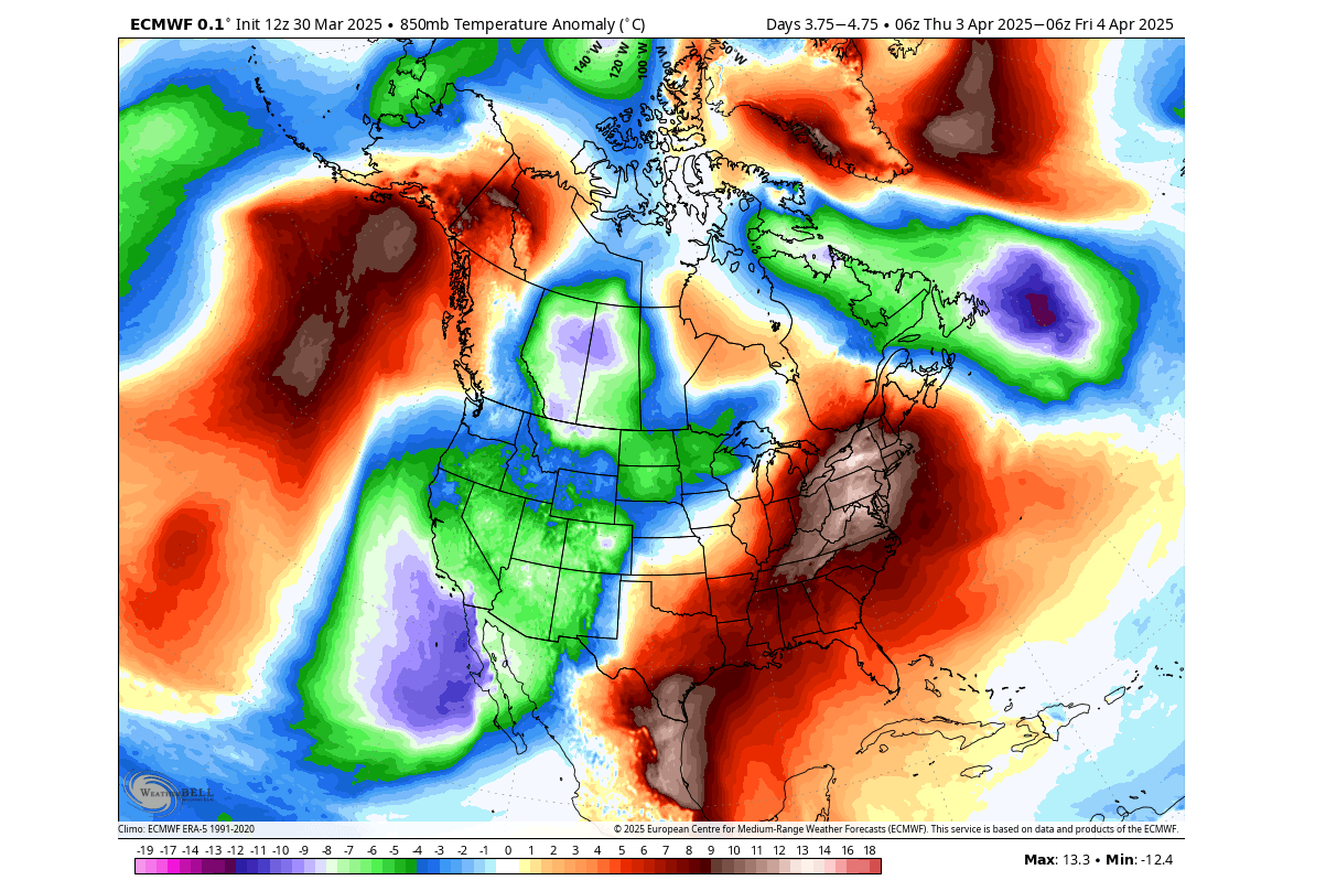
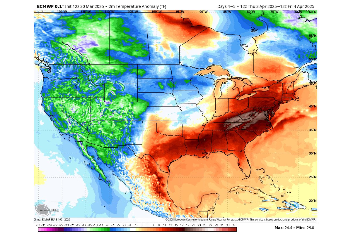
Below is the surface temperature anomaly, and you can see most of the eastern United States and the deep south are forecast to be warmer than normal for this time of year. A colder anomaly covers the western and northern parts of the United States and southwestern Canada.
This is just the starting pattern of April, and we can already see a strong pressure difference, with a colder airmass in the west and a warmer airmass in the eastern United States.
But as the pressure anomaly from the stratosphere connects deeper down, major pattern changes will unfold toward mid-April.
AS WEATHER PATTERNS CHANGE
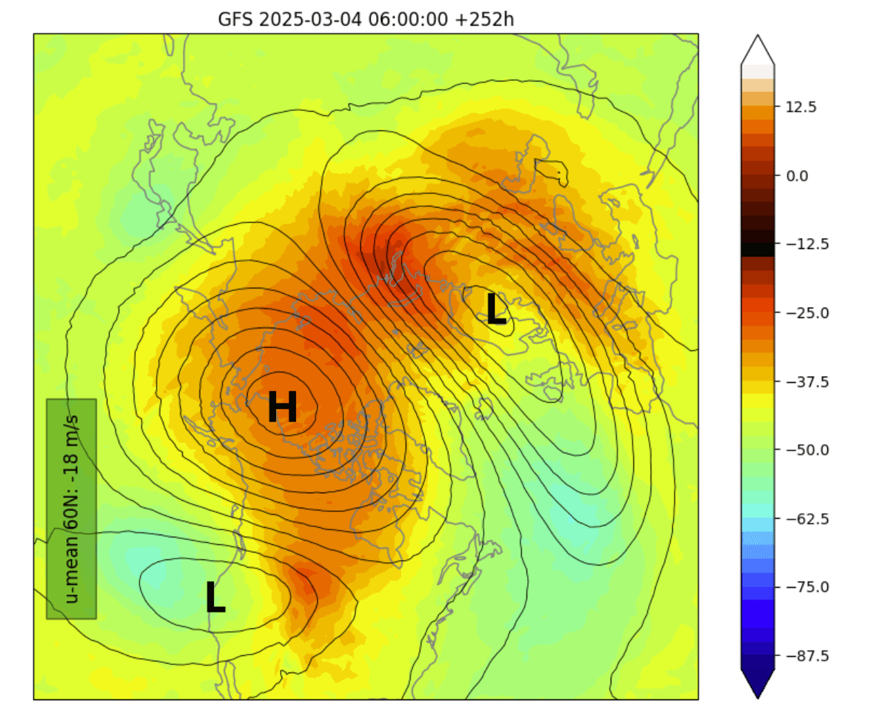
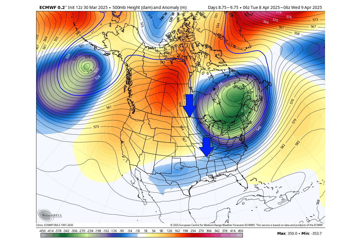
First, we will look at the pressure anomalies across the atmosphere. Below is the day 10 forecast, which shows the pressure anomalies from the surface up to the top of the Stratosphere. You can see a high-pressure anomaly connected to the lower level around the North Atlantic and Greenland.
This high-pressure anomaly in the stratosphere is the remnant of the stratospheric warming event. But you can also see a low-pressure anomaly centered over the eastern United States and Canada that will bring a whole new weather pattern to North America.
This usually happens because the high-pressure area blocks the polar regions, releasing a colder airmass towards southern Canada and the United States.
Below is the latest pressure anomaly forecast for the same period as above, in around 8-10 days. You can see the strong high-pressure anomaly over Greenland and northern Canada connected upwards to the remains of the stratospheric warming event.
Such high-pressure anomalies help to bring a strong low-pressure system down into eastern Canada and the eastern United States. The low-pressure system over the east helps to create a strong northerly flow, bringing unseasonably cold air into eastern Canada, the Midwest, and the northeastern United States.
Below is the 5-day surface temperature anomaly forecast for April 7-12th. You can see the large area of colder-than-normal temperature covering much of the eastern United States and southeastern Canada. This is the influence of the low-pressure system over the east and a strong northerly flow.
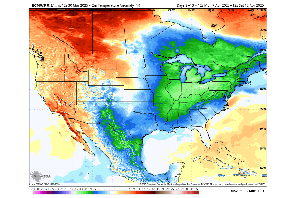
A warmer airmass will rise over the western United States and western Canada under a high-pressure area. But the cooler air will reach all the way down to the southern United States.
In the image below is the single day temperature anomaly forecast for around the 10th, and it shows an unseasonably cold anomaly over the Midwest and the northeastern United States. Some of the cooler air will spread as far as the southern United States.
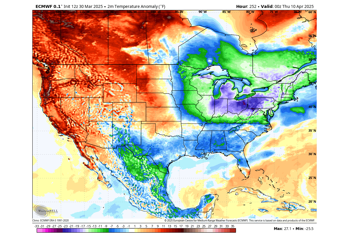
At the same time, above-normal temperatures are forecast for much of the western United States and western Canada.
Looking at the actual temperatures at this time, you can see near or below freezing temperatures over much of the Midwest and the northeastern United States. Temperatures in the mid-40s and low-50s are forecast from the central Plains to the southern and southeastern United States.
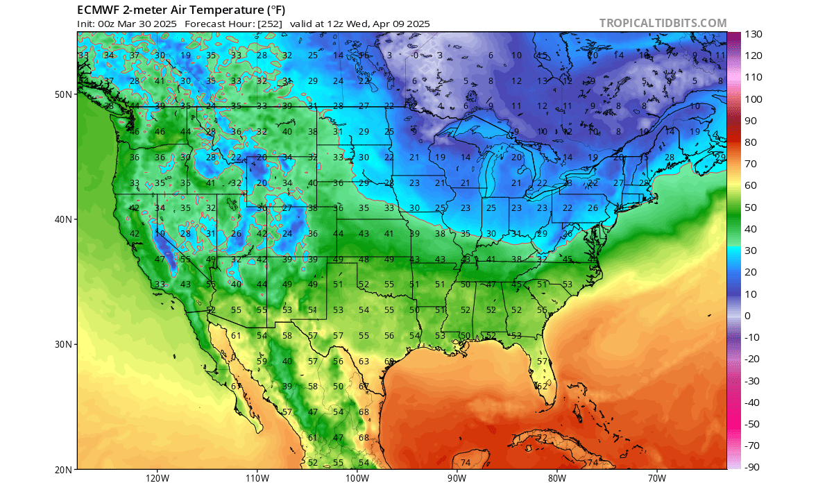
Single-digit temperatures are forecast over southeastern Canada and upper Midwest, while the northeastern United States is forecast to be in the 20s.
With cold air usually comes snowfall. The total snowfall forecast below shows a fair amount of snowfall across the elevations of the western United States. But you can also see a decent amount of snowfall over the northern United States, upper Midwest, over the northeastern U.S., and over southeastern Canada.
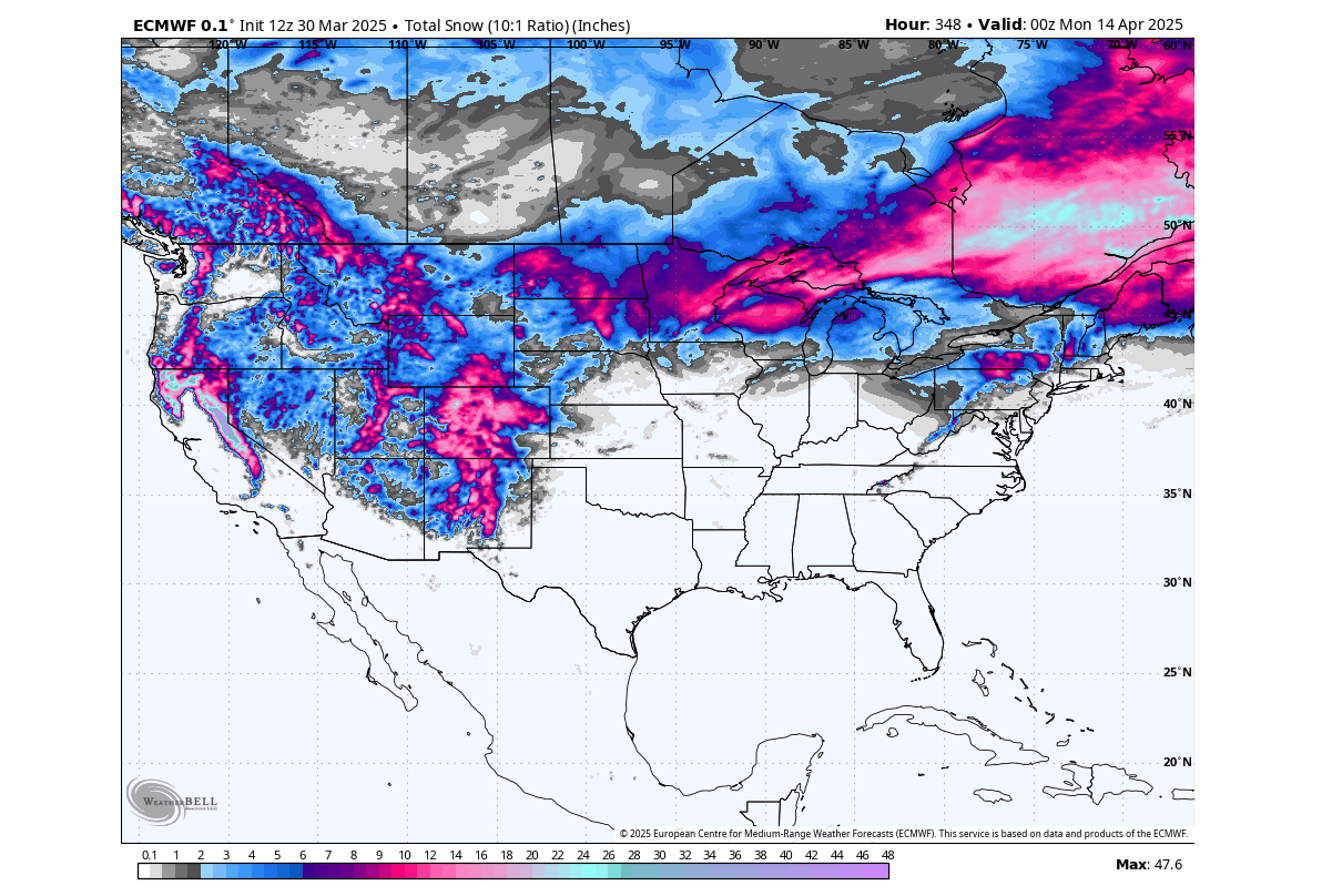
The colder northerly flow brings colder air, but that also means drier air. So most of the snowfall over the eastern parts of Canada and the United States will occur in the early parts when the cold air first moves over.
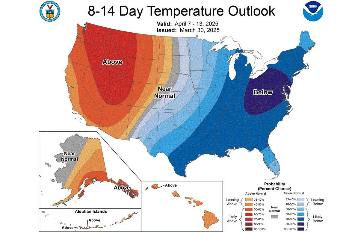
The official temperature outlook for the United States looks almost like a proper winter pattern. We see a colder anomaly is forecast over the eastern half in the 8-14 day range. But the western United States will have some seasonal Spring weather, while the east greets a temporary return of Winter.
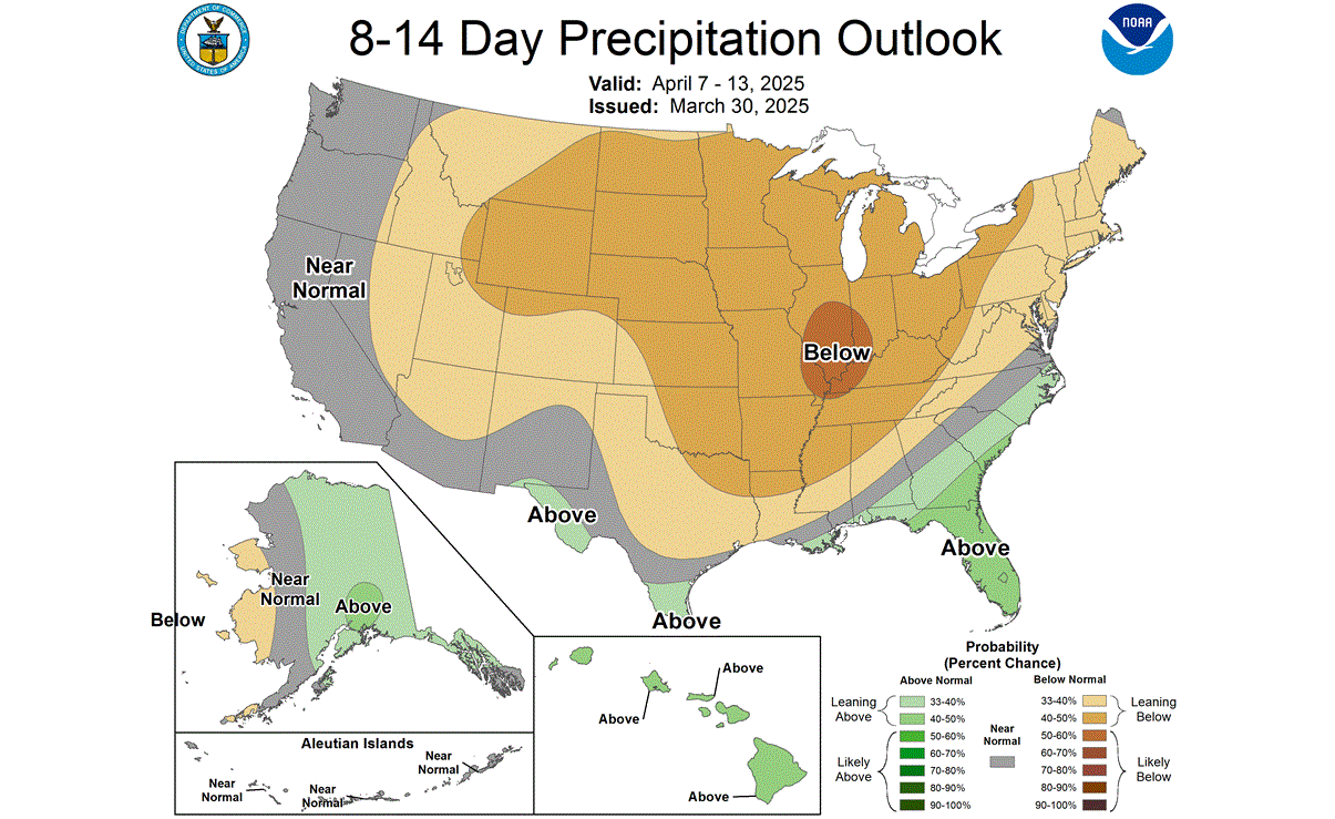
The official precipitation forecast for the 8-14 day period shows that the colder air mass will be dry, which is normal. There is less precipitation forecast in this period over much of the United States. So most of the snowfall in the forecast over the eastern U.S. will occur in the very early stages of the first cold air advance.
But what about the rest of April, and what do the trends show after this cold event?
EXTENDED RANGE FORECAST
Below is the extended range pressure anomaly forecast for mid-April by the GEFS model. It shows a continued low-pressure area present over eastern Canada and the northeastern United States. This enables a continued northerly flow over the eastern United States and eastern Canada.
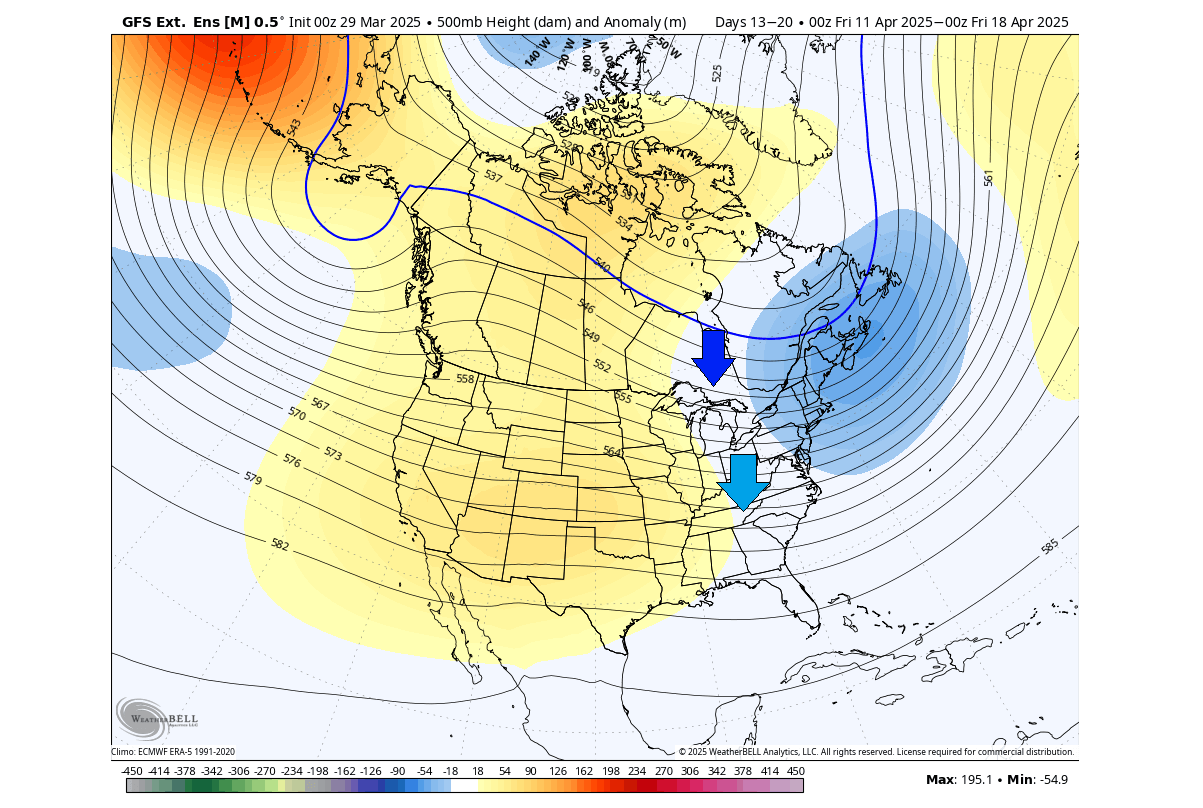
You can see high-pressure areas over the western United States and northern Canada. This will bring above-normal temperatures into the western and central United States and parts of western Canada.
In the extended temperature forecast below, you can see the effect of the northerly flow. An area of below-normal temperatures is forecast over the Midwest, the northeastern and eastern United States, and southeastern Canada.
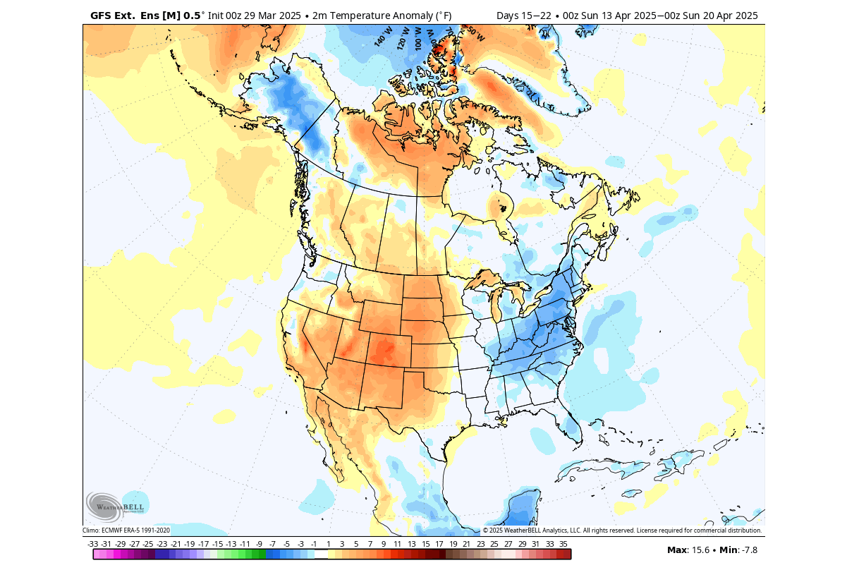
This is due to the counter-clockwise circulation of the low-pressure system over the northeast. But at the same time, a warmer air mass will advance over the western United States and the Great Plains under a high-pressure system.
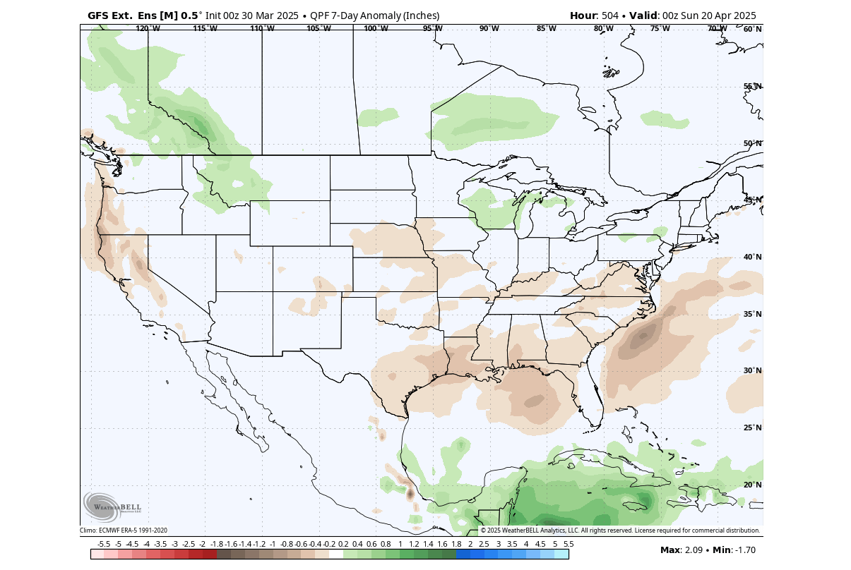
The precipitation forecast trend for this period shows a bit more precipitation than normal over the northern United States and the upper Midwest, and over parts of southern Canada. Less precipitation is in the forecast for this period across the southern and southeastern United States and over the West Coast.
Overall, the remnants of the Stratospheric Warming event will really help to bring a significant weather pattern change across the United States and Canada. We will see a power struggle between an early Summer and late Winter over the United States.
We will keep you updated on the global weather pattern development, so bookmark our page. Also, if you have seen this article in the Google App (Discover) feed, click the like button (♥) there to see more of our forecasts and our latest articles on weather and nature in general.