The latest August monthly Weather forecast for Europe shows a cooler start to the month over the central parts. But a new subtropical ridge pattern is currently forecast to return with a low-pressure area locked to the north, creating a new heatwave scenario over the continent.
First, we will look at the Summer weather anomalies so far and how the pressure pattern has developed. Then we will focus on the week-by-week breakdown of the latest August forecast, and the shifting weather patterns over the last third of Summer.
STRONG SUMMER SO FAR
The meteorological summer covers the three warmest months of the year: June, July, and August. It is based on actual weather patterns and temperatures. This means that with June and July already over, we have entered the last third of the meteorological Summer season.
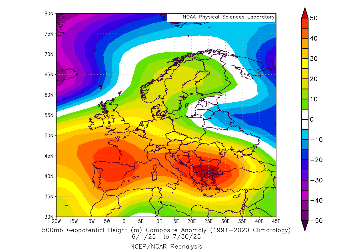
Below is the pressure analysis of the June/July weather pattern over Europe, and you can see a strong pressure difference from north to south. A stronger-than-normal subtropical ridge completely took over southern and central Europe, with a semi-persistent low-pressure area passing the northern parts.
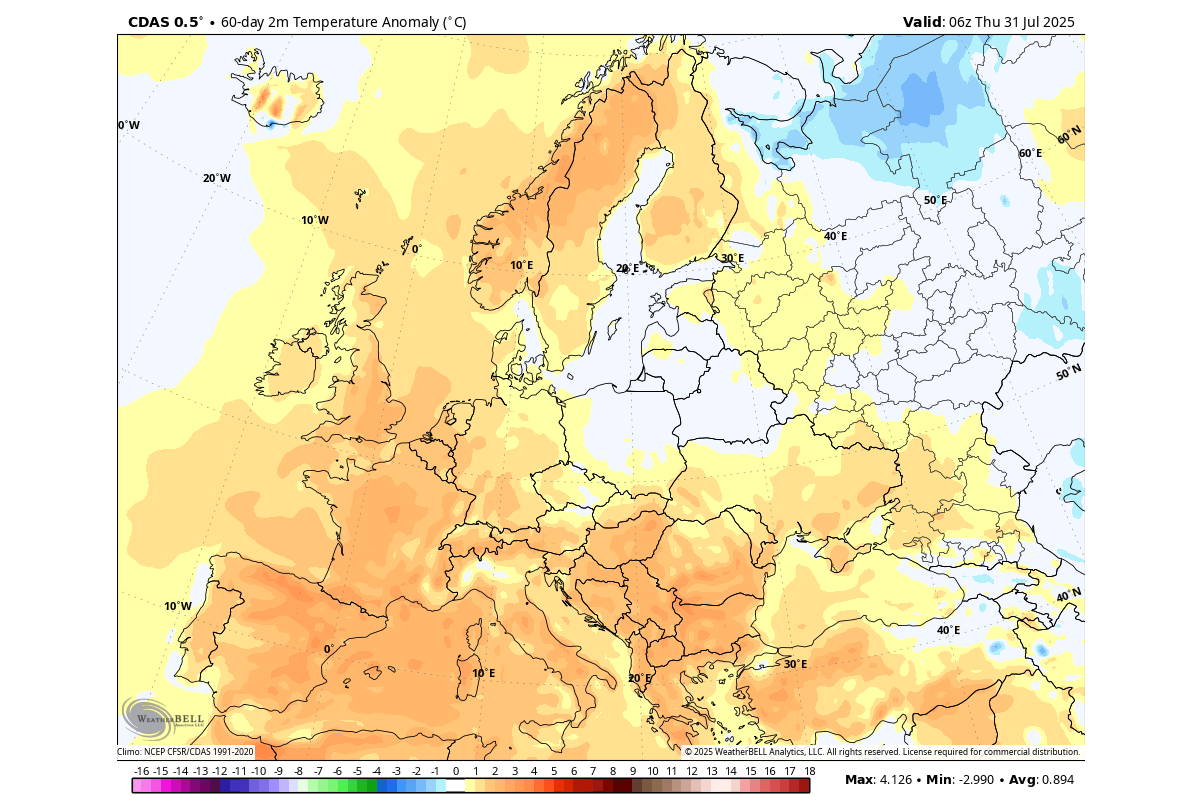
This brought an unseasonably warm airmass into a large part of Europe, with the exception of the far northeastern parts. The image below is a 60-day average, with the daily anomalies reaching far higher values over the west-central parts. There were several days with temperatures rising over 40°C in parts of southwestern and west-central Europe, and very rare 30°C streaks far over Scandinavia.
Below is the precipitation analysis for Summer so far, and you can see that a large part of southern and parts of central Europe received less than 10-15% of the normal rainfall. An area over central Europe spanning from eastern France to Poland shows near-normal rainfall, which is a result of plenty of storm activity, with more precipitation towards the northeast.
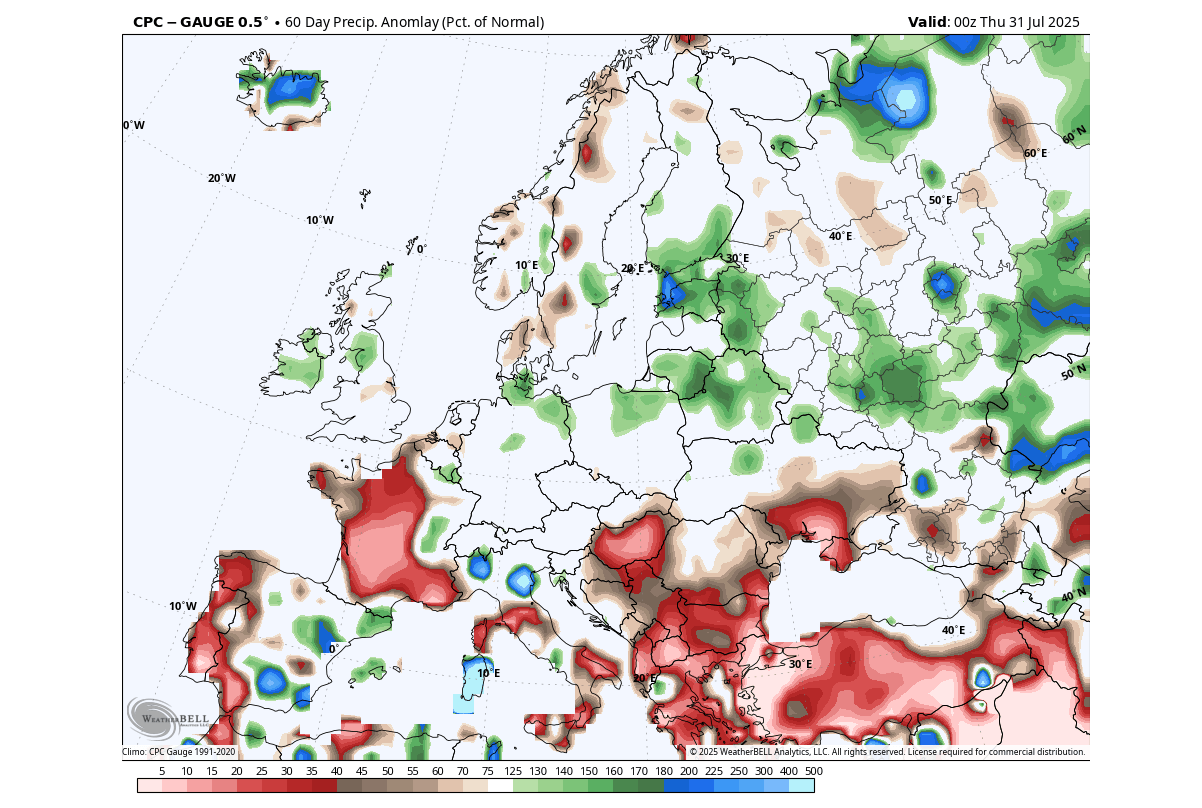
This is a clear drought pattern over the southern half of the continent. But there was more rainfall over the northern and eastern parts, under the influence of the low-pressure area.
AUGUST PATTERN BEGINS
Below is the pressure anomaly forecast for the first week of August. You can see a strong low-pressure area developing over the northwest, with a low-pressure trough dives into central Europe. This is amplified with a ridge rising over the far western parts, and though the Rossby wave response helps to build a ridge towards the east.
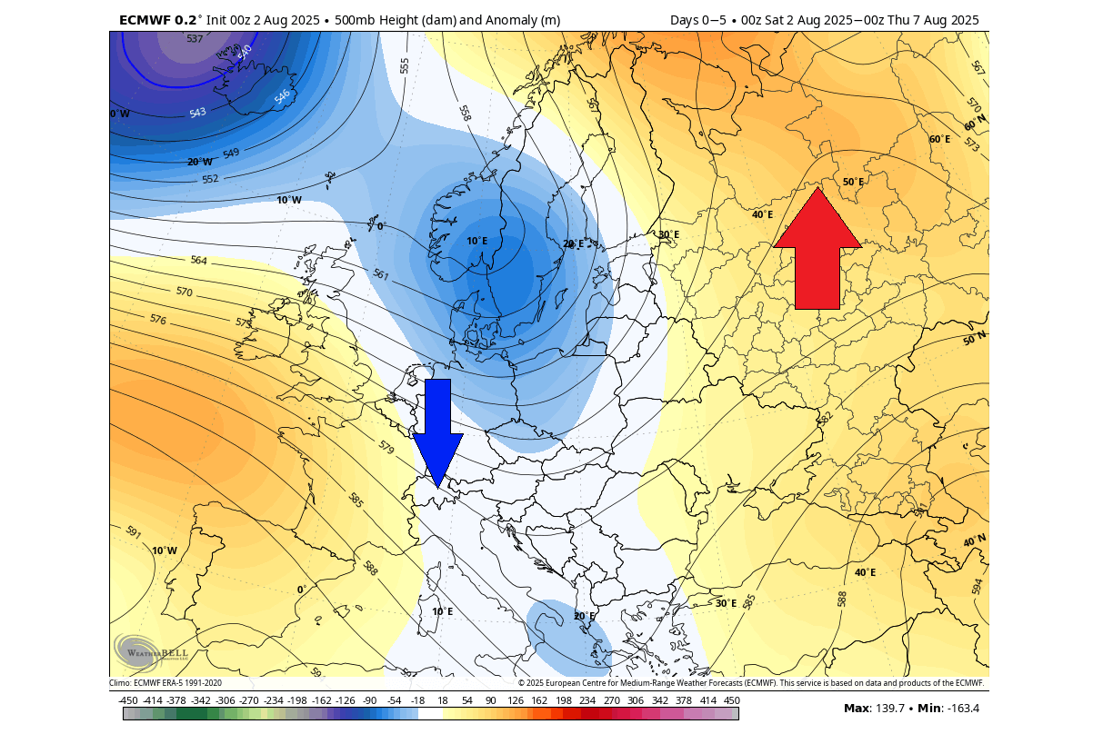
The temperature forecast for the same period shows warmer-than-normal weather over much of the far northern, eastern, and western parts. A cooler airmass is spreading over the central and south-central parts of Europe, with a cooler airmass passing over the UK.
The precipitation forecast for the first week of August shows more rainfall over the northern UK and parts of Scandinavia, associated with a passing cold front. Another area of rainfall is seen over the central parts around the Alps, associated with the passing of the low-pressure trough over the region,
The rest of Europe shows less precipitation over the west and across parts towards the east.
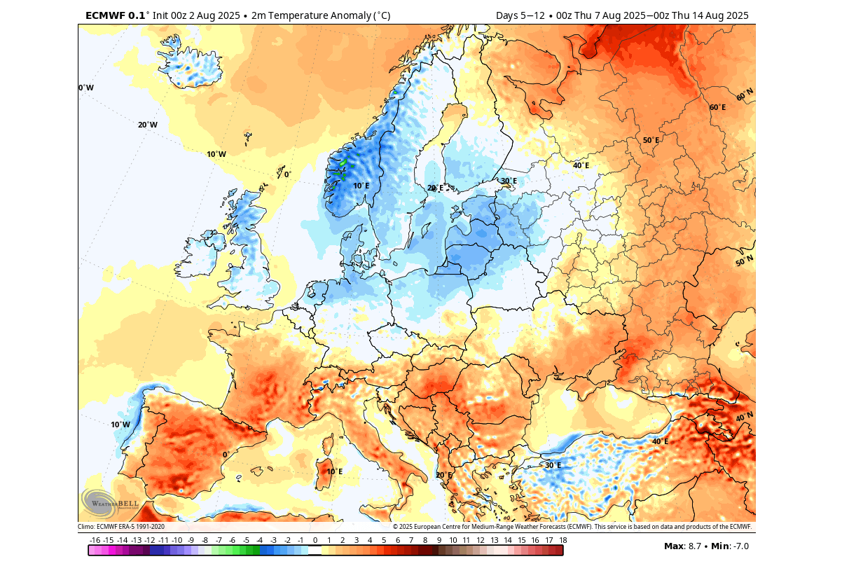
A PRESSURE PATTERN RESET
Looking at the latest pressure anomaly forecast for the second week of August, you can see a continued low-pressure area over the northwest, with an extension towards the east. But the pressure anomalies are reverting back to a high-pressure ridge rising over Europe, pushing high toward the northern parts.
This ridge will build behind the passing low-pressure trough after it passes over central Europe, bringing along a warmer airmass.
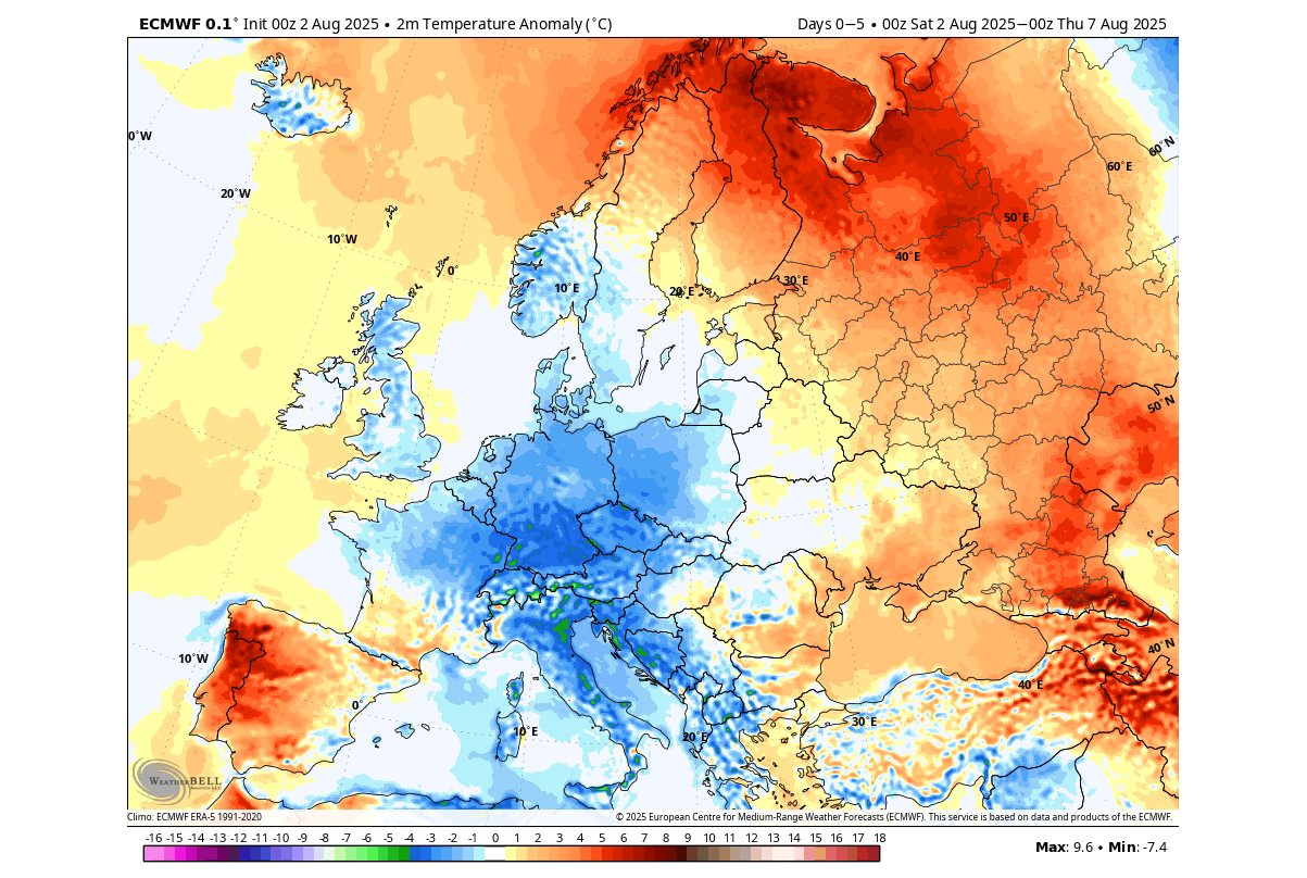
You can see the 5-day temperature forecast below for the same period. It shows the spread of the cooler air on the edge of the low-pressure corridor across the UK and Ireland, and parts of Scandinavia and north-central Europe. But as this is a 7-day average, it shows the anomaly over the whole weekly period.
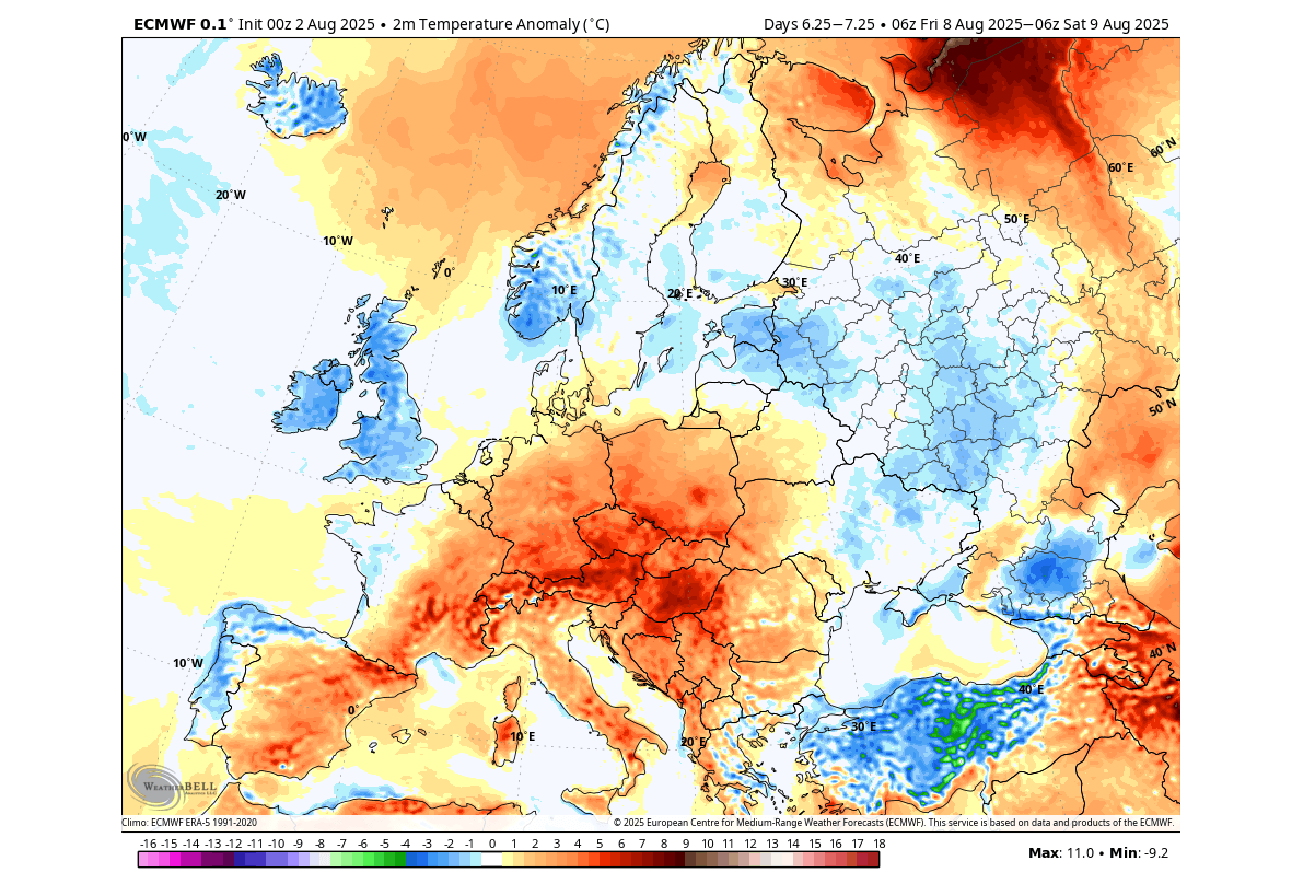
Below is the temperature anomaly forecast for next Friday, as an example of a single-day anomaly. Several areas over central Europe will see above normal temperatures during the rise of the high-pressure ridge. A cooler airmass will remain over the UK and Ireland, and across the northern and eastern parts of Europe down to the southeast.
Below is also a video of the ECMWF temperature forecast for the next 15 days. It shows the changing daily temperatures over Europe, which much better highlights the day-to-day changes.
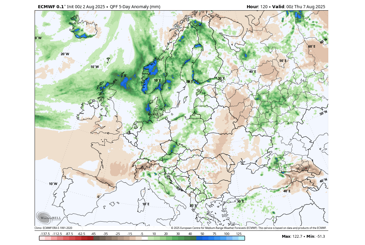
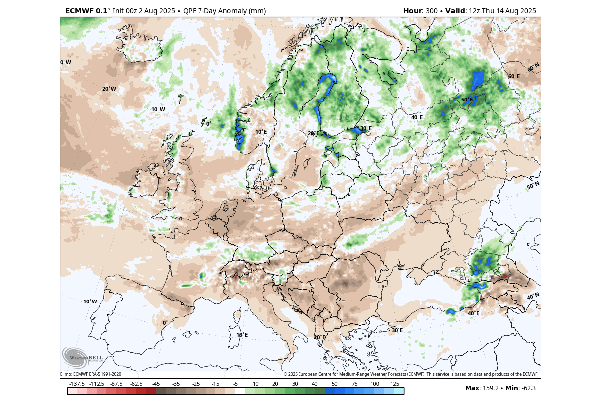
The precipitation forecast for this period shows a rather drier period across much of Europe. This reflects the expansion of a high-pressure ridge over the continent, with only scattered areas of rainfall. More rainfall is expected over the northern parts, under the direct influence of a broader low-pressure area.
As we go beyond this mid-August period, we shift to the “extended range” forecasting system of the ECMWF, which is basically a longer run of its ensemble forecast (EPS). It is good at revealing weather patterns and trends on a week-to-week basis.
A PRESSURE PATTERN EVOLUTION
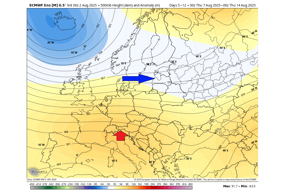
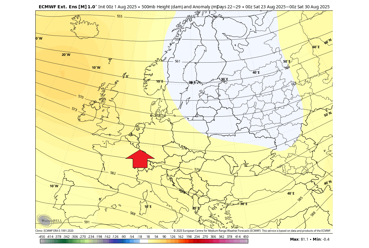
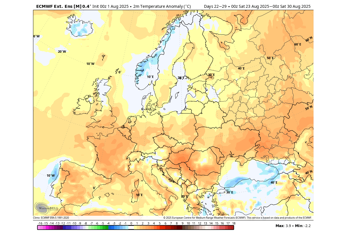
The third week of August will bring a change in the weather pattern. The pressure forecast below shows another high-pressure area rising over western Europe, with a contrasting low-pressure area over the northern and eastern parts.
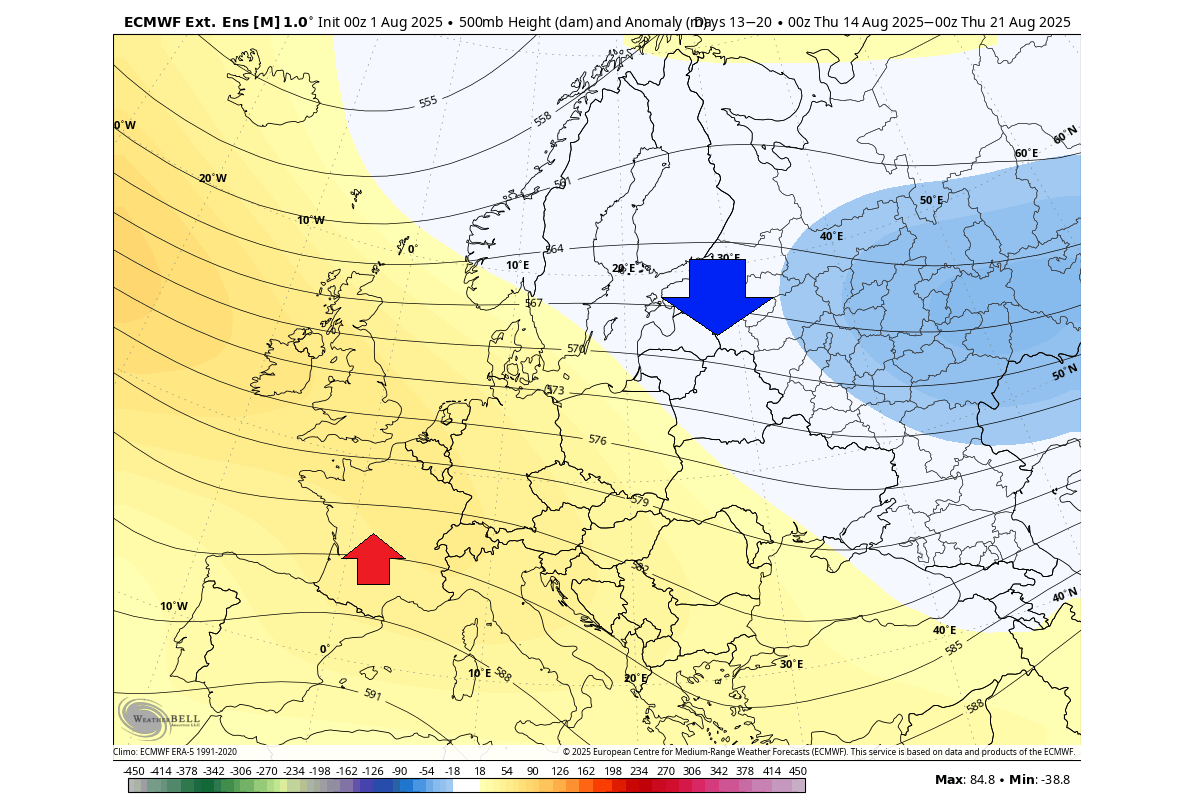
This means that a warmer airmass will persist over western and central Europe, also reaching north into the UK. A cooler airmass will be over the north and northeast, but for now, we are too far into the forecast to indicate any breaches of the cold air into the central parts.
The main rainfall area during this period is forecast to be pushed far to the north and northeast, limited to the main low-pressure areas. Most of the continent is forecast to receive below-average rainfall in this period. This is an indication of another heat dome episode for a large part of western and central Europe.
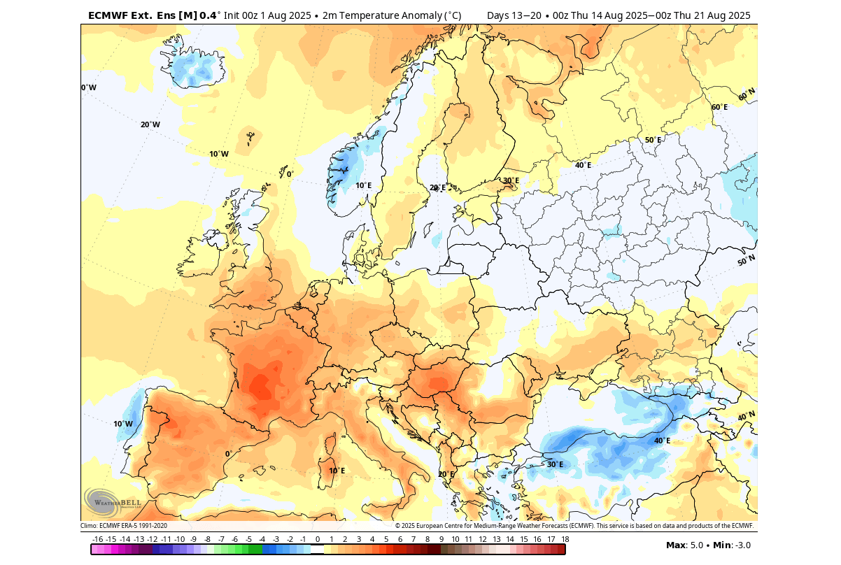
The final week of August shows some change, with the low-pressure area focusing more on the north and northeast. This can initiate a cooler airmass descent into the central parts. A high-pressure ridge is still forecast to remain over western Europe, keeping a warmer airmass over the west.
The temperature forecast is not much different from the previous week, still showing the strong heatwave signature over a large part of Europe. The exception is currently over the north, under the influence of a low-pressure area.
This pattern clearly brings an increased potential of another heat dome event over western and central Europe for the second half of August, reaching all the way into the southern UK.
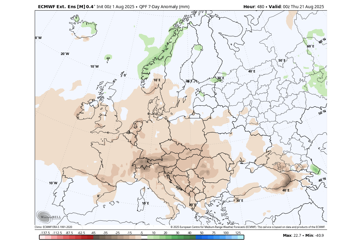
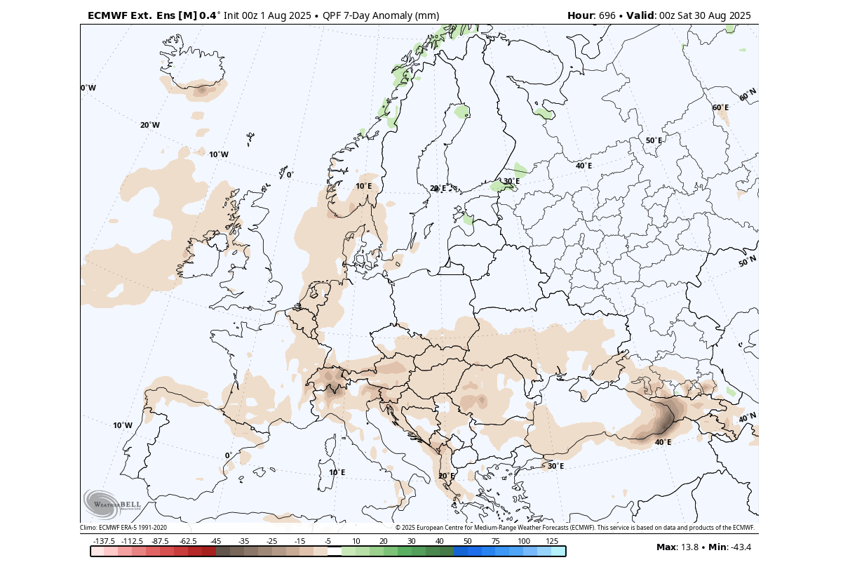
There are no major rainfall anomalies forecast over Europe in the final week of August, apart from the north. Most of the continent is forecast with less rainfall than usual, due to a persistent high-pressure anomaly and a stable pattern with the low-pressure systems staying to the north.
This overall shows a clear heatwave and drought signal for western and central Europe in the second half of August. These are just the latest extended range forecasts that can change. But it does usually show a rather accurate overall prevailing weather trend.
Forecast images in the article are from WeatherBell using a commercial license.
We will keep you updated on the global weather pattern development, so don’t forget to bookmark our page. Also, if you have seen this article in the Google App (Discover) feed, click the like button (♥) or a star there to see more of our latest articles and forecasts.
Don’t miss: Fall 2025 Forecast: A Major Weather Pattern Reversal Leading Into Winter