The Alps are in for another snowstorm in the next 48 hours, through Tuesday. Up to 80-120 cm of snow, possibly up to 150 cm, is expected locally. Peak amounts of snow are expected in Switzerland.
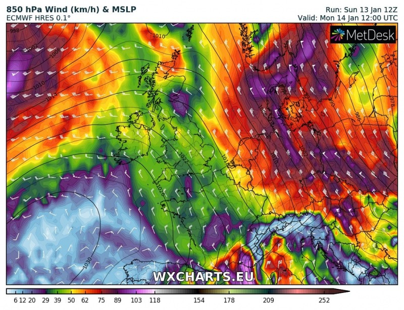
The persistent pattern with northerly and northwesterly flow continues and more intense stau-effect snowfall across the northern Alps. Another round of intense snowfall will impact the northern Alps from southwestern Switzerland to central Austria through Tuesday.
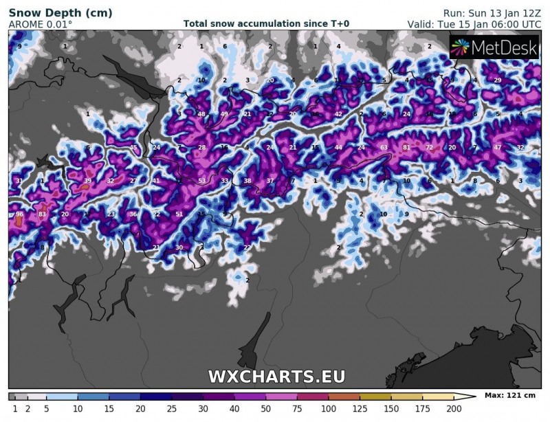
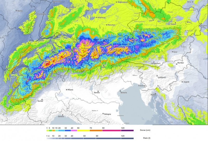
Maximum amounts of snow are expected across southern Switzerland, where up to 120-150 cm of fresh snow is expected, locally possibly even more. Also expect up to about 70-90 cm, locally over 100 cm in western Tyrol. The area that received enormous amounts of snow over the past 5 days or so, in central Austria, will receive slightly less snow, up to 50-90 cm. Consult the maps below to see how much snow is expected in your area.
Snowfall depth across central Alps by early on Tuesday. AROME model guidance. Map: Wxcharts.eu
850 mbar (~1500 m) level winds on Monday noon. ECMWF HRES model guidance. Map: Wxcharts.eu
Total snowfall through Tuesday, 6h UTC. Map: Bergfex.com
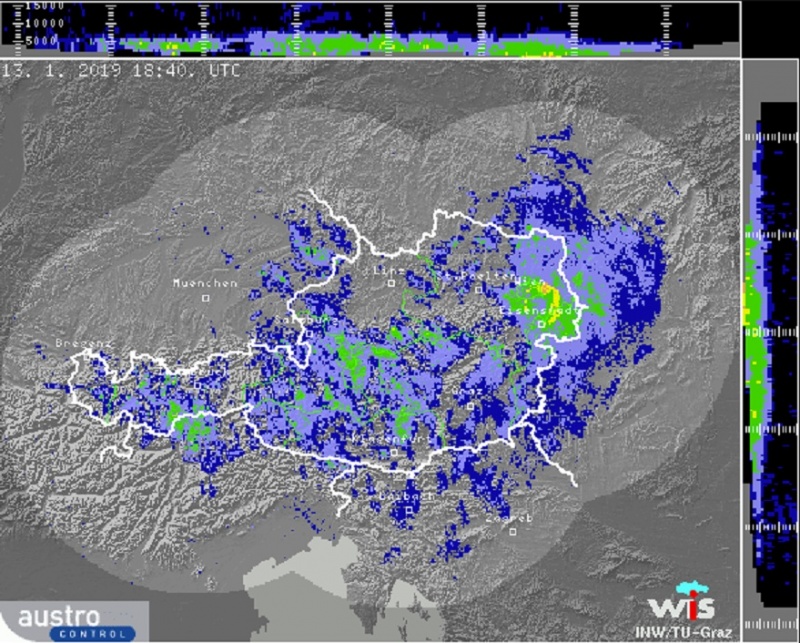
Radar scan indicating significant precipitation across Austria. 18:40 UTC, Monday.


