July will end with much colder weather for part of Europe, thanks to a large upper cold wave now moving over the Alps into the Mediterranean. Before colder temperatures spread, severe weather will affect areas from Italy across the Balkans to Ukraine on Sunday and Monday.
In the coming days, a significant temperature drop is forecast for central Europe, a large part of the Mediterranean, and the Balkans. A much-needed refreshment and rainfall as well. A large cold wave is gradually progressing south these days.

Saturday, July 26th, brought an extreme, historic heatwave to parts of the south-central Balkans. Temperatures reached up to 44 °C in Serbia and Greece, 43 °C in Montenegro, North Macedonia, and Albania, and 42 °C in Romania.
Conditions are already refreshed further north, which is associated with the cold wave’s significant progress in the upper levels.
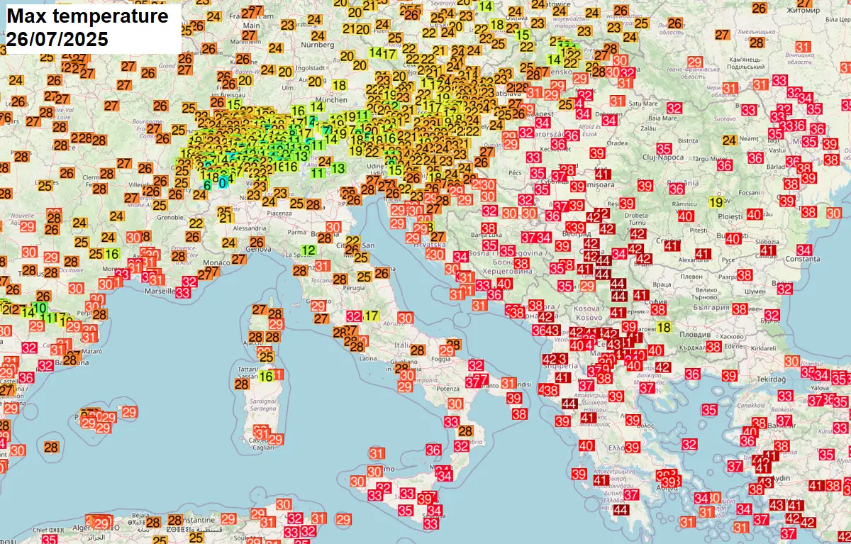
Note: On Friday, July 25th, eastern Turkey experienced a historic day, with temperatures exceeding the 50 °C threshold for the first time in the country. Silopi, Turkey, now holds the new Turkish national temperature record.
This was the final day of extreme heat. For this part of Europe, temperatures will be much cooler in the following 5-7 days. Below is a short overview of the upcoming pattern change.
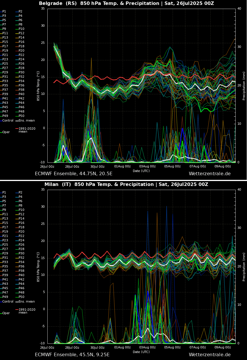
The most significant temperature change will be over the Balkans, which will flip from extreme heat into below-average temperatures in just two days. The meteogram below represents the temperature and rainfall forecast for Belgrade, Serbia (upper chart) and Milan, Italy (bottom chart).
We can see how extremely anomalous the air mass was over Serbia. After Monday, it will cool down to around 10 °C and remain below average into early August.
The chart for Milan, Italy, suggests temperatures are already much colder and below the average this weekend and will continue for at least another 7-10 days.
This will also be similar across Central Europe and the western Mediterranean as the trough brings significantly colder air masses, as seen in the discussion below.
Deep trough digs south, spreading an intense cold wave deep into the Mediterranean
The weather pattern evolving over the North Atlantic and Europe through the final days of July indicates an intense blocking High over the Atlantic, allowing a deep cold wave/trough to dig south across central Europe into the Mediterranean.
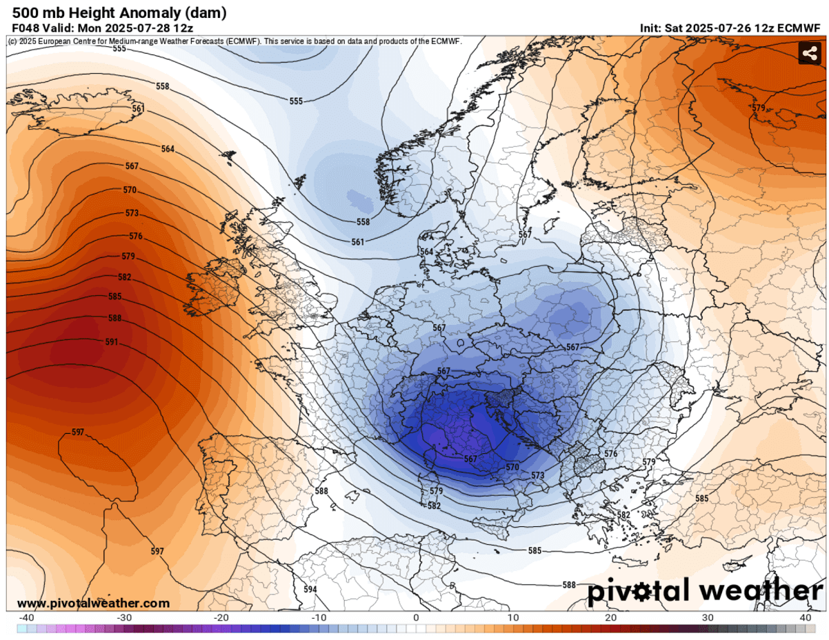
This allows a much colder air mass to spread far south, vanishing the ongoing heatwave across the southern Balkans, and introducing severe weather with the frontal systems moving across.
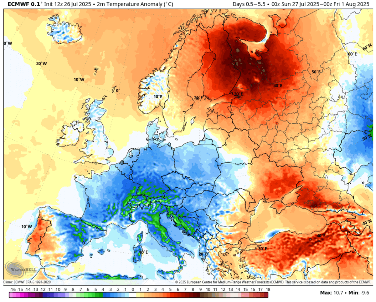
The following 5-7 days will be much colder than usual across western Europe, central Europe, and the Mediterranean. Temperatures will be 4-7 °C lower than usual.
The 5-day temperature anomaly at the surface (2 m) will also be significantly lower than expected for the end of July and early August.
4-8 °C below normal for the whole week across eastern France, southern Germany, the Alpine region, the western Balkans, and Italy, including eastern Spain and northern Algeria, indicating how deep south the cold wave will reach.
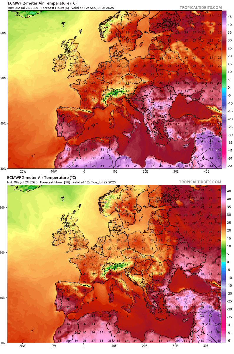
The following chart represents afternoon temperatures on Saturday this weekend versus Tuesday afternoon. We can see how much colder weather arrives in Italy, especially in the Central Balkans, from the 40s on Saturday to the low to mid-20s on Tuesday.
Refreshment is also noticeable over northern African countries, Greece, and central and eastern Europe.
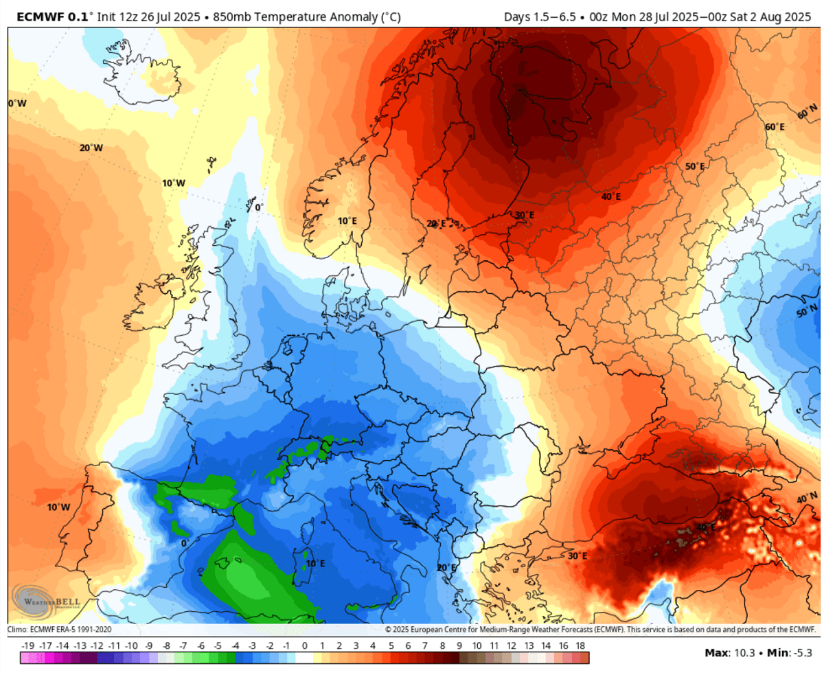
However, as the deep wave sits over the Mediterranean, the extreme heat from the Middle East will remain or re-intensify over Turkey and the Black Sea region into eastern Ukraine and southwestern Russia.
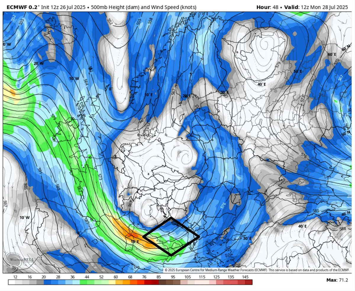
Severe weather outbreak for the eastern Balkans on Sunday, Italy, and the Adriatic on Monday
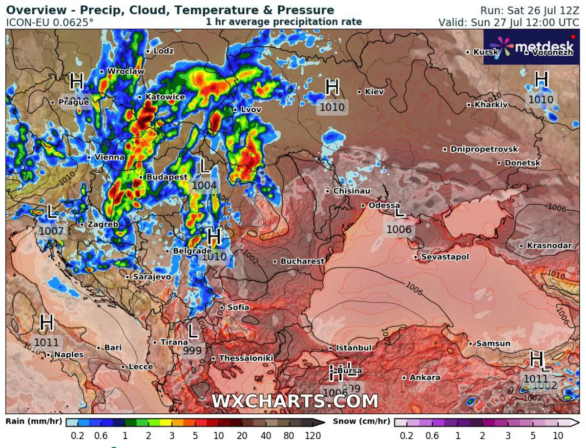
After active weather across the Mediterranean and west-central Balkans on Friday and Saturday, Sunday will bring another potentially significant severe weather outbreak across the eastern parts of the peninsula. Conditions will rapidly deteriorate during the day on the edge of a historic heatwave and the moving frontal system.
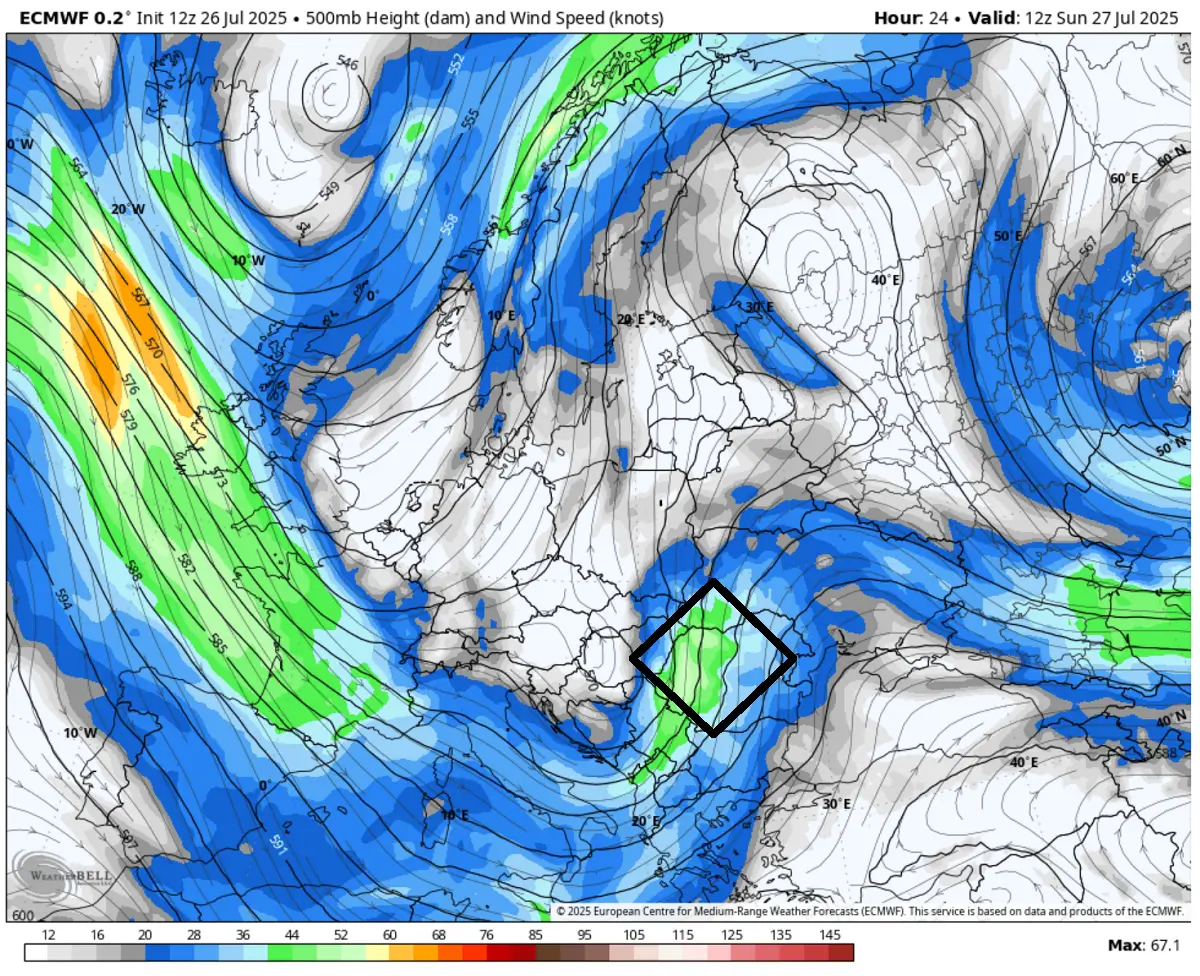
Rounding the deep upper wave, a left-exit region of a powerful jet stream overspreads the moderately unstable airmass across the south-central and eastern Balkans into eastern Europe.
The favorable lifting will be maximized from eastern Serbia across Romania to Moldova and western Ukraine.
This should lead to widespread convective activity, including intense supercells with large hail, damaging winds, and torrential rainfall.
Favorable east-southeast winds over northeast Romania, northern Moldova, and western Ukraine will also support tornadoes.
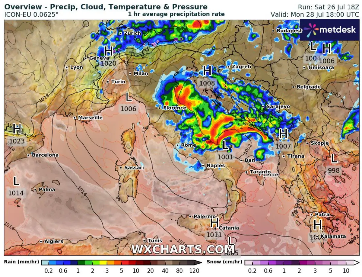
Early Monday, the primary upper wave emerges over the Alps, introducing another round of widespread thunderstorms across Italy and the Adriatic Sea region.
With the upper core centered over the northern Mediterranean, an intense jet stream spreads over central Italy into the Adriatic, supporting intense lifting that allows storms to grow into large clusters.
All kinds of severe weather are likely, including a few tornadoes, damaging winds, large hail, and torrential and excessive rainfall.
The most intense storms are forecast from the early morning hours near the Po Delta Valley, spreading south on both sides of the Adriatic Sea, while the surface low moves across during the day and evening hours.
Excessive rainfall associated with widespread severe thunderstorm activity is expected from Romania across Ukraine into Belarus and the Baltic region as the wave moves north from Sunday through Monday.
High rainfall is also forecast across parts of the western Balkans and the west Adriatic along the Italian coast. This is mainly associated with the second wave on Monday.
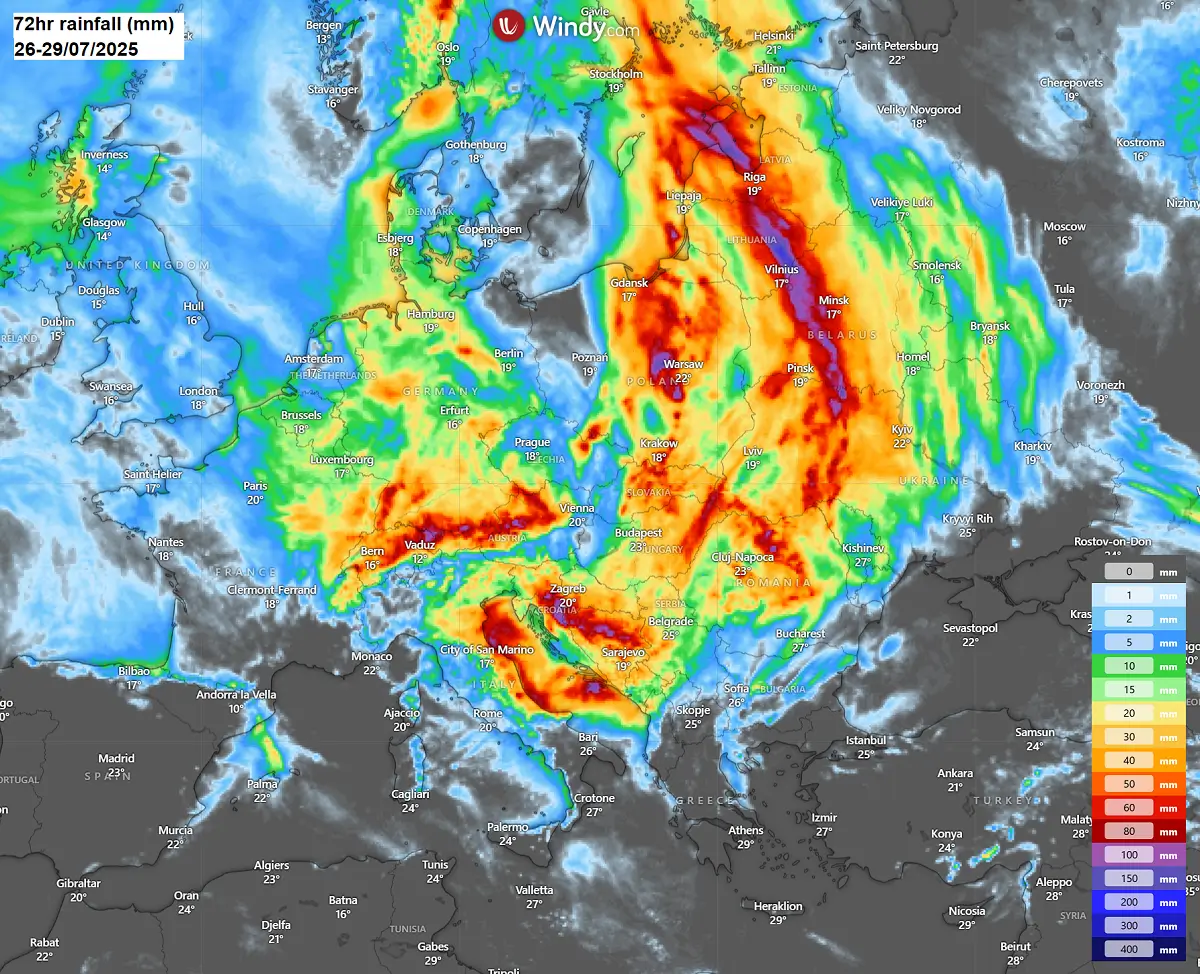
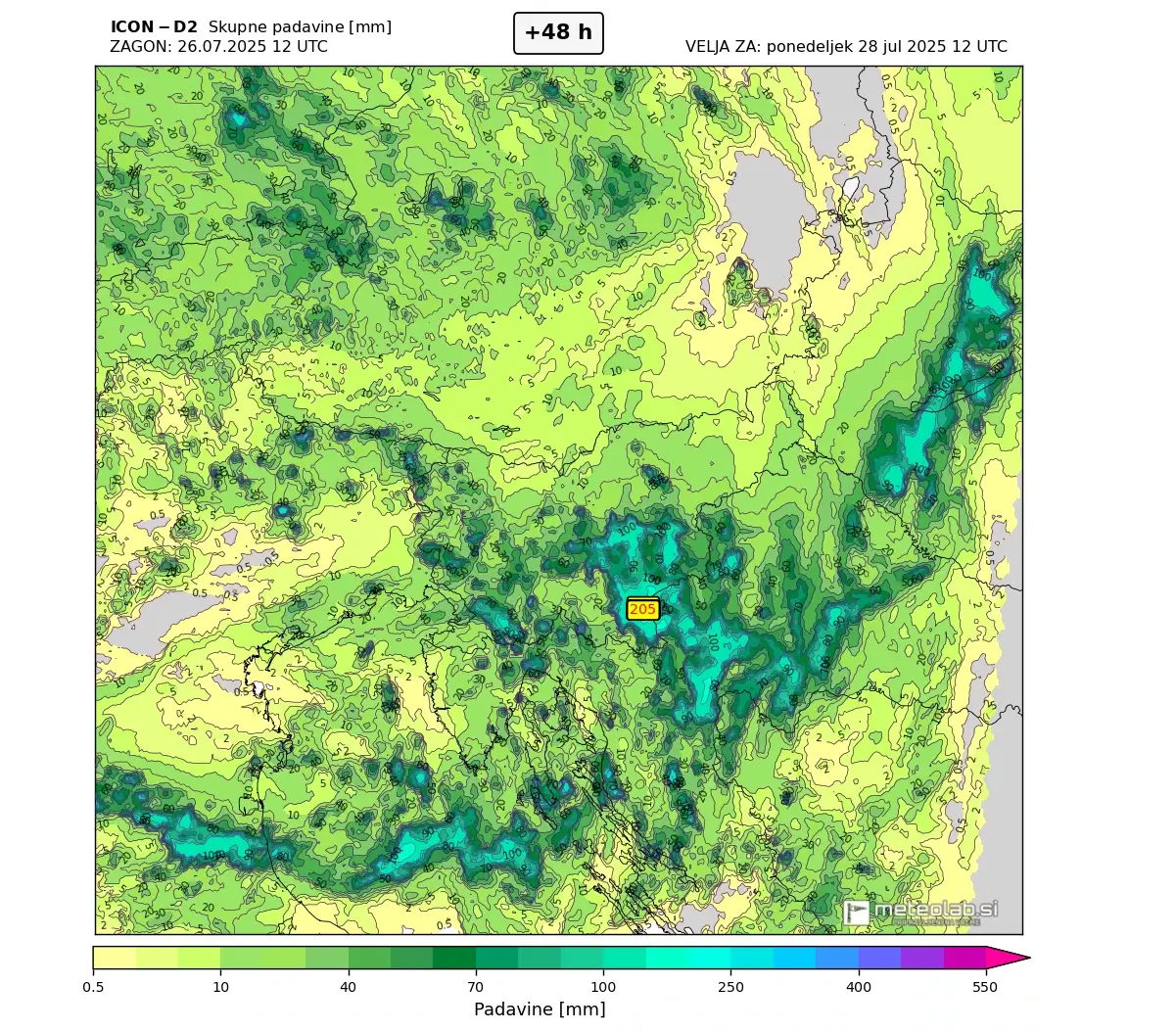
Here is a close-up view of the rainfall sums from mid-Sunday through Monday night over the northern Balkans and Italy. Locally, 100-200 mm will be possible, where storms could maintain with training cells, leading to high rainfall sums.
By Monday, the highest potential for flooding rains is over southeast Slovenia, northern Croatia, and from the Emilia-Romagna coast (Italy) to the central Adriatic region (Croatia).
With the colder air mass arriving behind these fronts, severe weather conditions will gradually vanish on Tuesday. Temperatures will remain near or slightly below the average for this period and continue into early August.
We will continue to monitor the evolution of the weather pattern and update the forecasts accordingly. Stay tuned.
Pivotalweather, Wxcharts, Weatherbell, and Wetterzentrale provided images for use in this article.
See also:
Fall 2025 Forecast: A Major Weather Pattern Reversal Leading Into Winter