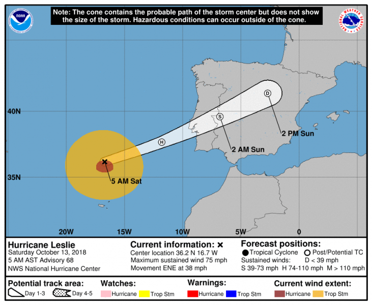
Hurricane Leslie is nearing landfall on the west coast of Portugal. It will reach the south/central coast tonight around midnight.
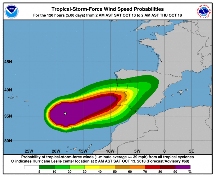
Models have finally come to agreement about the location of the landfall, which is currently forecast around the Lisbon area, or perhaps slightly north as some models suggest. Hurricane force winds are expected at landfall.
Hurricane Leslie forecast track by National Hurricane Center
Hurricane Leslie hurricane force winds probability forecast by National Hurricane Center
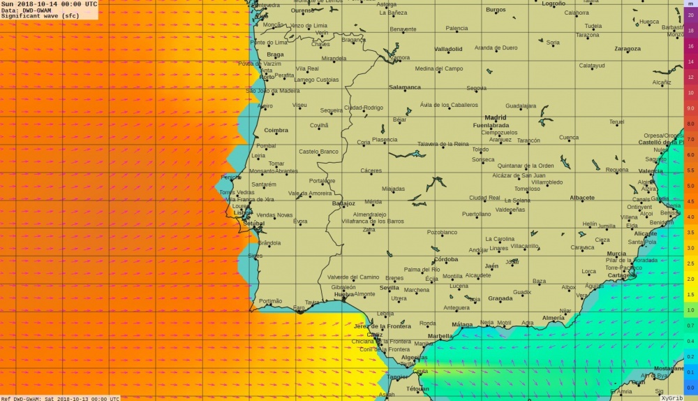
Ocean wave models are suggesting heights up to 4-5 meters associated with the hurricane arrival.
ocean wave forecast by the DWD-GWAM model
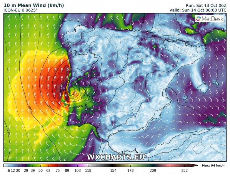
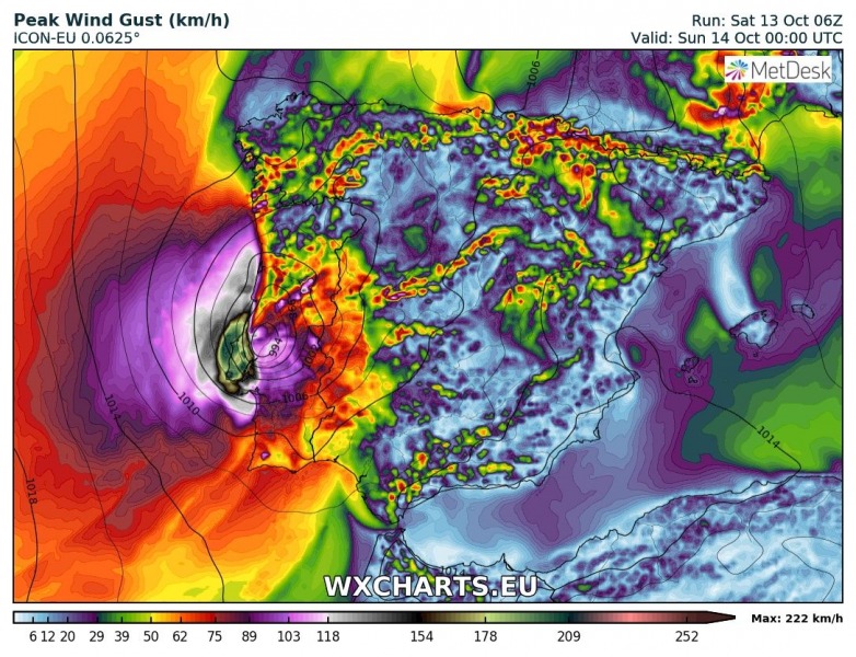
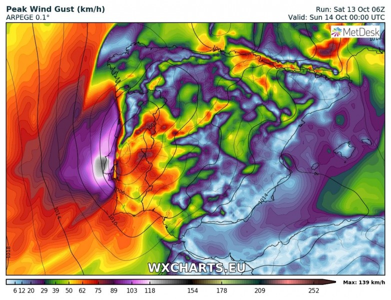
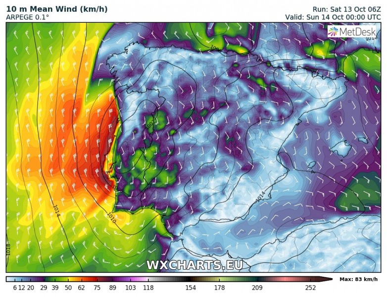
ICON-EU model has been the best model recently with the suggested track and landfall location. It does, however, simulate abnormally strong wind gusts, exceeding 200 km/h! The ECMWF operational model also simulates wind gusts over 180 km/h, but both also have maximum sustained wind speed just up to 80-90 km/h. ARPEGE model also agrees with sustained winds up to 80 km/h maximum, and gusts at landfall around 125 km/h, which is much lower and likely more realistic then ECMWF or ICON-EU.
ICON-EU model forecast for Sunday 00 UTC. Map by wxcharts.eu
ICON-EU model forecast for Sunday 00 UTC. Map by wxcharts.eu
ARPEGE model forecast for Sunday 00 UTC. Map by wxcharts.eu
ARPEGE model forecast for Sunday 00 UTC. Map by wxcharts.eu
Stay tuned as we follow the landfall of hurricane Leslie!
