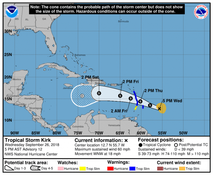
The re-developed Tropical Storm Kirk in on the way towards Lesser Antilles tomorrow. The remnants of the tropical depression have emerged as a better organized system and are now strong enough to support Tropical Storm winds – sustained winds were lately observed at 60 mph with 998 mbar central pressure. Kirk will then continue across the Caribbean sea over the weekend.
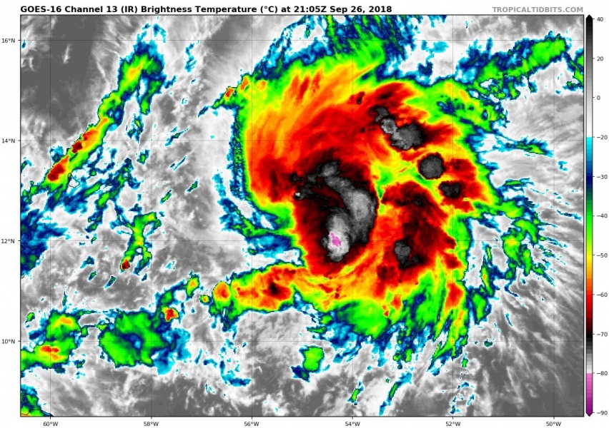
Latest Infrared satellite of Kirk indicates very cold cloud tops, a sign of intense deep convection ongoing with this wave.
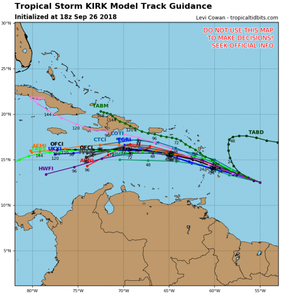
The NHC (National Hurricane Centre) tracks the storm almost due west across the Caribbean sea until early next week. Confirmed also by model guidance.
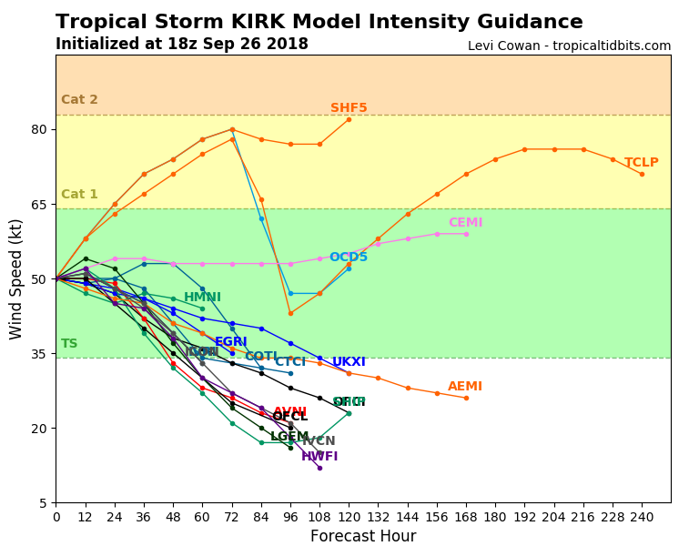
The intensity map suggests Kirk will likely remain a Tropical Storm, but some chances remain it could potentially strengthen into a CAT 1 hurricane this weekend.
The offical NHC Forecast discussion:
Tropical Storm Kirk Discussion Number 12
NWS National Hurricane Center Miami FL AL122018
500 PM AST Wed Sep 26 2018
The storm’s cloud pattern now has a more comma-shaped appearance, with the estimated center near the western edge of the comma head. Some low-cloud lines are becoming exposed over the western portion of the circulation, which is suggestive of some increase in vertical shear. Based on flight-level and uncontaminated SFMR winds from the Air Force Hurricane Hunter mission a few hours ago, the intensity is kept at 50 kt for this advisory. The dynamical guidance is in good agreement that the shear will increase significantly in 18 to 24 hours, and a weakening trend is likely to commence around that time. The system is predicted to dissipate due to the strong shear over the Caribbean Sea in about 5 days, and several of the reliable global models show this occurring even sooner. The official intensity forecast is similar to the latest multi-model consensus, IVCN, which has been a good performer in the Atlantic basin so far this year.
Kirk is moving west-northwestward, or 285/16 kt. A pronounced mid-level ridge over the southwestern North Atlantic and Florida should continue to steer Kirk on a west-northwestward to westward heading through the forecast period. Based on the latest track model guidance, the official forecast is somewhat faster than the previous one and now takes Kirk over the Lesser Antilles in about 24 hours. On this basis, the arrival of tropical-storm-force winds in the warning area is a few hours earlier than implied by the previous advisory. For specific timing information, please consult the latest arrival time of tropical-storm-force winds graphic on the National Hurricane Center website.
FORECAST POSITIONS AND MAX WINDS
INIT 26/2100Z 12.7N 55.7W 50 KT 60 MPH
12H 27/0600Z 13.5N 57.9W 50 KT 60 MPH
24H 27/1800Z 14.4N 60.2W 45 KT 50 MPH
36H 28/0600Z 15.1N 62.5W 40 KT 45 MPH
48H 28/1800Z 15.7N 65.0W 35 KT 40 MPH
72H 29/1800Z 16.3N 70.0W 25 KT 30 MPH
96H 30/1800Z 15.7N 74.0W 20 KT 25 MPH…POST-TROP/REMNT LOW
120H 01/1800Z…DISSIPATED
Forecaster Pasch
Stay tuned for further updates if models reveal more robust Tropical Storm or Hurricane development soon.


