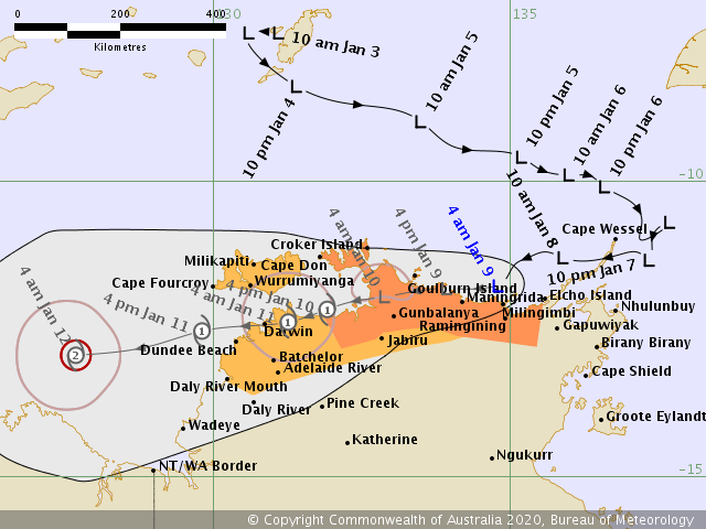
While the still ongoing tropical depression – ex-Tropical Cyclone #Blake is visible on the satellite and providing much-needed rainfall over Western Australia, a new tropical wave is shaping up along the northern tip of Northern Territory state in Australia – Invest #92S (tropical low/depression). It is currently packing winds around 30 knots and pressure near 999 mbar. It will be gradually strengthening while drifting almost due west in the coming days, likely becoming Category 1 Tropical Cyclone by Saturday while moving very near the city of Darwin. #92S will then continue moving west and intensifying next week – it could become an intense (Category 3+) cyclone.
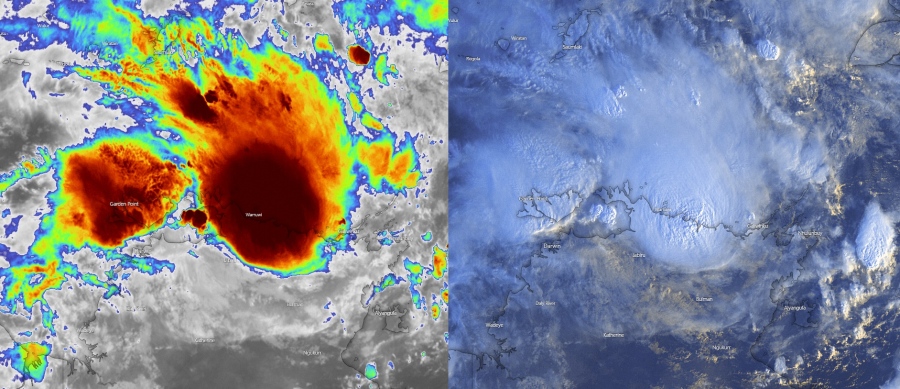
The Invest #92S is revealing some very deep convection, cloud tops are pushed below -80 °C this morning local time, Jan 9th. An intense bursts of convection and good upper-level outflow indicate the system is in a rather healthy environment for further strengthening. Attached are the latest Infrared and Visible satellite scans.
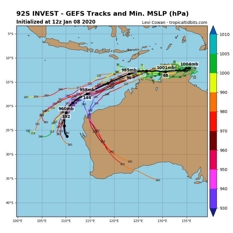
Tropical system #92S will be moving almost due west through the next 3-4 days, then likely turning more towards west-southwest next week. All models are in fairly good agreement 92S will be gradually strengthening along its track and could potentially reach a Category 3 strength (Australian classification) sometime next week. 92S will is expected to reach Category 1 strength by Saturday while moving towards the city of Darwin.
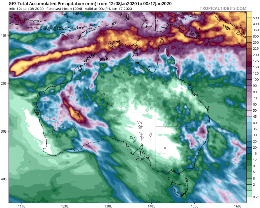
Looking over the rainfall totals map we can see a huge amount of rainfall is expected along the system’s track across the extreme north Northern Territory state, including the city of Darvin and further west over the sea. Notice also some additional rainfall is coming for the Western Australia state, besides the ongoing ex-Blake rainfall. This will undoubtedly help to reduce the fire threat more.
We are closely monitoring the evolution of this new potentially dangerous tropical system and will keep you updated – stay tuned!
See also – the first Tropical Cyclone od the season – #Blake:
Interested in our calendar? We are proud to present and promote the best weather photographers in Europe – see details:


