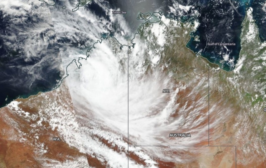
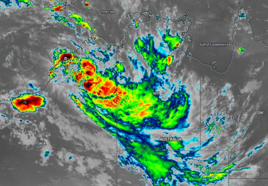
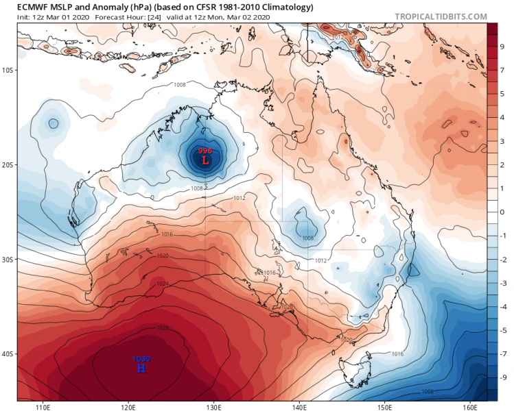
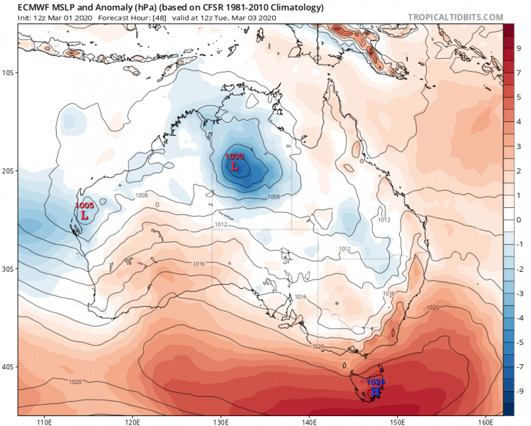
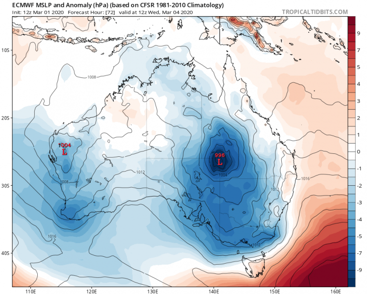
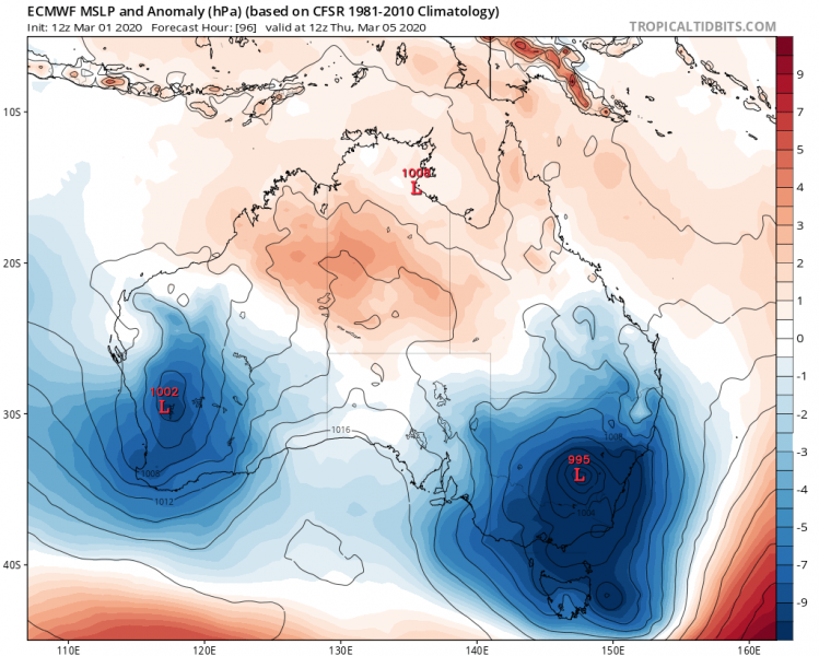
A tropical depression #Esther has made the U-turn back towards southeast, and is now moving into the Northern Territory state again. Excessive rainfall threat continues along its path. Models are hinting the wave associated with this depression should maintain the suface low all the way until it reaches New South Wales later this week.
Satellite imagery indicates Esther is still quite large system with maintaining deep convective storms producing heavy and excessive rainfall. Upper-level outflow is healthy in equatorial direction.
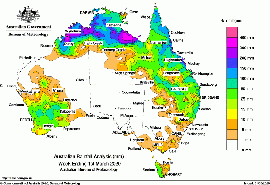
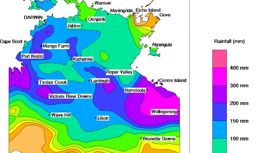
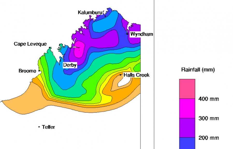
Esther has resulted in very high amount of rain while travellling from the Gulf of Carpentaria across the Northern Territory into the northeast parts of Western Australia, 250-400 mm has accumulated in some areas. Attached are maps for Australia, Northern Territory and Western Australia state for the past week of precipitation.
What is lately becoming remarkable on the models is that #Esther might potentially cross the whole Australian continent. ECMWF model is simulating the impacts in every single state with its centre passing over every single state.
Ex-Tropical #Cyclone #Esther looks like it will do an Australian tour. We could see impacts in every single state, not impossible for the centre itself to pass over every single state.
Remarkable. Has this ever happened before? pic.twitter.com/LbgRw2RXK9
— Scott Duncan (@ScottDuncanWX) February 29, 2020
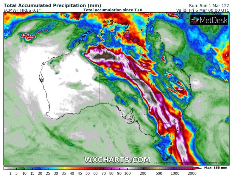
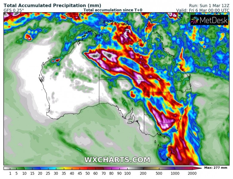
Here are the expected amount of rainfall through this week by global models ECMWF and GFS. They both are hinting the system with lots of rain could cross the continent and reach the state of New South Wales towards the weekend.
We will continue monitoring the system in the coming days, stay tuned for further updates!
See previous discussions:
