https://www.facebook.com/severeweatherEU/videos/1861814604041632/
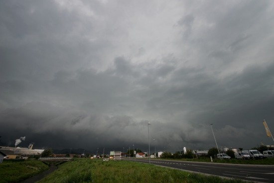
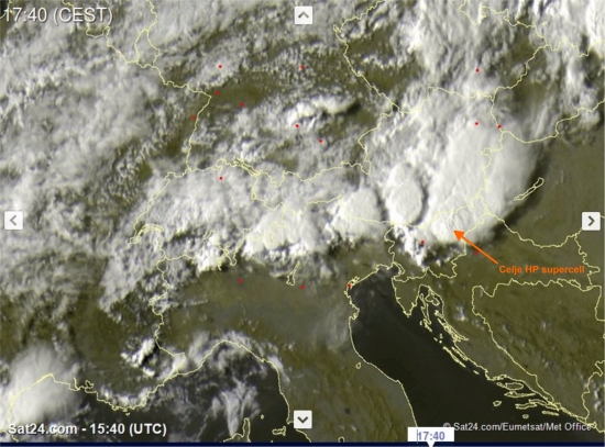
A prefrontal severe supercell hit Celje and its surroundings in central Slovenia with extreme torrential rainfall and large hail late on August 29. Very hight cumulatives, reaching 91 mm were reported (Griže pri Žalcu). Large hail accumulations were reported in Velenje, while to the south Polzela is reported to have been hit with wallnut-sized hail. Flash flooding and numerous landslides were also reported, one of them blocking the Celje-Ljubljana railroad. Chaser reports indicate a well-developed HP supercell.
Chaser reports
View of the supercell E of Celje. Shelf cloud, wall cloud, inflow tail and mid-level inflow banding well defined. Photo: Jure Atanackov.
View of the supercell near Žalec, Slovenia, photo by Marko Korošec.
View of the supercell near Celje, Slovenia, photo by Marko Korošec.
Weather & damage reports
https://www.facebook.com/severeweatherEU/videos/1861763684046724/
Hail in Velenje. Photo: Slovenske Novice.
Debris flow aftermath near Trbovlje. Photo: RTV SLO.
Satellite images & radar
EUMETSAT vis satellite image of the Celje HP supercell at 15:40 UTC. IMAGE: Sat24.com.
ARSO SIRAD radar scan of the Celje HP supercell at 15:10 UTC. Map: ARSO.


