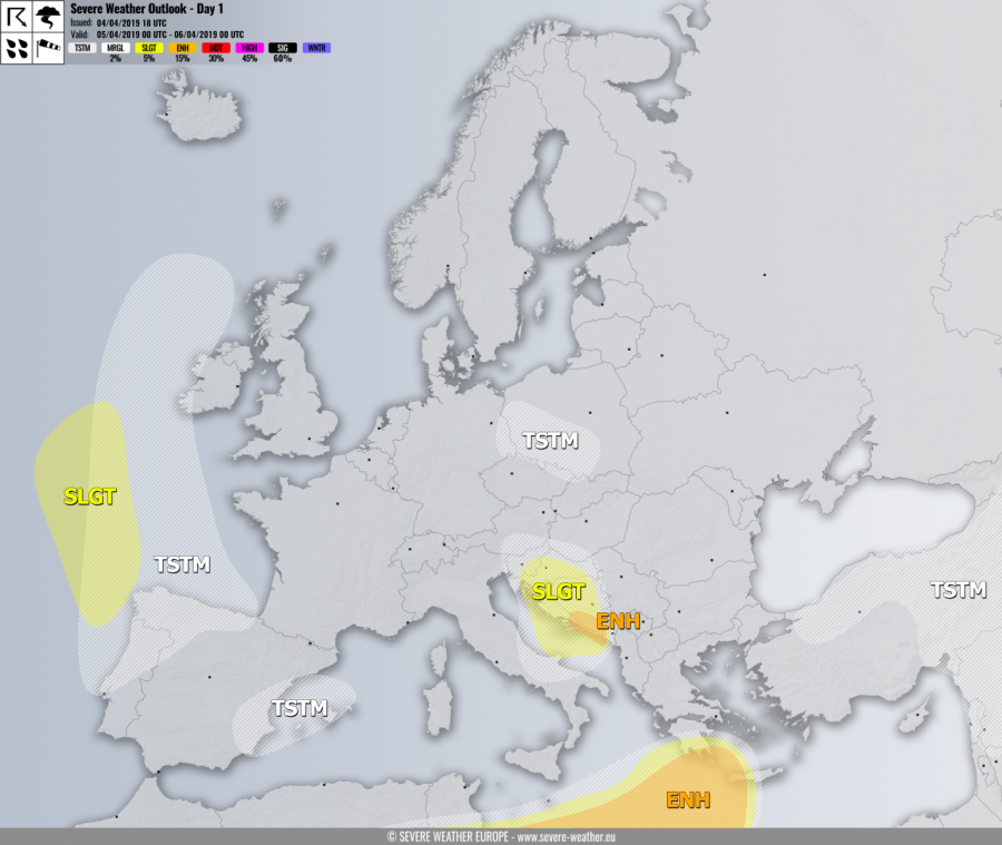
VALID FOR 05-04-2019
SYNOPSIS
A large deep upper low is located over WSW Europe while ridging remains over the Arctic region. An upper low ejects from the main large low and pushes across the E Alps and N Balkan peninsula. Another wave with surface cyclone pushes across the S Mediterranean into Greece. A deep surface cyclone moves across the W Bay of Biscay towards NW Iberia.
DISCUSSION
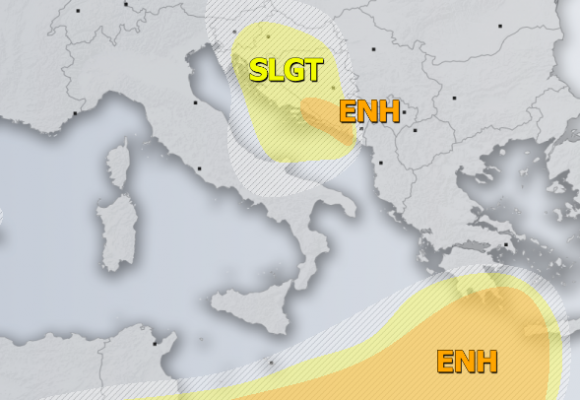
ENH / SLGT risks have been issued for south Mediterranean into extreme S Greece and Crete island with threat for severe storms, capable of producing intense rainfall, severe winds and large hail. Some tornado threat should exist across the eastern half of the ENH risk area where strong backing near-surface winds support higher helicity and low-level shear.
ENH risk has been issued for S Bosnia & Herzegovina with threat for excessive rainfall, resulting both from convective and orographic precipitation. Locally more than 150 mm is possible and local flash floods.
SLGT risk has been issued for W Balkan peninsula into central Adriatic sea with threat for severe storms along the eastwards moving cold front. Despite a quite strong shear available, low instability should limit the higher severe threat.
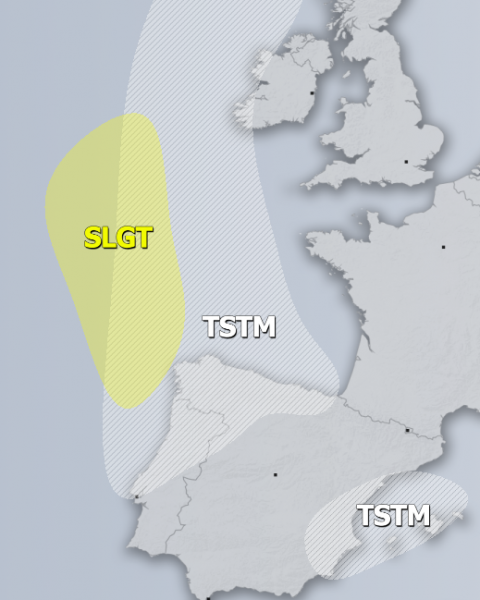
SLGT risk has been issued for W parts of the Bay of Biscay with threat for severe winds in excess of 90 km/h.
TSTM risk areas have been placed where convective storms are possible.


