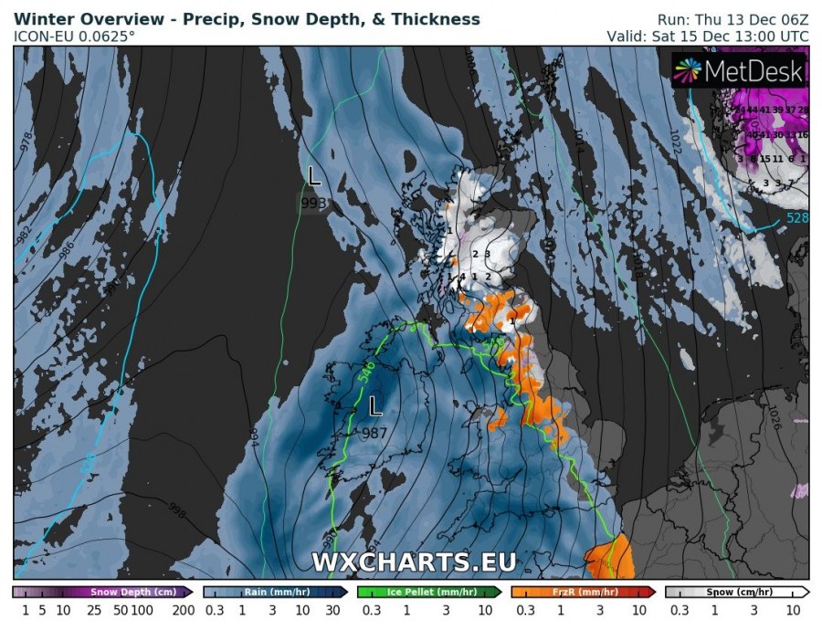
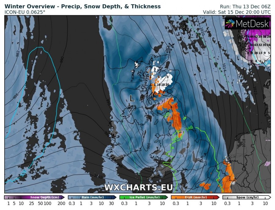
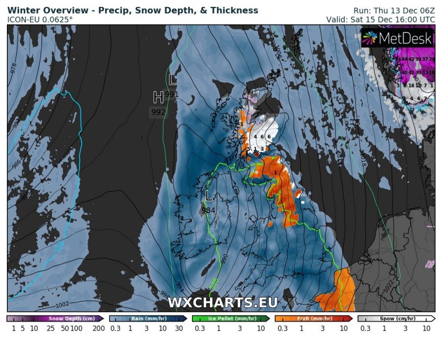
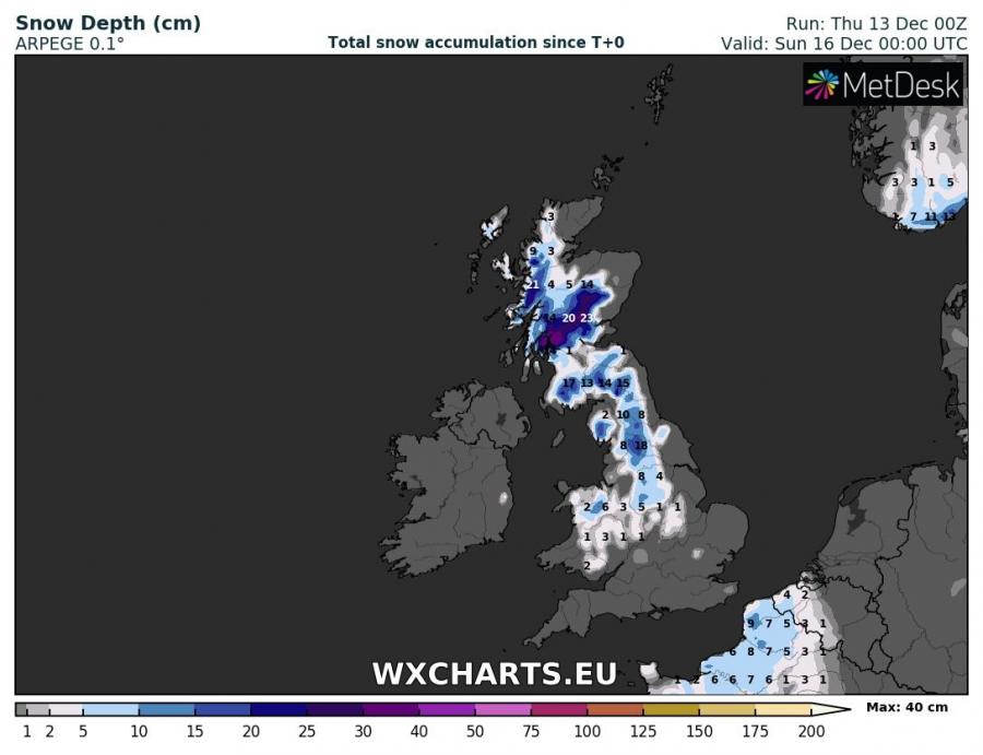
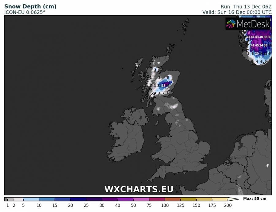
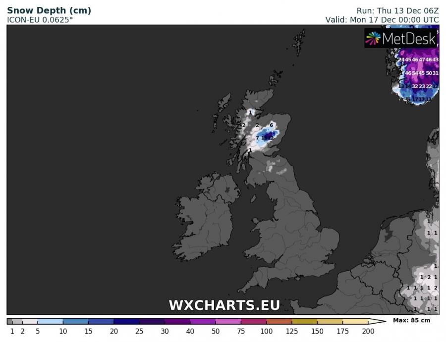
A round of locally quite significant snowfall is coming to the British Isles this weekend. Scotland will receive the most snow, locally up to 10-20 cm at higher elevations. Other parts of the British Isles may receive some snow too, including parts of northern and central England and Wales. We take a closer look.
Two deep lows cross the British Isles and Ireland in rapid succession over the weekend, bringing unsettled weather and precipitation to the region. Higher elevations of Scotland in particular and also parts of northern and central England as well as Wales will receive snow. Lower elevations in northern and central England as well as Wales will locally also likely receive freezing rain.
Two successive deep lows push across the British Isles and Ireland over the weekend. The upper 4 panels show the winter outlook for from the morning to mid-afternon on Saturday. ICON-EU model guidance. Snowfall is indicated for parts of Scotland. Most of the other parts of will receive rain. Note the zone of freezing rain in orange – expect glaze ice and, more importantly, black ice in these areas. Note that other models are more optimistic for snowfall in some of these areas. Map: Wxcharts.
Much of Scotland will receive snow, with up to 10-20 cm at higher elevations, possibly more. Northern and parts of central England will likely also receive some snow, several cm and possibly up to about 10 cm. Also some snowfall likely for northern Wales.
Total snow depth across the British Isles and Ireland early on Saturday, Sunday and Monday. ARPEGE model guidance. Map: Wxcharts.
Total snow depth across the British Isles and Ireland early on Sunday and Monday. ICON-EU model guidance. Map: Wxcharts.

