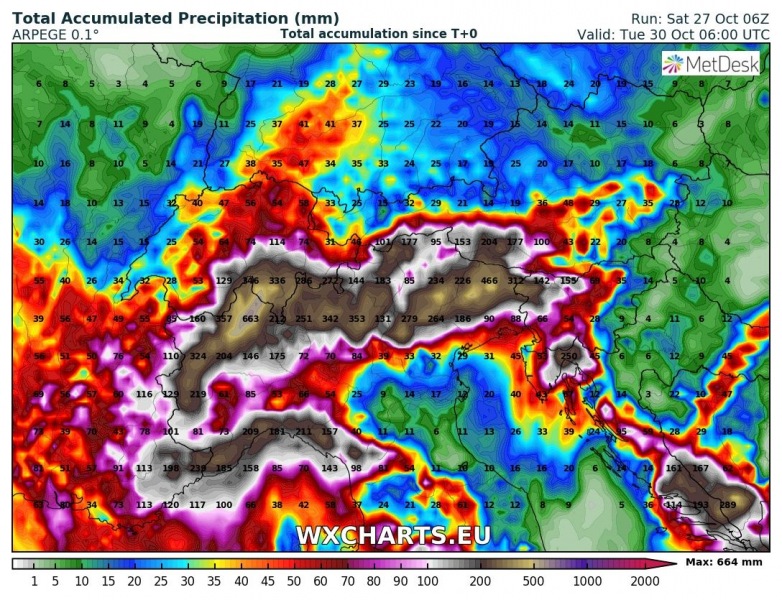
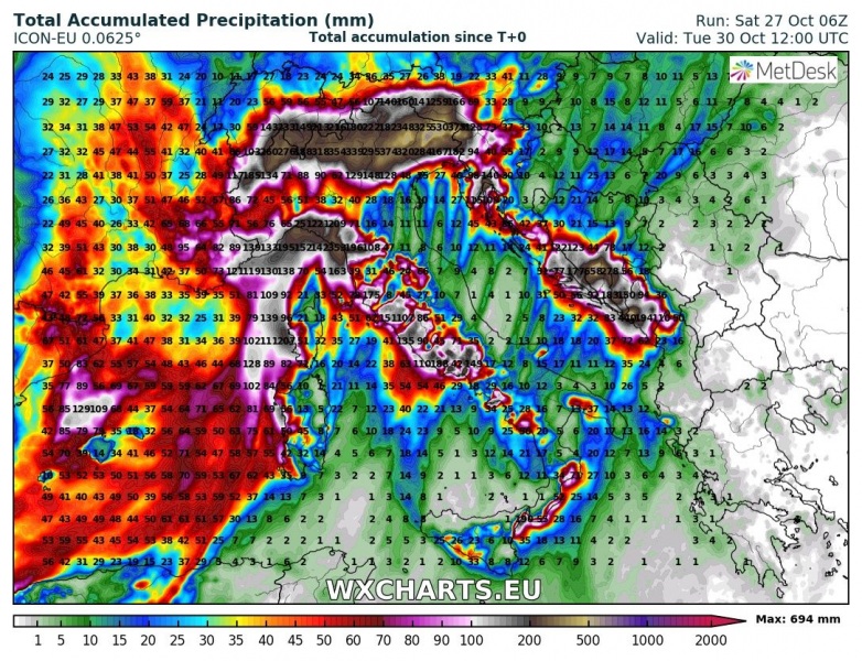
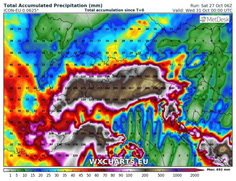
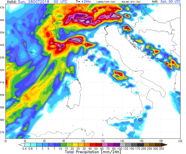
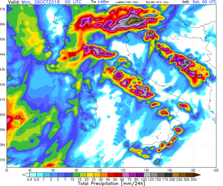
The persistent southerly flow with intense Scirocco winds will combine orographic and convective rainfall along coastal and mountain ranges along the coast of the central and northern Mediterranean. Extreme rainfall is expected: locally over 300-500 mm over 72 hours. Potential exists for major floods.
The largest rainfall totals are expected in:
- Southern Alpine flanks in northwestern, northern and northeastern Italy and into northwestern Slovenia. Peak indicated totals exceed 600 mm / 72 hours
- Coastal area of Liguria and Tuscany, NW Italy, likely with up to 300-400 mm / 72 hours
- Northwestern Croatia (Gorski Kotar, parts of Istra) with up to 300-450 mm / 72 hours
- Western part of central Italy (Lazio, parts of Campania, Umbria and Abruzzo) with up to 150-250 mm / 72 hours
- Extreme SW Croatia, SW Bosnia and Herzegovina, coastal part of Montenegro with 200-300 m / 72 hours
p align=”justify”>Such extreme rainfall will lead to major flooding and landslides across the affected regions.
Rainfall totals over the central Mediterranean and (detail) the Alpine region until early Tuesday. ARPEGE model guidance. Map: Wxcharts.eu.
Rainfall totals over the central Mediterranean and (detail) the Alpine region until early afternoon on Tuesday. ICON-EU model guidance. Map: Wxcharts.eu.
24-hour rainfall totals for Saturday, Sunday and Monday. BOLAM model guidance. Map: Consorzio LaMMA.

