Meteorological Autumn is just around the corner. The latest seasonal forecasts show clear signs of a weak La Niña leaving an impact on the Fall atmosphere. But its influence will spread on the Winter weather patterns across the Northern Hemisphere, especially North America, with a cold reversal now indicated.
The tropical Pacific Ocean is already cooling, pointing to the likely return of a weak La Niña in the coming weeks.
This is important because La Niña is well-known for its impact on seasonal weather patterns, even in a weak form. So, before going into the Fall forecasts, we will quickly look at how La Niña works and what its past influence can tell us for the upcoming season, with very interesting cold winter indicators found in the latest data.
COLD LA NINA RETURNING
La Niña is a cold phase of the large and powerful oceanic ENSO oscillation. It is a region of the tropical Pacific Ocean that shifts between cold and warm phases. The cold ENSO phase is called La Niña, and the warm phase is called El Niño.
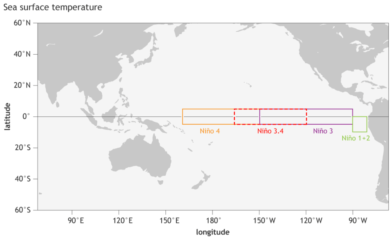
We determine the ENSO phase by the temperature anomalies (warmer or colder) in the ENSO 3.4 region, as shown in the image below. The image also shows all the other ENSO regions, which together cover most of the open equatorial Pacific.
ENSO has a major impact on the tropical rainfall and pressure patterns, impacting the very delicate ocean-atmosphere weather system. This system then distributes the ENSO influence globally, changing and impacting our daily weather.
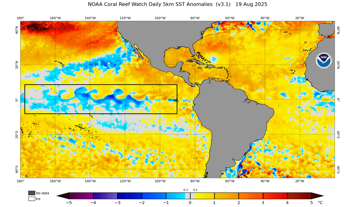
The image below shows the latest ocean temperature anomaly analysis. It reveals cooler surface waters in the central ENSO regions, and a bit warmer in the far east. You can see the cold anomalies have a “wave-like” shape. This is because the easterly trade winds push the surface waters towards the west, bringing deeper, cooler water to the surface (upwelling).
Despite the recent cooling, we are still officially in a neutral ENSO phase. But while the oceans are currently calm, the latest forecasts indicate further cooling over the Fall season, with strong support for a weak La Niña event impacting the Winter season.
We have also produced a video from the latest ocean data, which you can watch below. The video shows changing ocean anomalies over the past 4 weeks, showing the recent surface cooling trend across the ENSO regions, thanks to the trade winds and upwelling.
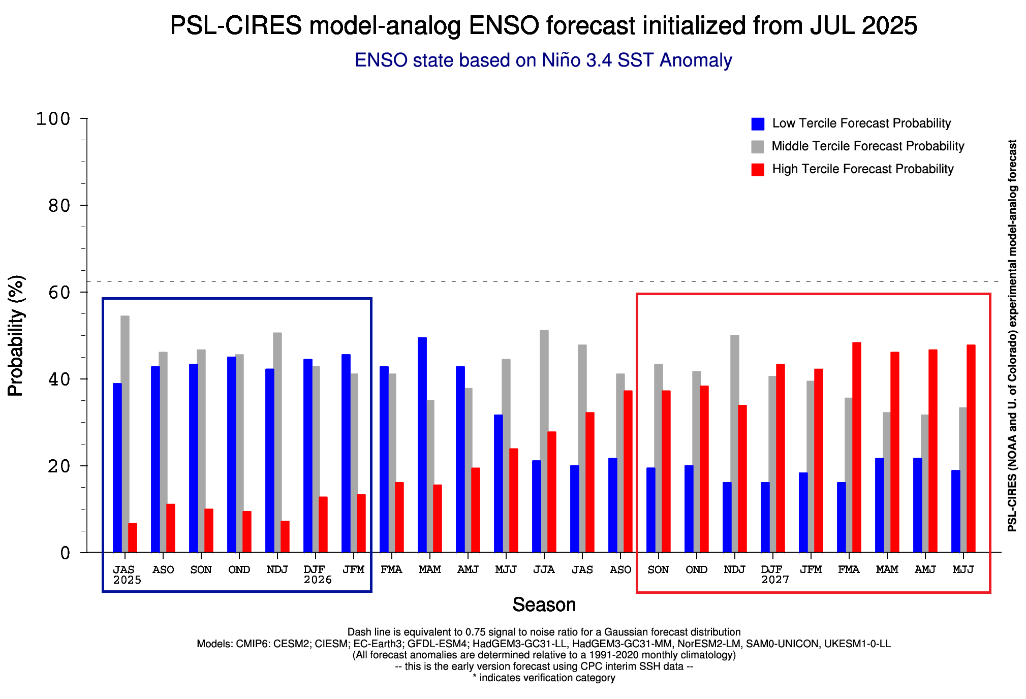
Below is an extended analog forecast by the PSL for the main ENSO region. It shows the high La Niña probability going towards this winter. But a weakening of the cold phase is forecast in 2026, with El Niño event chances greatly increasing mid-year and increasing even higher in 2027, perhaps even indicating a rare double El Niño event.
Below, you can see the ocean temperature forecast for Fall and early Winter from the North American multi-model blend called the NMME. You can see an area of cold anomalies over the tropical Pacific, indicating a weak La Niña event. Despite being classified as a weak event, it can have a clear impact on the atmosphere during the cold weather season.
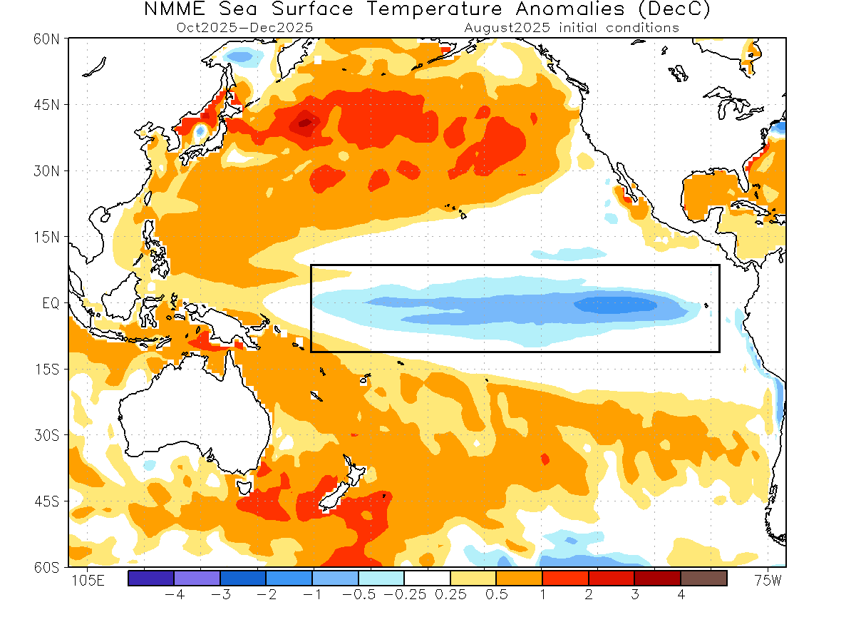
This is because even if the official La Niña criteria is not reached, the cooling itself speaks volumes about the state of the atmosphere. So, being classified as a proper weak La Nina or not in the end, the cooling itself tells us what the global weather system is doing.
FALL WEATHER IN A WEAK LA NINA
Several Fall/Winter seasons have had an active La Niña phase in recent decades. This gives us an opportunity to examine past data to see how the Fall weather patterns usually developed under a weak La Niña event, forcing its way from the ocean into the atmosphere.
We produced our own image analysis from high-resolution ERA-5 data, focusing on weak La Niña winters. The images show some of the weak La Niña Fall seasons in the past 45 years, and what their average Fall weather pattern was. It can give us some hint of the seasonal weather influence of a weak La Niña.
The temperature analysis shows below-normal temperatures over Alaska and the Pacific Northwest, and the far western United States. This indicates an influence from a low-pressure area over western Canada. A large part of the United States and southern Canada shows good warmer anomalies due to a more southerly flow, creating a “calm before the storm” pattern ahead of winter.
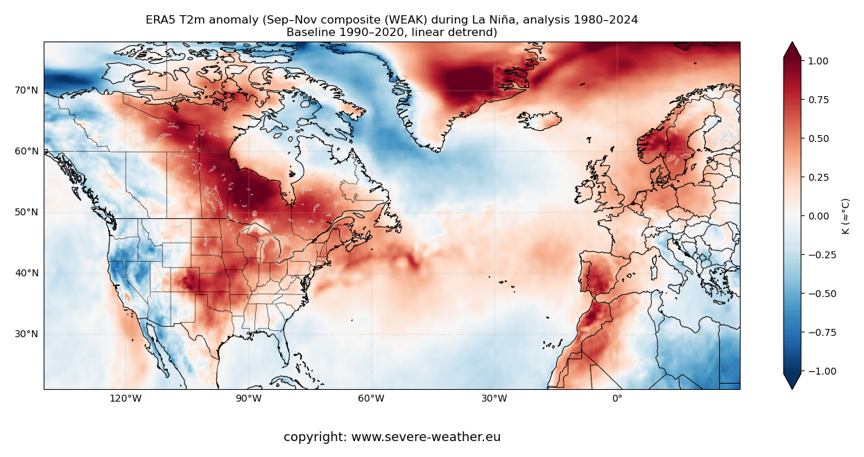
Europe is divided into a cooler southern part and a normal to above-normal northern half. This is due to the easterly flow over the south, produced by the low-pressure system over the area, and a high-pressure area to the north.
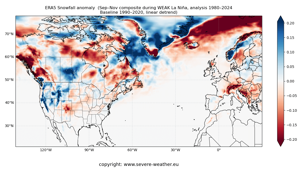
For the precipitation pattern, we decided to use the snowfall anomaly instead. You can see a drier-than-normal pattern over most of the southern parts of the United States, parts of Europe, and wetter conditions over the northern United States and southern-central Canada.
Of course, these images show a mix of different years, all under a weak La Niña. There are also other factors that play a role in global weather. But the La Niña influence is more direct over North America, so there we can see that it usually produces a warmer Fall over much of the U.S. and southern Canada.
Knowing what La Niña is and how it can impact the Fall seasonal weather, we will now look at the actual forecasts to see if we can find its influence on the coming Fall 2025 weather season.
FALL 2025 LONG-RANGE FORECAST UPDATE
For this Fall 2025 forecast, we decided to focus on the two main (or most used) seasonal models: The ECMWF model and the NMME, which is a combined forecast from several different North American models. Forecast images are from the Copernicus Climate EU project and Weatherbell (commercial license).
All these forecasts are an average picture over 3 months (September-October-November) and show the general prevailing weather pattern forecast for the meteorological Fall.
The pressure pattern forecast shows a high-pressure system in the North Pacific, with another high-pressure area extending from the northeastern United States into the Atlantic. It also shows a low-pressure zone over northwestern Canada, with a possible extension into the U.S., with a break in the high-pressure pattern across the Plains.
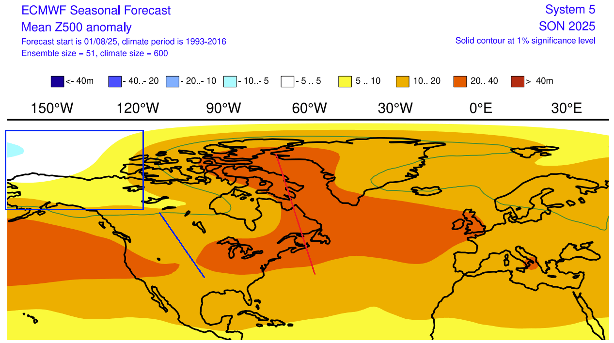
In the European sector, a high-pressure area is indicated over the UK and Ireland, and a low-pressure area to the north. This promotes a warmer airmass into the continent, as there is also an indication of a ridge over the south-central parts.
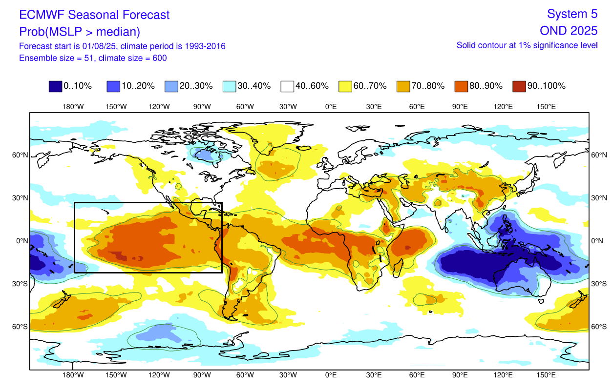
The ECMWF is currently the model that shows a borderline La Niña or a cool-neutral phase. But its surface pressure forecast for Fall and early Winter shows a slightly amplified high-pressure zone over the ENSO regions. There is a low-pressure anomaly over the Maritime Continent, which in total indicates a stronger Walker Circulation and a clear signature of a La Niña-like pattern.
This effect is also reflected in its weather pattern forecast, but how about the temperature and precipitation?
FALL TEMPERATURE AND PRECIPITATION FORECAST
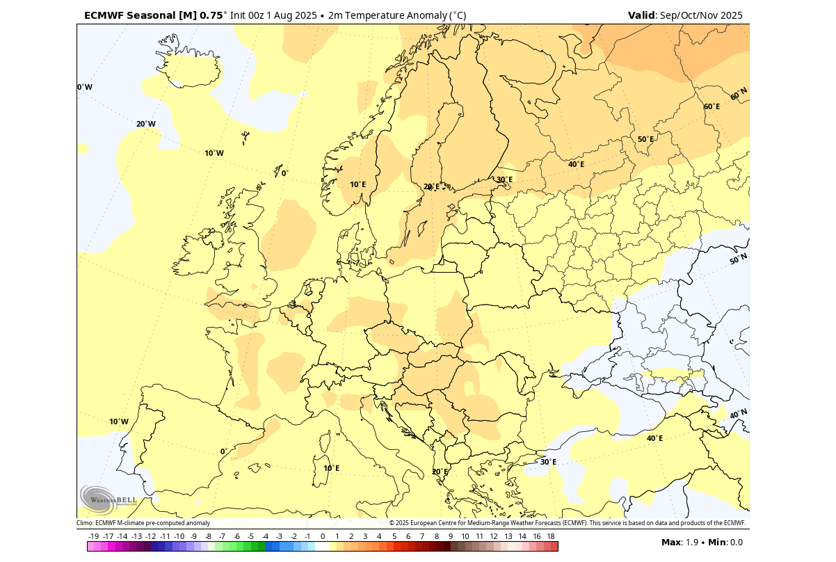
First, looking at Europe, we can see warmer-than-normal surface temperatures over much of the central and northern parts of the continent. This is due to a warmer airmass spreading along with a high-pressure anomaly.
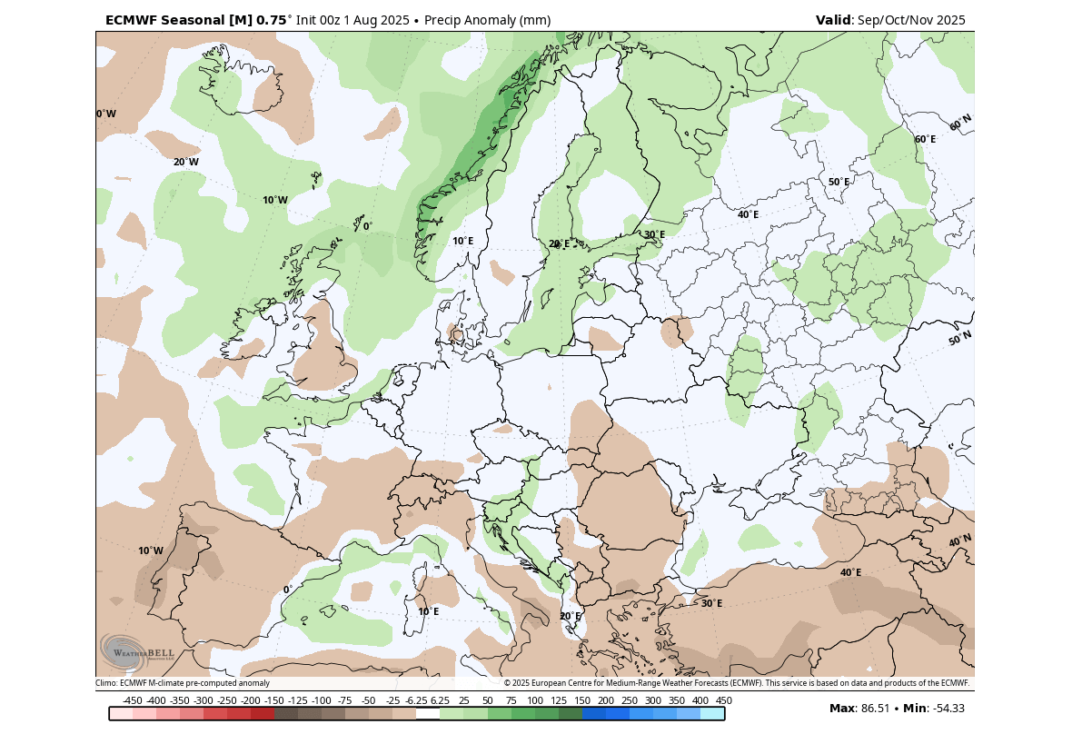
The precipitation forecast shows a drier Autumn over the southwestern and southeastern parts. At the same time, more precipitation is forecast over the central parts. You can also see more precipitation over a large part of the north, due to a low-pressure area and the polar jet stream further north.
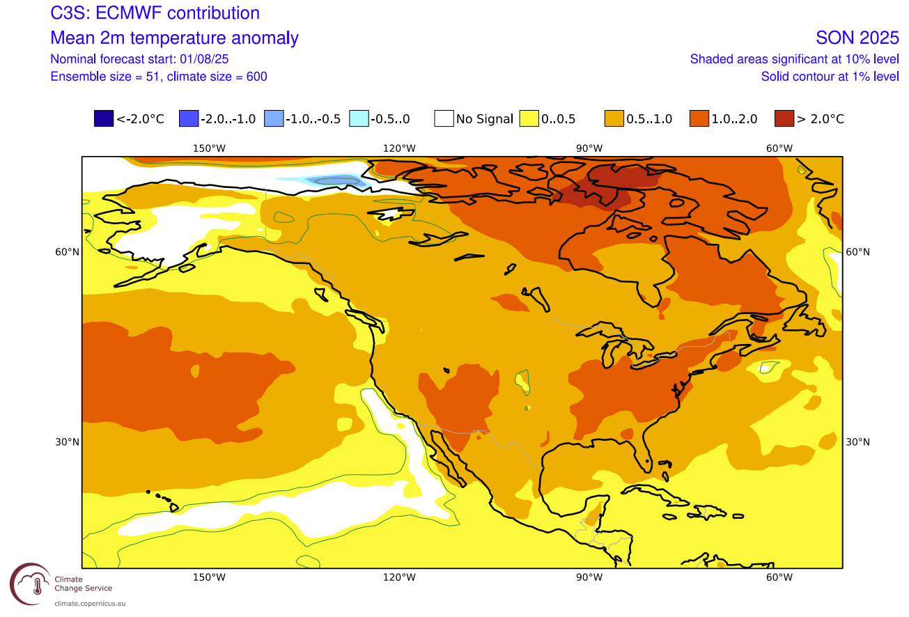
The core of warmer Fall temperatures over North America spans the southwestern and eastern parts of the United States, and over eastern and northern Canada. You can see an interesting break in the warm anomalies across the Plains, associated with an indication of a low-pressure extension (trough) in the pressure forecast above.
Overall, this looks similar to what you would expect from a weak La Niña event, based on the new analysis maps we created from the high-resolution data above.
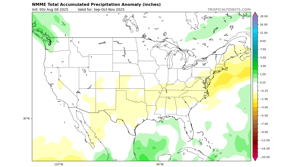
Looking at precipitation, you can see drier conditions over a larger part of the United States and south-central Canada. More rainfall is forecast for the Pacific Northwest, eastern Canada, and also over the central Plains, merging with a hinted low-pressure area and a break in warm anomalies.
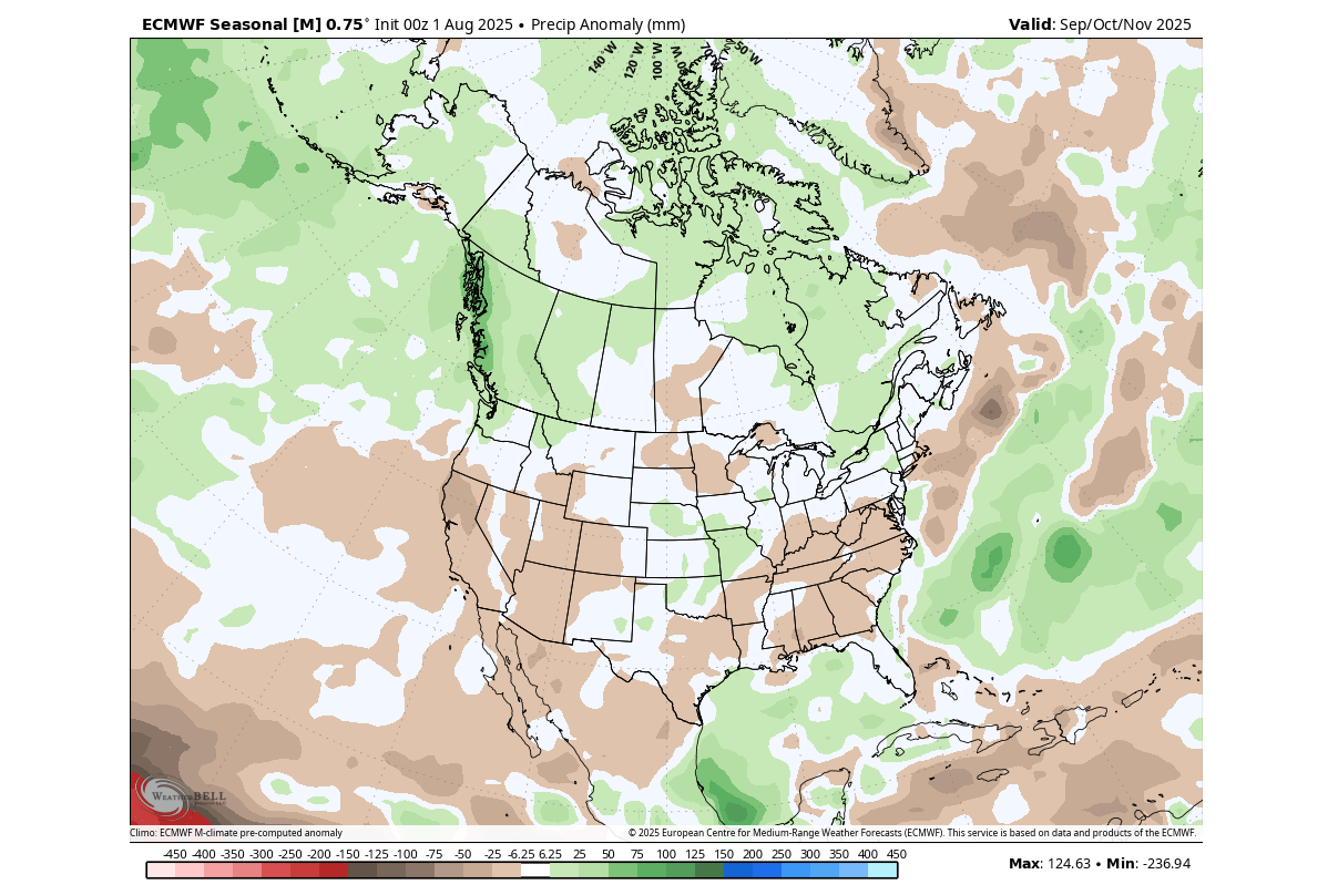
Overall, this suggests a more high-pressure dominant Fall across the United States, based on temperature and precipitation patterns. But this pattern is likely more dominant in the first half of the season, as it looks more like an extension of the Summer pattern.
LATE SEASON SNOWFALL
As we look into late Fall, we are already in the month of November. So that means we can look at the snowfall predictions, as November is usually the month when the temperatures drop further and start to support broader snowfall events.
The latest snowfall forecast for November shows less snowfall over the northeastern and western United States and the upper Midwest. But there are areas of more snowfall forecast over the central Rockies, the Appalachians, and across the states of Iowa, Wisconsin, Illinois, and Nebraska.
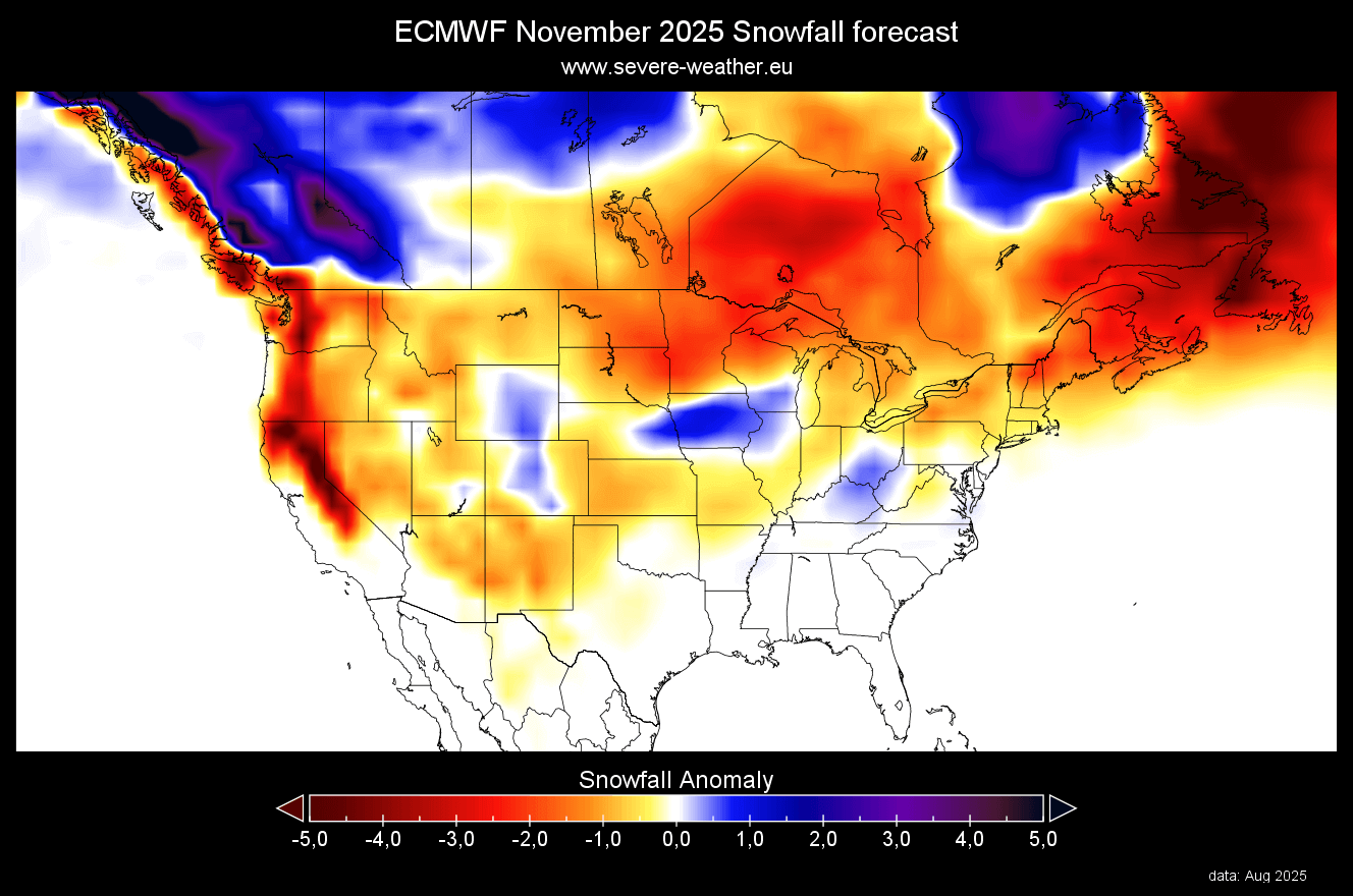
Another area of above-normal snowfall is across central and western Canada. This is important because a larger snow coverage over western Canada typically provides a potentially colder airmass to the United States. This is because the Polar air mass warms up more slowly when passing over a snow-covered area.
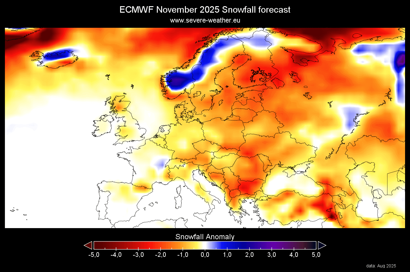
Across Europe, November also shows less snowfall than normal, due to a high-pressure dominant pattern. But, having less snowfall than normal does not mean no snowfall at all, just that the number of events or the snow amount itself is below normal.
NMME FALL 2025 FORECAST UPDATE
In contrast to the ECMWF model, we often use the NMME model system. It stands for North American Multi-Model Ensemble (NMME). It combines several individual models to show an average picture from different solutions.
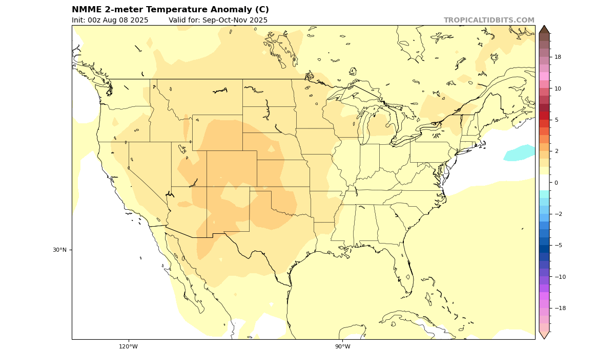
Looking at North America, the temperature forecast below shows a warmer Fall over the western and central parts of the United States. Southern Canada, parts of the upper Midwest, the eastern United States, and the Northeast all show weaker warm anomalies and have the most potential for some late Fall cold disturbance.
The precipitation forecast for North America shows less precipitation over the southern half of the United States and up towards the northeast. But normal Fall precipitation is likely over the northwestern parts of the United States, over the Pacific Northwest, and over eastern Canada, very similar to the expected weak La Niña influence.
This is not far away from the ECMWF forecast, but precipitation trends are usually harder to predict than temperature or pressure.
Overall, both models show a warmer/milder Fall season across the United States, but as we mentioned in the headline, it could be a calm before the storm.
ABOUT THAT WINTER STORM
Earlier in the article, we showed in a new analysis image that a weak La Niña usually comes with a warmer/milder Fall season across North America and Europe. The forecasts actually show that exact development, but whether it’s purely down to the cool ENSO area is up for debate in another article.
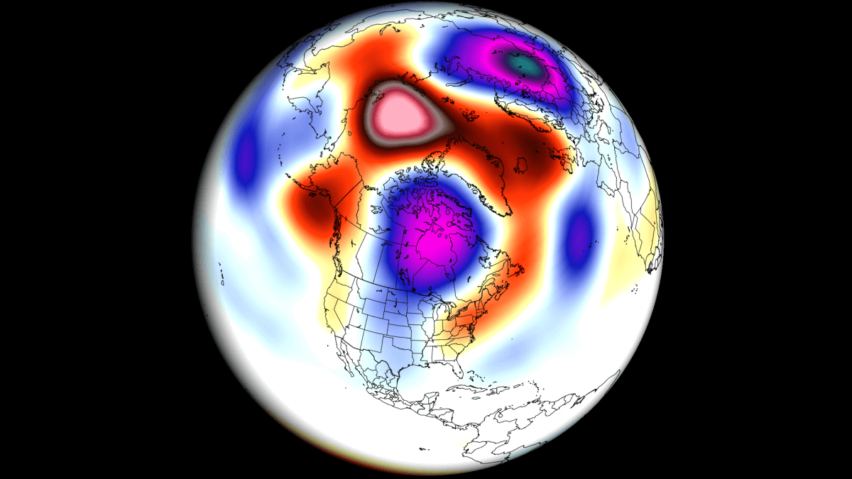
What we can do now is do a new analysis, but this time for the weak La Niña winters. You can see the temperature pattern below, and it shows quite a different pattern. There is a cold anomaly over much of southern Canada and a large part of the United States, and Europe.
This is an interesting development that shows almost a complete reversal compared to the Fall patterns, and if Fall was the calm before the storm, then this is now the “winter storm”. And keep in mind that this image is based on actual data from weak La Niña winters in the past 45 years.
This means a low-pressure system is likely over Canada, and a northerly flow of colder air into the United States. As the colder air is more easily accessible to the northern United States and southern Canada, it increases the snowfall potential.
You can see above-average snowfall across much of the northern United States and southern Canada in a La Niña winter. Peak snowfall is usually across the higher elevations of the Pacific Northwest. But in other areas, states like Minnesota, Wisconsin, Michigan, New York, Vermont, and northern Pennsylvania stand out with more snowfall in such winters.
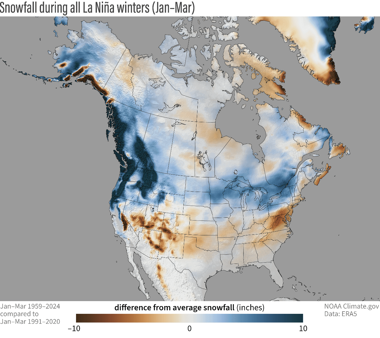
The southern United States usually experiences less snowfall in such winters because of less precipitation and also because the jet stream is more confined to the northern United States and southern Canada.
Looking at the actual forecasts, the temperature pattern does not show a clear, broad cold anomaly at this range. But you can see the typical pattern of a cold corridor, which is supported by the pressure pattern. You can see that the eastern United States shows no warm anomaly, which is an indication in itself. This indicates a northerly flow, resulting from the low-pressure area over eastern Canada.
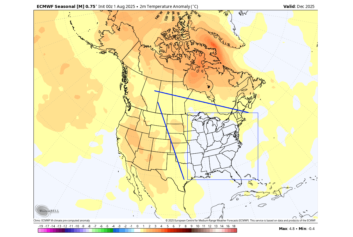
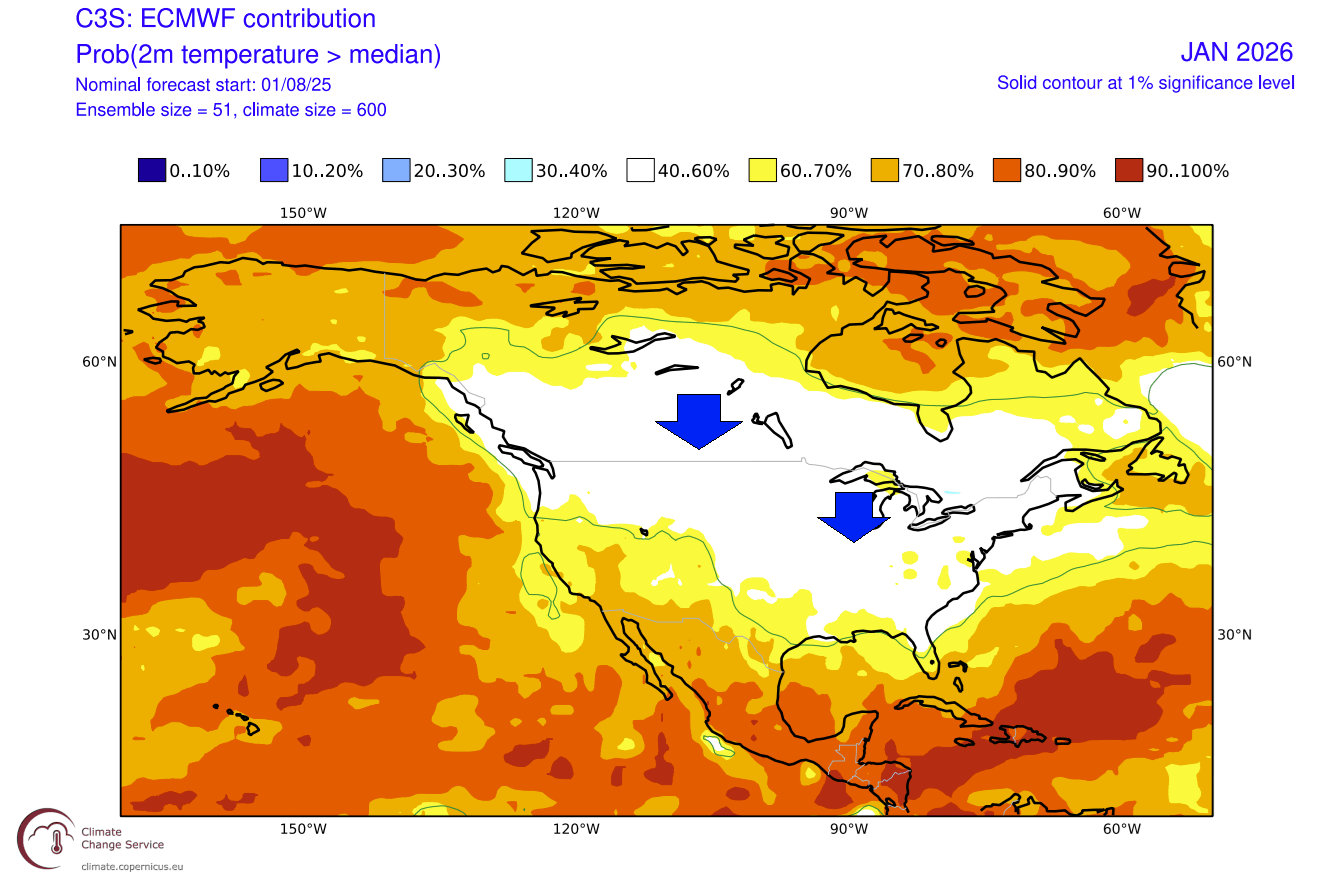
Below is also a single-month forecast for January 2026, and it shows much less warm anomaly areas both over the United States and southern Canada. This indicates further expansion of the northerly flow, bringing the potential for some colder winter days to a large part of the United States, and for now confirming the cold La Niña trend in the analysis above.
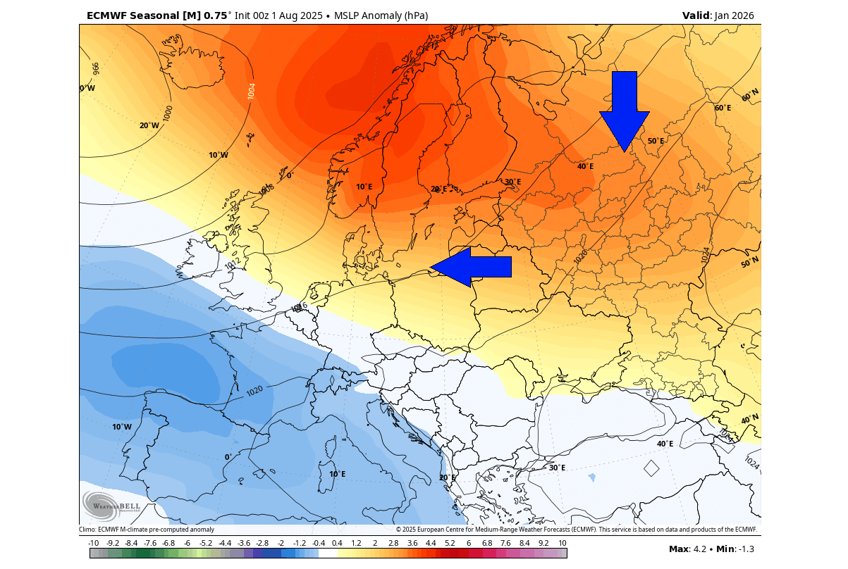
Looking at Europe, the most interesting month in the winter forecast is January 2026. Below is the pressure forecast, which shows a broad high-pressure blocking pattern over the north. As an anticyclone spins clockwise, this means a colder northerly to northeasterly flow across the continent, transporting down a colder air mass.
This is just one of the factors that currently suggests a high potential for weaker winter circulation and increased cold potential. For a more in-depth analysis and other factors involved, you can read our latest Winter Forecast article: Winter 2025/2026 Early Forecast: La Niña and Polar Vortex Shape a Cold Surprise Ahead
We will keep you updated on the developing weather trends in the coming seasons, so make sure to bookmark our page. Also, if you have seen this article in the Google App (Discover) feed, click the like button (♥) or add us to preferred sources there to see more of our forecasts and our latest articles on weather and nature in general.