It has been a horrible and deadly wildfire season in the western United States. Severe wildfires have been burning across Oregon, Washington, California, and Colorado in August. Wildfires have burned a record-breaking area, following recent hot summer and extreme drought conditions. A massive smoke cloud was forecasted to spread into the Atlantic and has now also reached Europe this week.
Key points
The worst wildfires have been in California and Oregon. Soon after the extreme heatwave in the western United States, the fires have started in California.
Finally, a cool and humid start to the weekend and this week has helped thousands of firefighters across Oregon to make some progress against massive wildfires burning across parts of Oregon.
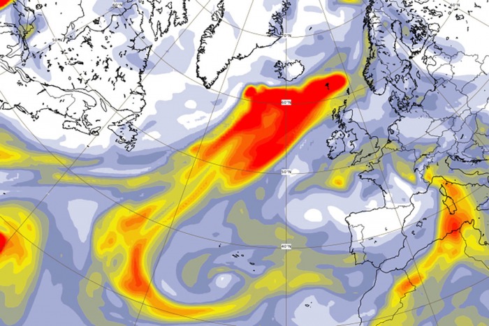
A thick smoke cloud was spreading across North America, including both the United States and southern Canada. Impressively, the smoke cloud has already reached the North Atlantic.
Now, the smoke cloud has also spread into Europe.
Wildfires in California and Oregon
The wildfires were first mostly ongoing over California and Colorado during the second half of August. Then, wildfire threat also significantly enhanced over Oregon and Washington states in early September.
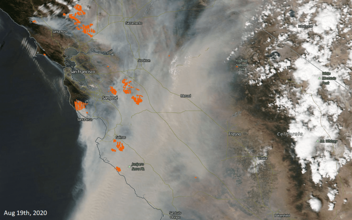
Attached is the visible satellite view of the active fires mainly across southern California on August 19th. The thick and huge smoke cloud was pushed towards the south and southwest with prevailing winds on that day.
Visible satellite imagery shows that an enormous area has been affected by heavy smoke from these fires.
Mid-September smoke cloud spread
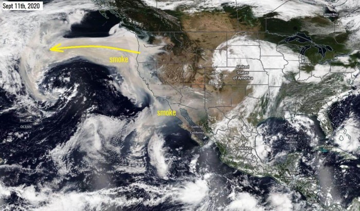
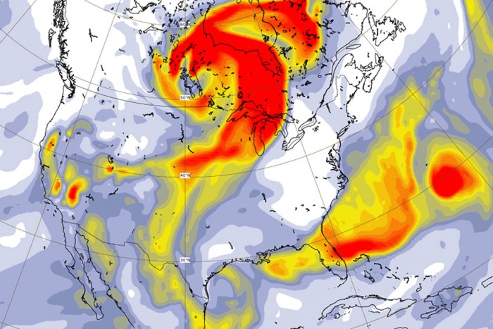
One particularly extreme situation was around Sept 11th when the wildfires were very active over California and Oregon. A thick smoke cloud spread westward into the northern Pacific with prevailing easterly winds. The West Coast turned red.
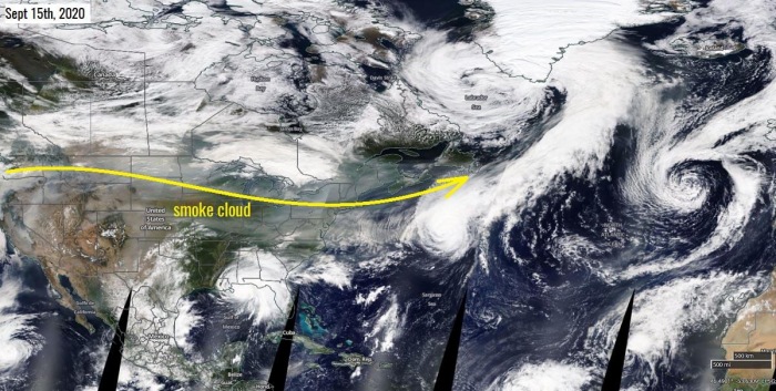
On Sept 15th, the pattern shifted into more westerly prevailing winds. This resulted in the smoke spreading across the United States and southern Canada. Even reaching northwestern Atlantic in the afternoon.
Notice there are also hurricane Sandy and Paulette visible on the image.
Smoke cloud spread across the Atlantic and reaches Europe
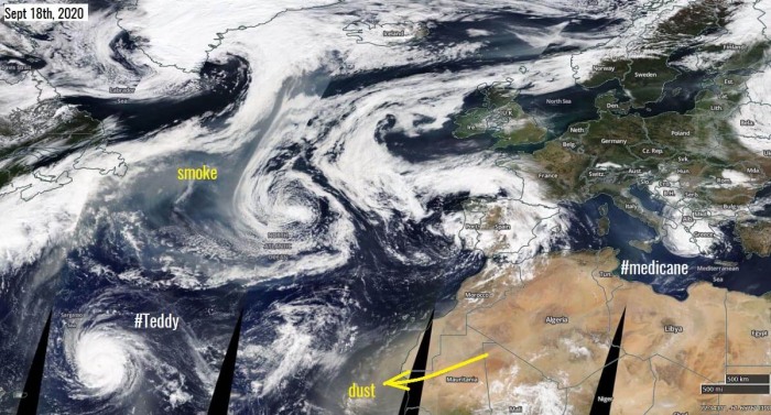
It has been one very active period lately. This attached NASA MODIS satellite image says it all. There is a smoke cloud spreading across the North Atlantic towards Europe. To the east of the cloud, remnants of Paulette were moving towards the Azores.
Then, there is a monster Category 4 hurricane Teddy in the Central Atlantic. While a dust storm has spread the dust from northwestern Africa into the Eastern Atlantic.
While Europe has been on focus with the intense medicane Ianos over the Ionian Sea and Greece.
And… to make this image even more complex, there is also the 22nd Atlantic tropical system of the season – a Subtropical Storm Alpha nearing Portugal. Yes, Greek alphabet usage as the reserved names for hurricane season has been used already.
What a week to say at least!
Smoke cloud forecast
Using the atmospheric models, we can predict the winds in the atmosphere and the trajectory of these smoke clouds. One such model which does this by default is the GEOS-5 model from NASA.
Below is the video of the thick smoke cloud originating from the California and Oregon wildfires spreading across the United States, North Atlantic, and now also reaching Europe. We can see the sequence of the developing smoke cloud from Sept 20th until the 24th, 2020.
Let’s see some more details:
North American continent
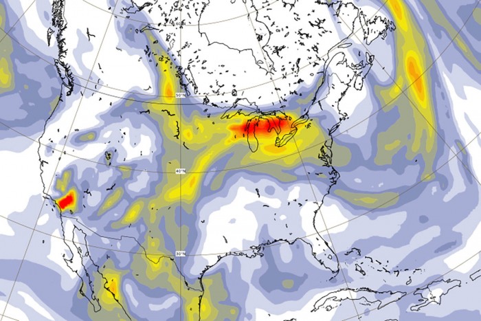
Smoke cloud has been very thick over North America also this weekend, but conditions are finally improving with moist and cooler air coming into the West Coast. Today (Monday, Sept 21st), a thick smoke cloud was mainly spread across the northern US and Canada.
And with the decreasing number of fires, the less dense thickness of the smoke cloud is forecast in the coming days. The overall situation across the US and Canada is finally improving!
North Atlantic and Europe
The prevailing western shift pattern has brought the smoke cloud across the North Atlantic this past weekend. It has been particularly thick over northwestern Europe on Sunday!
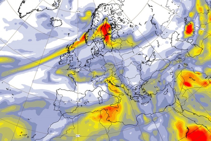
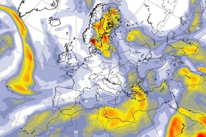
By Monday (today), the smoke has spread into northern Europe, as the remnants of the ex-hurricane Sally were rapidly moving across the Atlantic into the far northeast Atlantic. Powerful southwesterly winds pushed the smoke into Scandinavia.
Notice there are also quite thick aerosols over the Mediterranean. Those are actually Saharan dust particles advecting northward across Italy towards the Alps ahead of a shallow upper low over southwestern Europe.
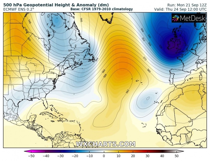
Later this week, a major pattern change is forecast over Europe. A quite significant deep trough will bring the fall weather into a large part of Europe. Also much cooler weather and lots of rain in some areas.
This pattern will flush away the dust from central Europe and the Mediterranean. However, some smoke aerosols will remain over Scandinavia as favorable winds should maintain the air mass over the northern parts of Europe.
CAMS data & forecasts
The attached maps in this article are a result of the Copernicus Atmosphere Monitoring Service (CAMS) which is monitoring the scale and intensity of the fires and the transport of the resultant smoke across the globe.
The maps indicate an ‘Aerosol optical depth’. It is a measure of how much sunlight is blocked by aerosol particles in the atmosphere. CAMS motoring service analyses and forecasts, combining both satellite and ground observation into the final product.
CAMS data has shown that the thickest smoke cloud has been accumulating off the US coast over the Pacific Ocean first. But then, the pattern change has advected the smoke across North America through mid-September, over both the US and Canada.
CAMS forecasts predicted that the smoke cloud will continue over the North Atlantic and will reach northern Europe this past weekend.
Note: The smoke might not be seen anymore at this distance. But the particles can still reach very long distances, only visible with instrumentation.
