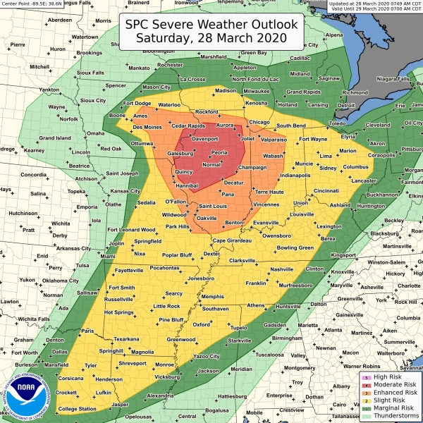
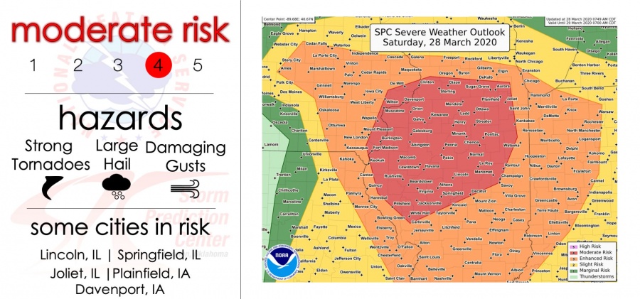
A significant severe weather outbreak seems possible across far eastern Iowa, northeast Missouri into north-central Illinois and northwest Indiana, United States through late this afternoon/evening hours and tonight. Conditions are merging together for a widespread event, conductive for large to very large hail, severe damaging winds and tornadoes, possibly some strong ones!
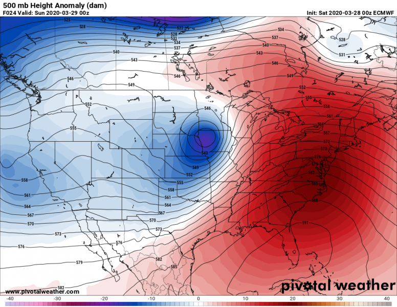
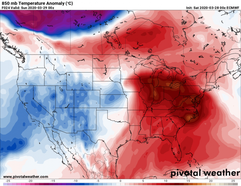
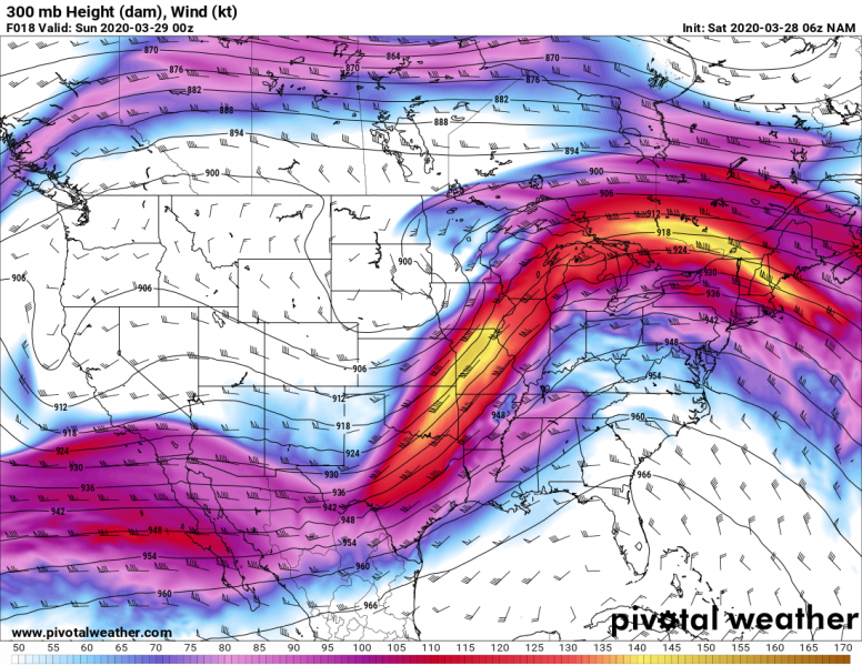
The pattern over CONUS indicates there is a deep trough moving across the Plains into Midwest, with a deepening surface low. This is resulting in strong warm/moist air mass advection through the Mississippi valley into Midwest and Great Lakes region. A very strong jet stream is providing upper-level divergence to support storm initiation along the surface front and ahead of it, across the warm sector.
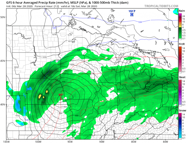
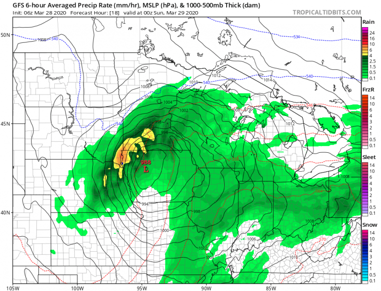
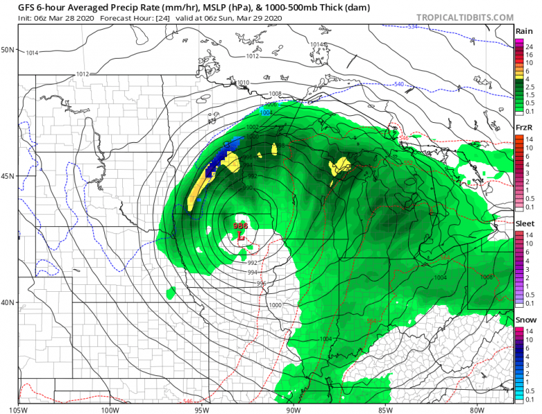
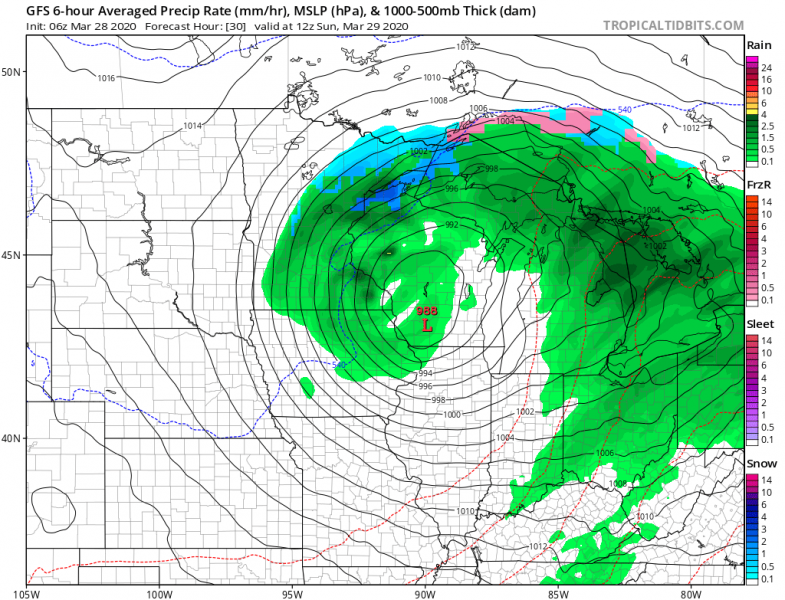
A surface is currently deepening over the central Plains and will continue moving northeast into Midwest through the evening hours. Crossing Iowa in the evening and reaching Wisconsin on Sunday morning. Heavy rain will develop around the low from eastern Nebraska into southern Minnesota.
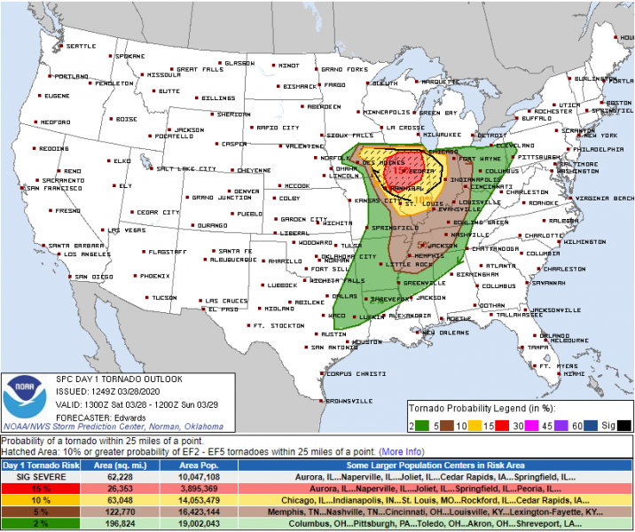
Storm Prediction Center (SPC) has issued MDT and ENH risks for the potentially most affected areas.
Close-up views of the primary hazards with this severe weather event:
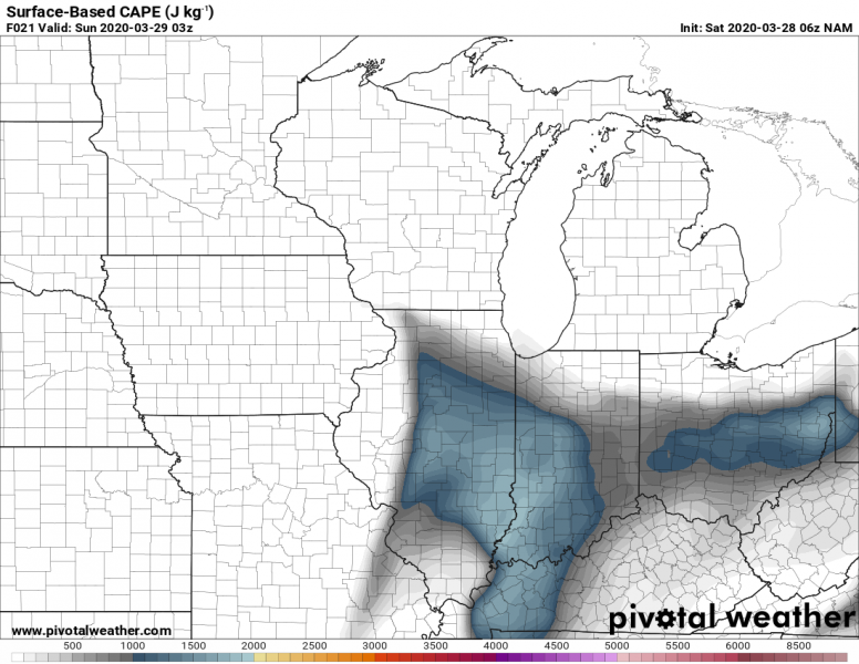
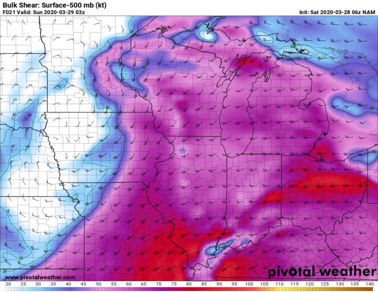
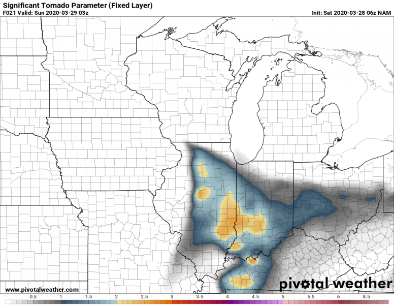
Moderate instability is building up across the warm sector, overlapped with the very strong deep-layer shear. The environment is becoming supporting strongly organized supercell storms, including tornadic storms. High surface dewpoints/shear and therefore helicity could potentially support significant tornadoes as well. Especially after dark when low-level shear increases across the MDT risk area.
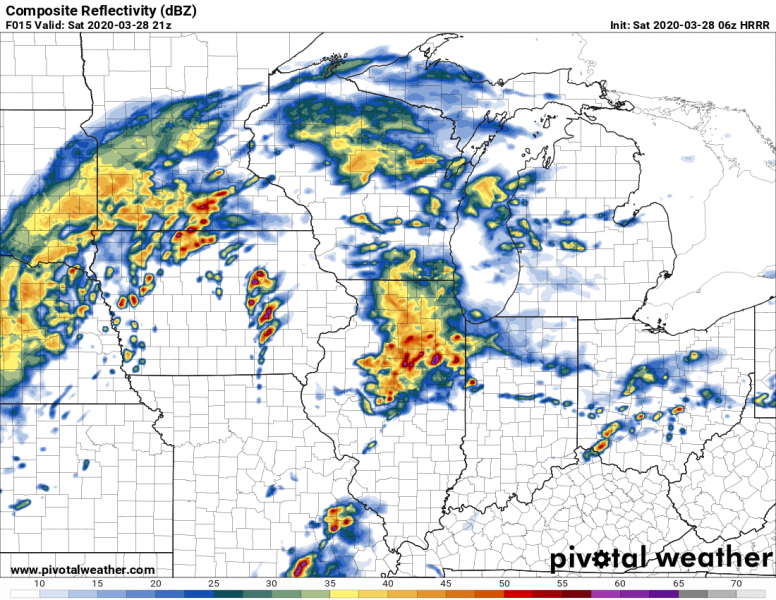
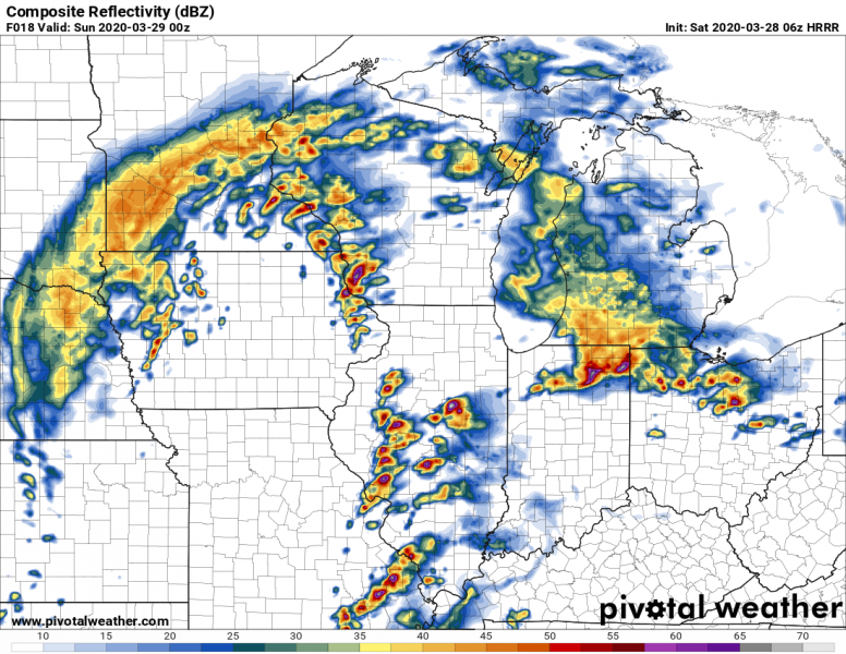
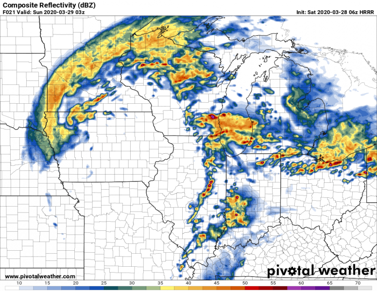
HRRR model guidance of simulated reflectivity through the evening hours. We can see some elevated storms along the warm front first (around 18-21 UTC), followed by severe storms initiating along the eastward-moving cold front across eastern Iowa and western Illinois (00 UTC – early evening time). Storms then continue across Illinois in the evening and night hours (00-06 UTC).
Stay alert for dangerous conditions!
