The powerful heat dome that brought a historic heatwave in parts of Europe through mid-August has finally collapsed, and has been replaced by a more progressive weather pattern. A deep trough will dig south over central Europe, resulting in a multi-day severe weather outbreak with floods for Italy and the western Balkans.
Multiple rounds of severe weather will develop through Wednesday and Thursday as a deep trough digs into a strongly saturated and hot air mass left by the recent heatwaves. This is a high-risk potential for severe flooding where heavy precipitation will occur.
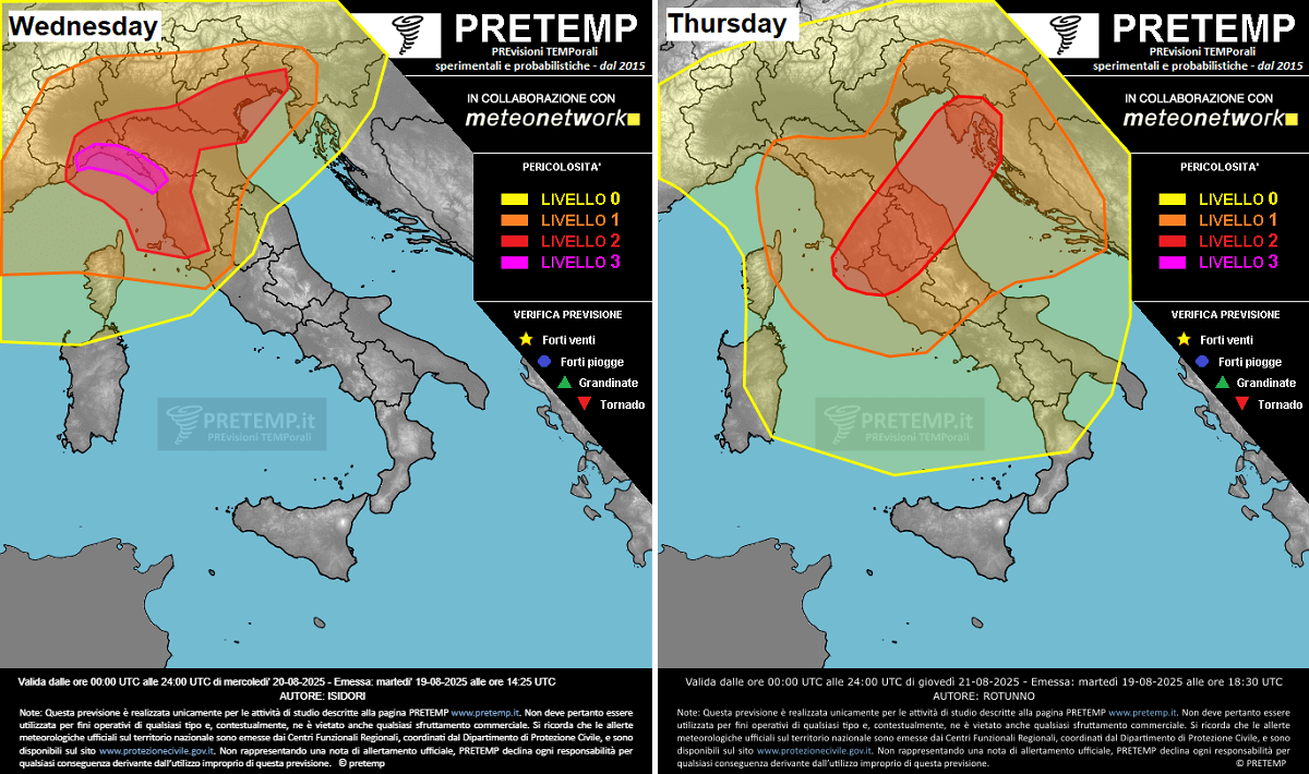
From Wednesday through Thursday and Friday, severe thunderstorms will develop, with a risk of large hail, damaging winds, a few tornadoes, and excessive rainfall.
The following is a quick overview of the dynamic weather pattern and active severe weather over the northern Mediterranean region over the next few days.
Wednesday and Thursday will bring widespread thunderstorm activity with heavy precipitation, supported by strong southerly winds and a volatile air mass.
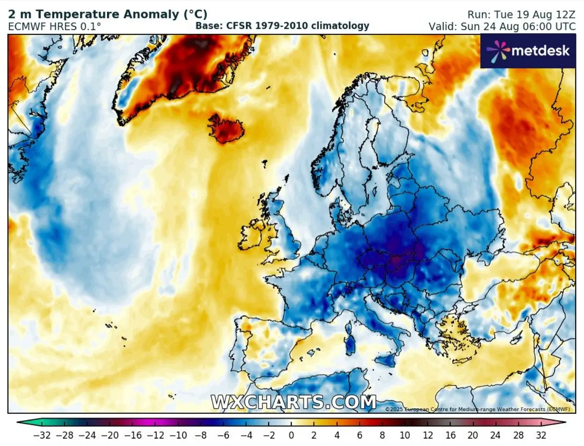
A colder period will follow behind the upper wave, bringing the temperatures below the average for the final days of August 2025.
Deep trough emerges into central Europe and the Alps, surface low forms
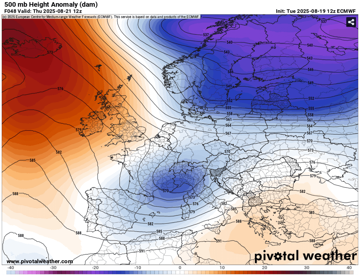
The heat dome and blocking high that recently dominated the European continent have finally collapsed, replaced by a deep trough over northern Europe. Meanwhile, a large block has been established over the North Atlantic.
A cold wave ejects off the main trough, travels across central Europe and the northern Mediterranean, and creates an environment conducive to active severe weather.
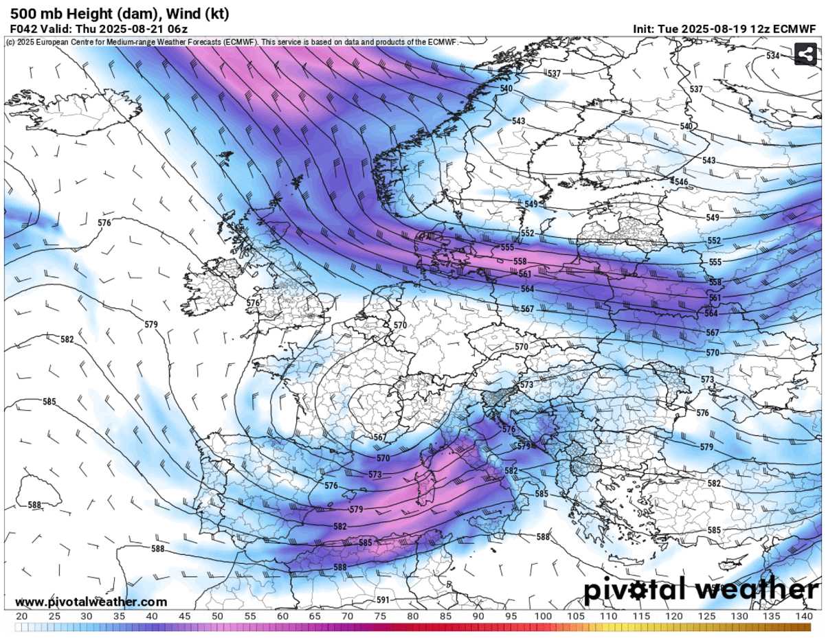
By Wednesday, a shallow long-pressure system was over northern Italy at the surface, gradually moving east into the Adriatic region and the Balkans.
While the low will not be particularly deep, it will be large and support a strong pressure gradient. It maintains a low-level jet stream that delivers high moisture and unstable air mass into the northern Mediterranean.
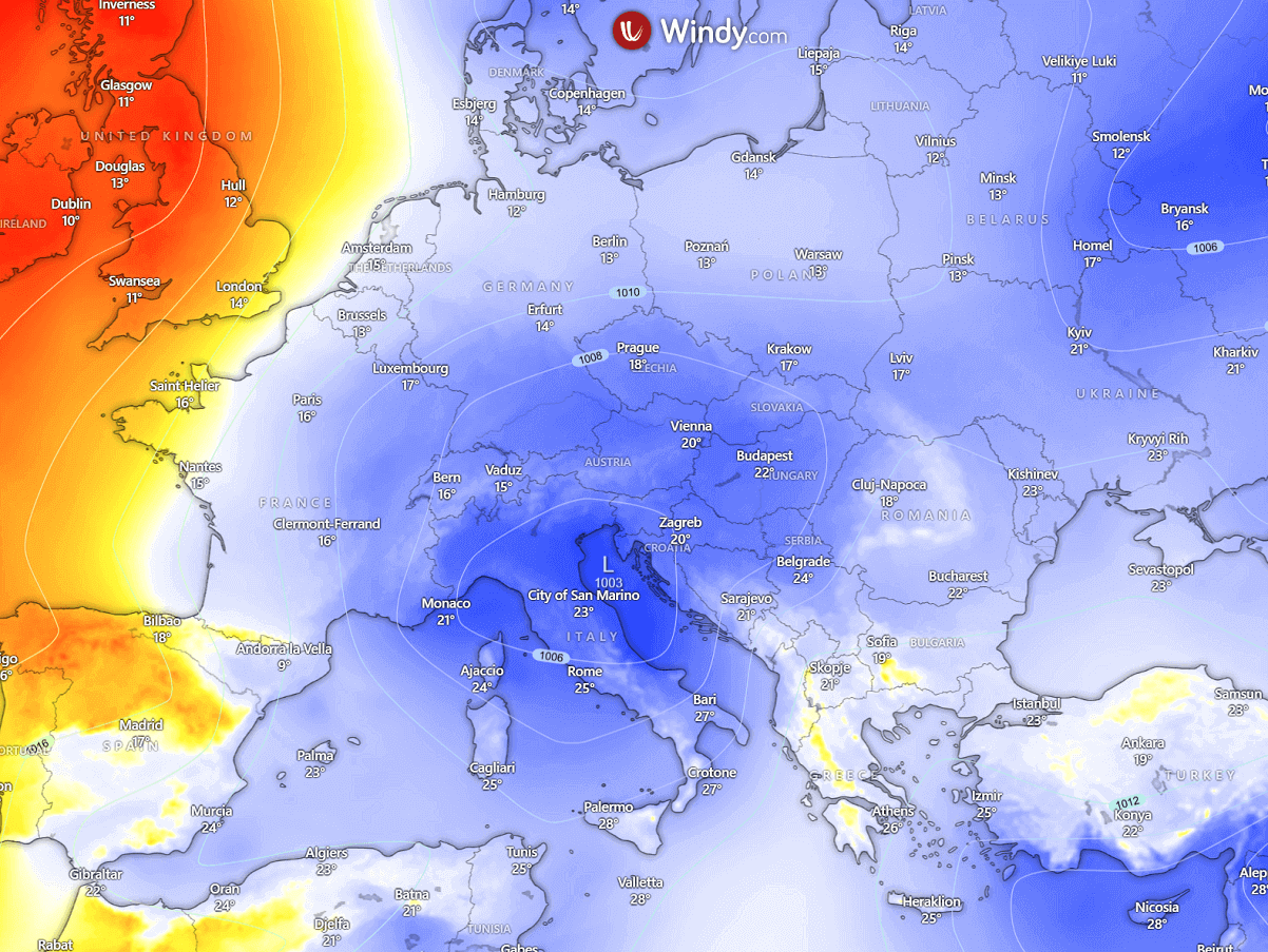
High pressure will bring stable and dry weather for western Europe.
A multi-day severe weather outbreak for the northern Mediterranean, Italy, and the Adriatic Sea
Rounding the base of the upper wave, a powerful jet stream develops across the Mediterranean, providing widespread lift for thunderstorms to develop.
The left-exit region of the jet stream will move over northern Italy and the Adriatic region, typically supporting the strongest forcing for organized storms.
The Mediterranean Sea is much warmer than usual after the scorching heatwave in mid-August. The high water temperature provides higher moisture, which leads to a more unstable air mass as the trough approaches.
The attached CAPE charts for Wednesday and Thursday indicate high to extreme instability, especially over the Ligurian, Tyrrhenian, and Adriatic seas. 2000-3000+ J/kg will be available to fuel thunderstorms.
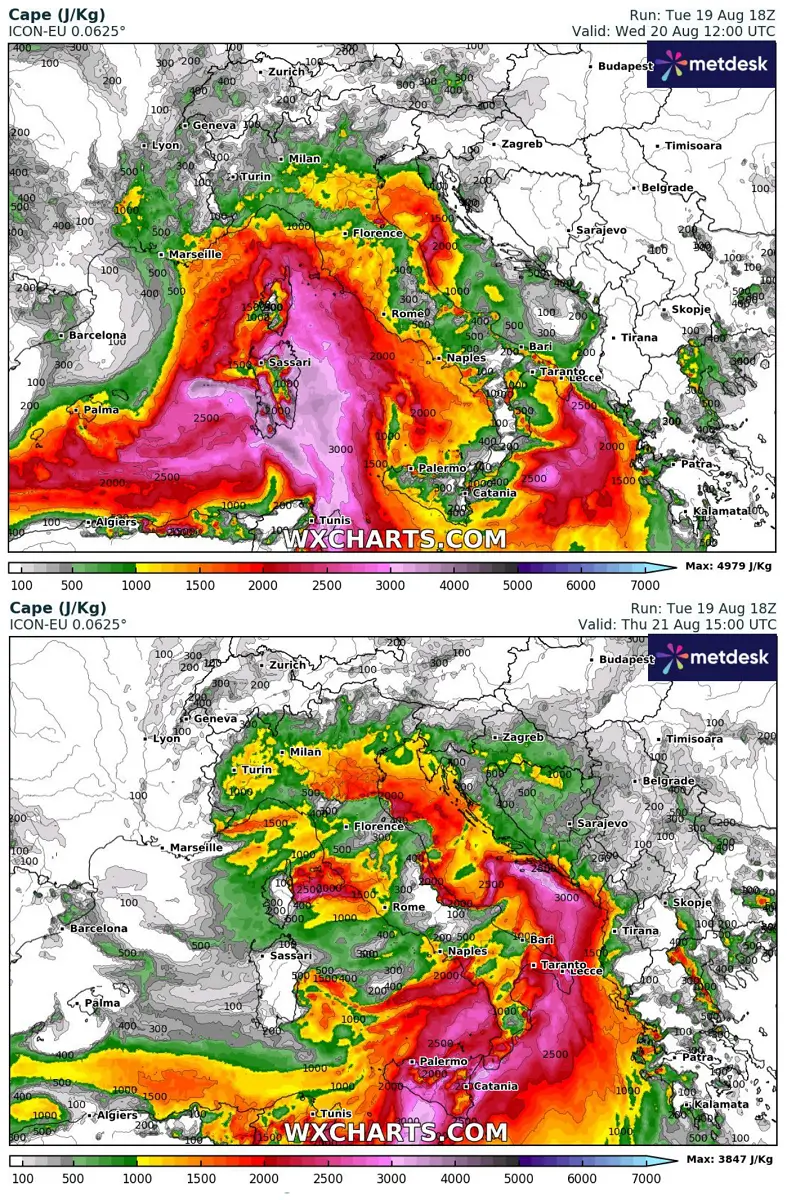
On Wednesday, the highest threat will be for the Liguria and Toscana coastal regions, where intense thunderstorm activity will bring extreme rainfall. Those could be more than 200 mm in less than 24 hours, resulting in severe flooding. High instability and strong low-level shear will support supercell storms with large hail, damaging winds, and tornado (waterspout) threats.
The threat shifts east Thursday and will be maximized over the Adriatic Sea and the west-northwest Balkans. High instability with strong shear will bring supercell storms with intense rainfall, damaging winds, and flooding. Tornadoes could also occur with the most organized storms.
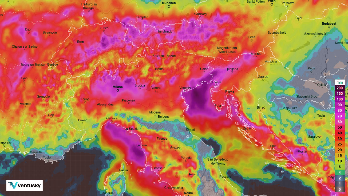
The system is expected to produce widespread high rainfall accumulations, from 80-100 mm in many areas, throughout the 3-day event, and much more locally.
The highest rainfall amounts are expected along the northern Apennines and Adriatic region into NW Croatia, where training cells will maintain thunderstorms long enough to bring excessive rainfall.
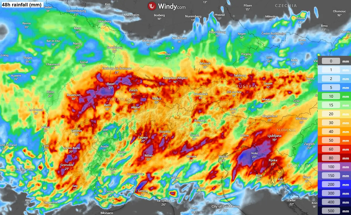
Here is a regional view of Wednesday night into Thursday activity over the North Atlantic region. Some high-resolution models predict extreme rainfall.
In some places, 200-300 mm of rainfall in 48 hours is possible, significantly increasing the threat of flash floods.
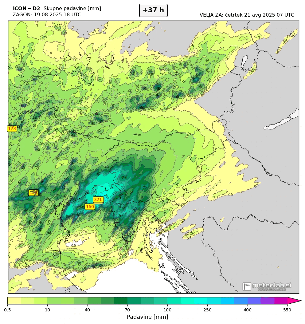
While the exact area of the most extreme rainfall is complex due to model variations, NE Italy, W Slovenia, and NW Croatia should be monitored for flooding risk through Thursday evening.
Colder weather follows into the final days of August 2025
Once the trough finally weakens and moves further east late this week, a much colder air mass will follow, bringing the following weekend’s temperature below average.
The coldest air mass will overspread central and eastern Europe, the northern Mediterranean, and the Balkan peninsula.
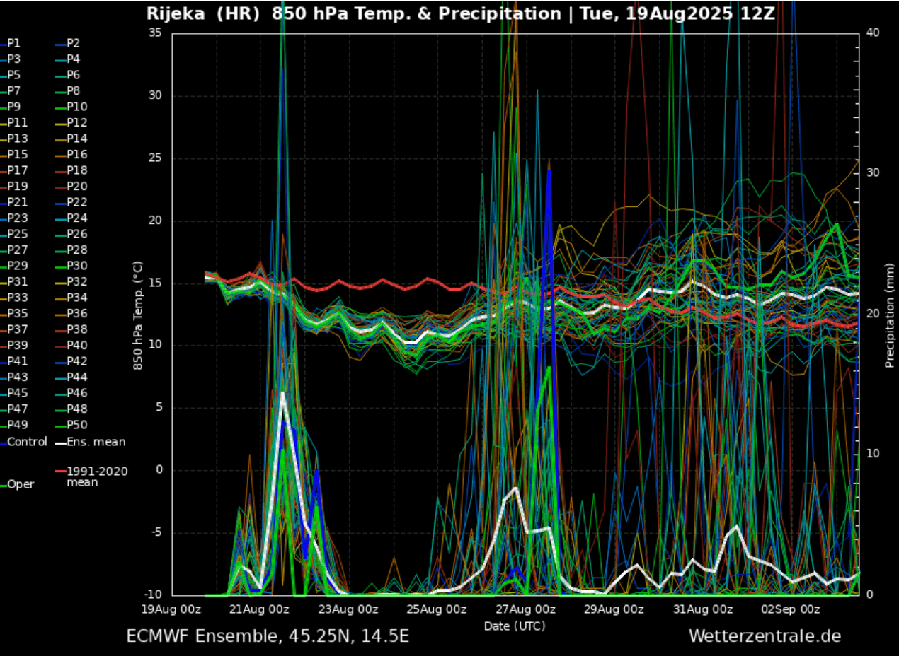
Below is the meteogram chart for Rijeka, Croatia, on the northern side of the Balkan peninsula. Temperatures are falling below the long-term average for late August.
Furthermore, one can quickly see intense rainfall in the following days, followed by another early next week.
The general trend suggests that central Europe and the northern Mediterranean will see more dynamic, autumn-like weather as August ends and September 2025 approaches.
Ventusky, Windy, Wxcharts, and Pivotalweather provided images used in this article.
See also:
La Niña Watch is issued by NOAA as Pacific Cools, with a major reversal now looming for 2026