After a couple of weeks with cooler temperatures across parts of Europe, the heat dome is back this week. While the heatwave over Scandinavia finally vanishes, it will intensify across western, central, southern, and eastern Europe late this week. It is likely to expand into mid-August as the pattern stabilizes and an extensive ridge dominates the continent.
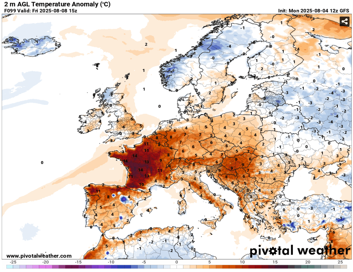
Over the next 10 days, peak temperatures will return to the low 40s °C over France, the central Balkans, and Italy. Portugal and Spain should maintain the upper 30s to low 40s until at least the following weekend. The weather has been hot over the peninsula, leading to large wildfires in Portugal.
Significant heat will also gradually worsen drought conditions across Iberia and Southeast Europe, where recent devastating wildfires have been ongoing.
A major Heat Dome will build up over a large part of Europe late this week and remain strong while gradually expanding east and north into next week. These mid-range trends suggest long-lasting, intense heat will return for many countries. Stable hot weather significantly increases temperatures, leading to low 40 °C again over France, the central Balkans, and Italy, towards the weekend.
Below are the Paris, France (upper) and Warsaw, Poland (bottom) meteogram charts. We can see that the heatwave intensifies over France after August 7th (Thursday) and extends until at least mid-August. Poland and Eastern Europe see a rapid increase in temperatures after August 8th (Friday), lasting for at least a week, possibly extending longer.
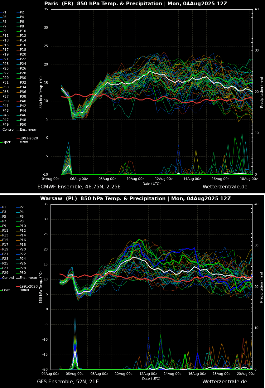
Both charts hint at the ongoing refreshment after Storm Floris crosses western Europe on Monday.
Unusual Atlantic storm Floris hits Scotland, bringing temporary but final refreshment for Europe before the heat returns
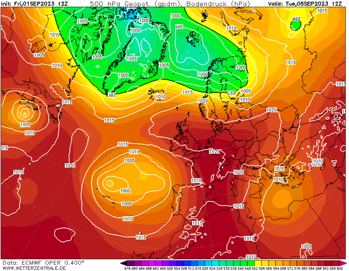
An unusually intense Atlantic storm Floris, smashed into northern UK and Scotland on Monday, with powerful winds around 130 km/h across the lowlands in Scotland, including the Outer Hebrides, as a deep low grazed across. The Scottish Highlands reached up to 180 km/h winds.
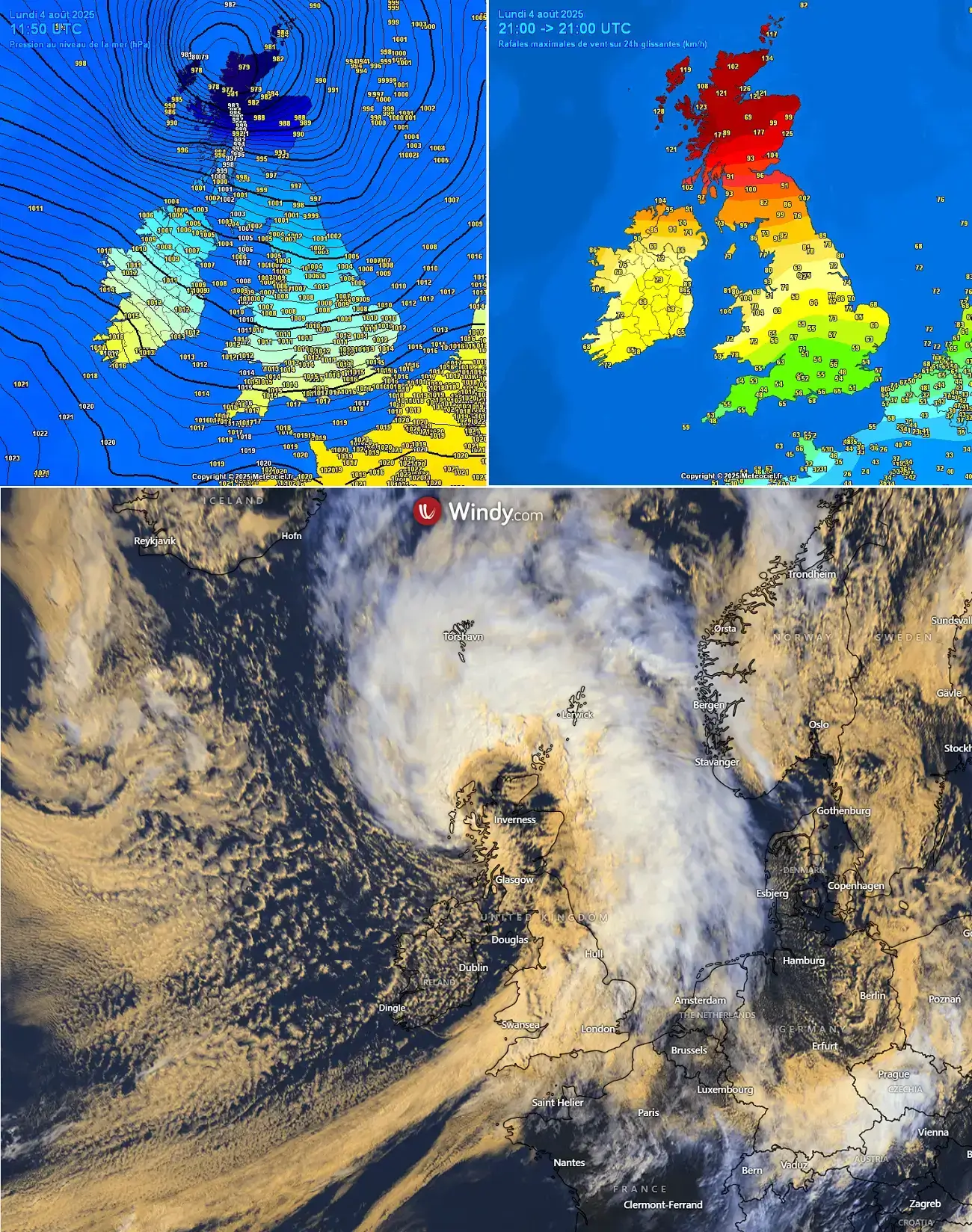
This was quite an unseasonably strong Atlantic low for August; it doesn’t happen too often. The lowest pressure was around 978 mbar in the center of the storm’s low.
The 500mb chart on Monday shows how deep the low was. A profound upper core was racing across the UK and the North Sea.
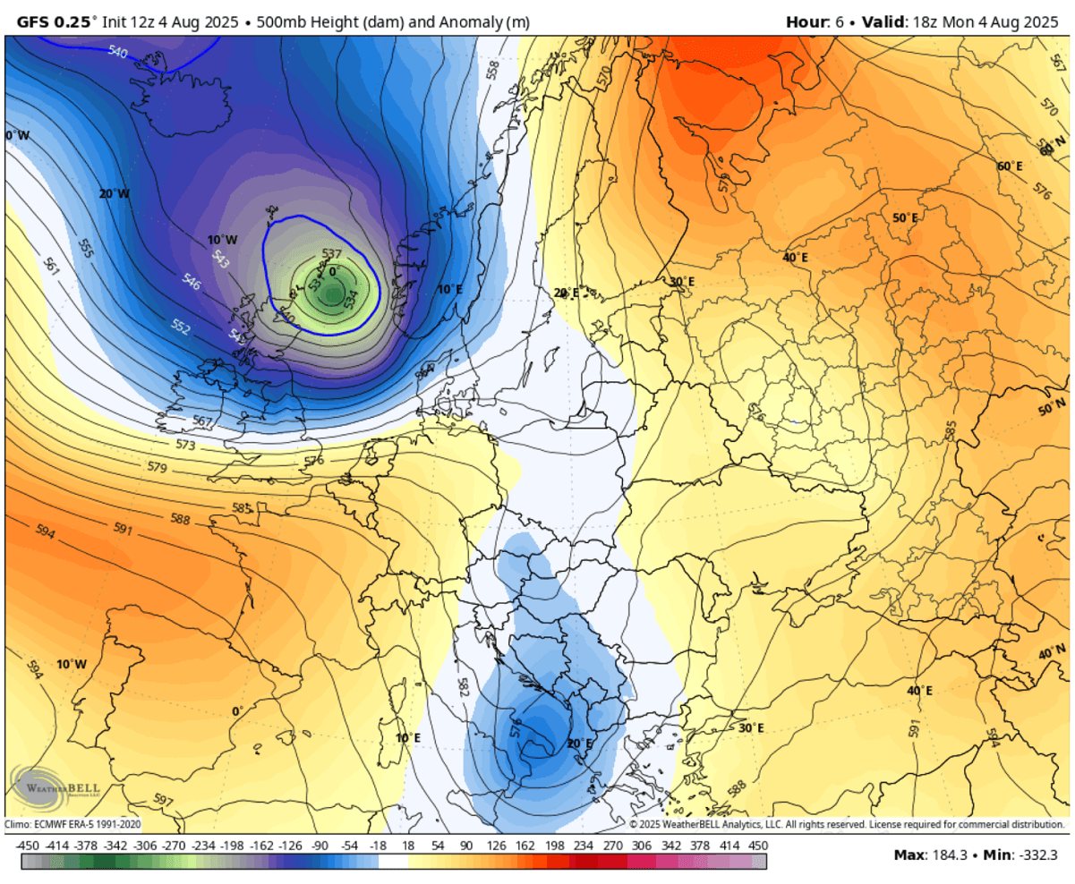
The low is now gradually weakening while moving towards Scandinavia. Further south, the Azoric high is strengthening and is forecast to expand into western and central Europe late this week, increasing temperatures, and the heatwave will re-develop.
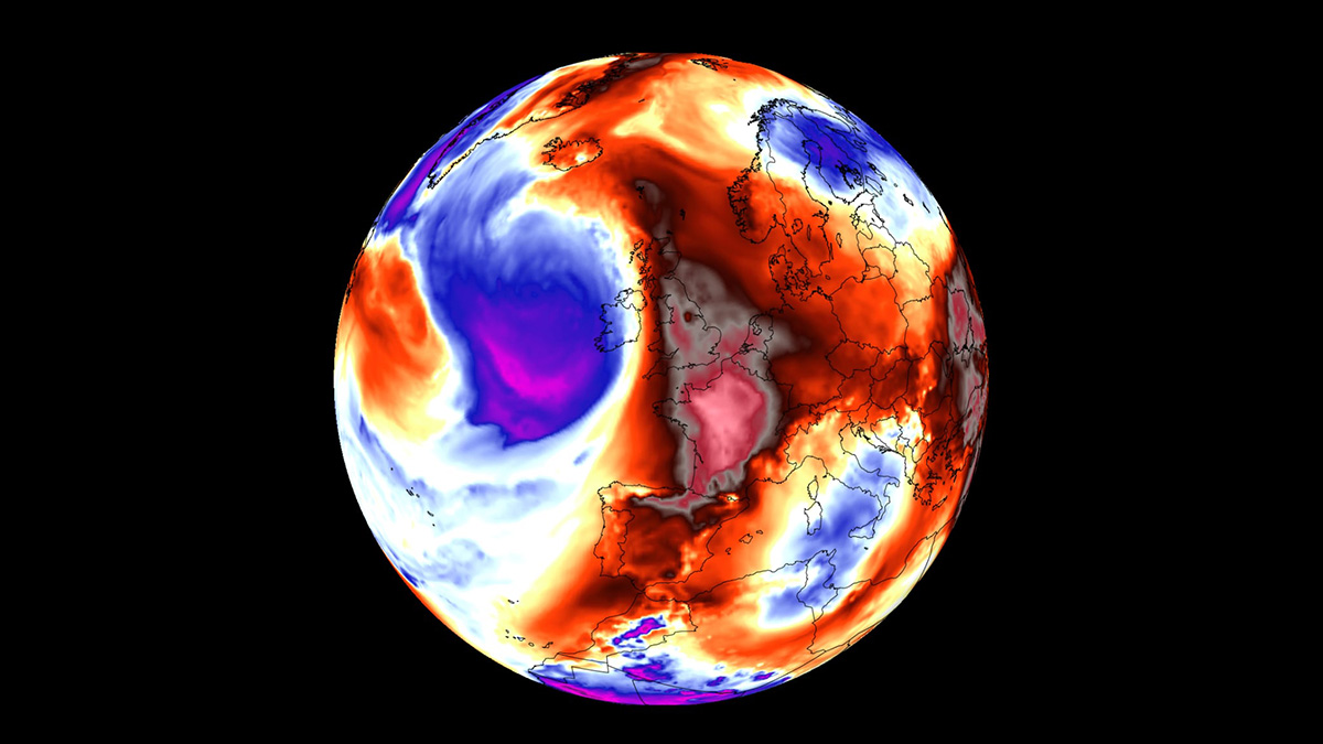
The following animation provides a quick overview of the heatwave coming up for Western and Central Europe this week. It will gradually extend north and east over the weekend and towards mid-August 2025.
One can notice how a large, dominant blocking High will dominate much of Europe, causing extreme heat to develop again for many countries. The northern parts of the continent will remain in normal weather conditions, which is a relief after extremely hot weather from the end of July. Norway, Sweden, and Finland have shattered many heat records during the event.
Again, the upcoming redevelopment of the heatwave results from the return of the heat dome feature aloft. Let’s examine this large-scale feature and why understanding its behavior is essential.
What is a Heat Dome?
When significant and historic record-breaking heatwaves occurred in Europe, the United States, and Canada in the past, the Heat Dome was a contributing factor. The heat dome is usually the dominant feature of summer weather patterns on both continents.
We refer to this phenomenon as a heat dome when extremely high temperatures develop. Here’s how it works and why understanding it on a broader scale is essential.
The upper-level ridge pattern, or very warm air mass in the higher altitudes, also known as the Upper High (or blocking High), usually forms the heat dome. This weather pattern brings high and sometimes record-breaking temperatures to the region underneath.
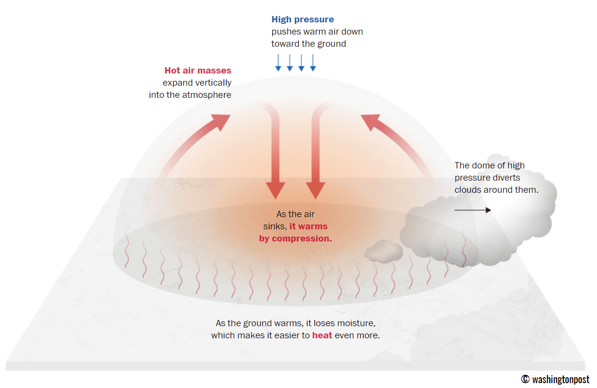
This term is used when a broad area of high-pressure air parks over a large portion of the continent. If the event is remarkably stable and extreme, it usually lasts several days or weeks.
The heat dome works like a lid on a pot. The extensive dome traps warm air at all levels underneath, with layers sinking toward the ground. Therefore, the air mass becomes anomalously warm at the lowest elevations and extremely hot near the surface.
How does a heat dome impact the life underneath?
Excessive heat in heat domes can significantly impact human health and be dangerous to particularly vulnerable populations, such as elderly individuals, children, and those with pre-existing health conditions that can be worsened by extreme heat.
Due to prolonged exposure to high temperatures, construction workers, farmers, and agricultural workers who work outdoors for long hours are at increased risk of heat-related illnesses. People living in poverty are also more susceptible to the fatalities of heat domes, as their houses are often built with heat-trapping surfaces such as concrete and asbestos.
Heat exhaustion occurs upon exposure to high temperatures for extended periods. It leads to dehydration, dizziness, and, in more severe cases, heat exhaustion can progress to heat stroke.
High relative humidity during a heatwave can also significantly affect the body. For this reason, we use a Heat Index to represent the natural feel of scorching hot temperatures and high humidity. These graphics illustrate the natural relationship between temperature and humidity.
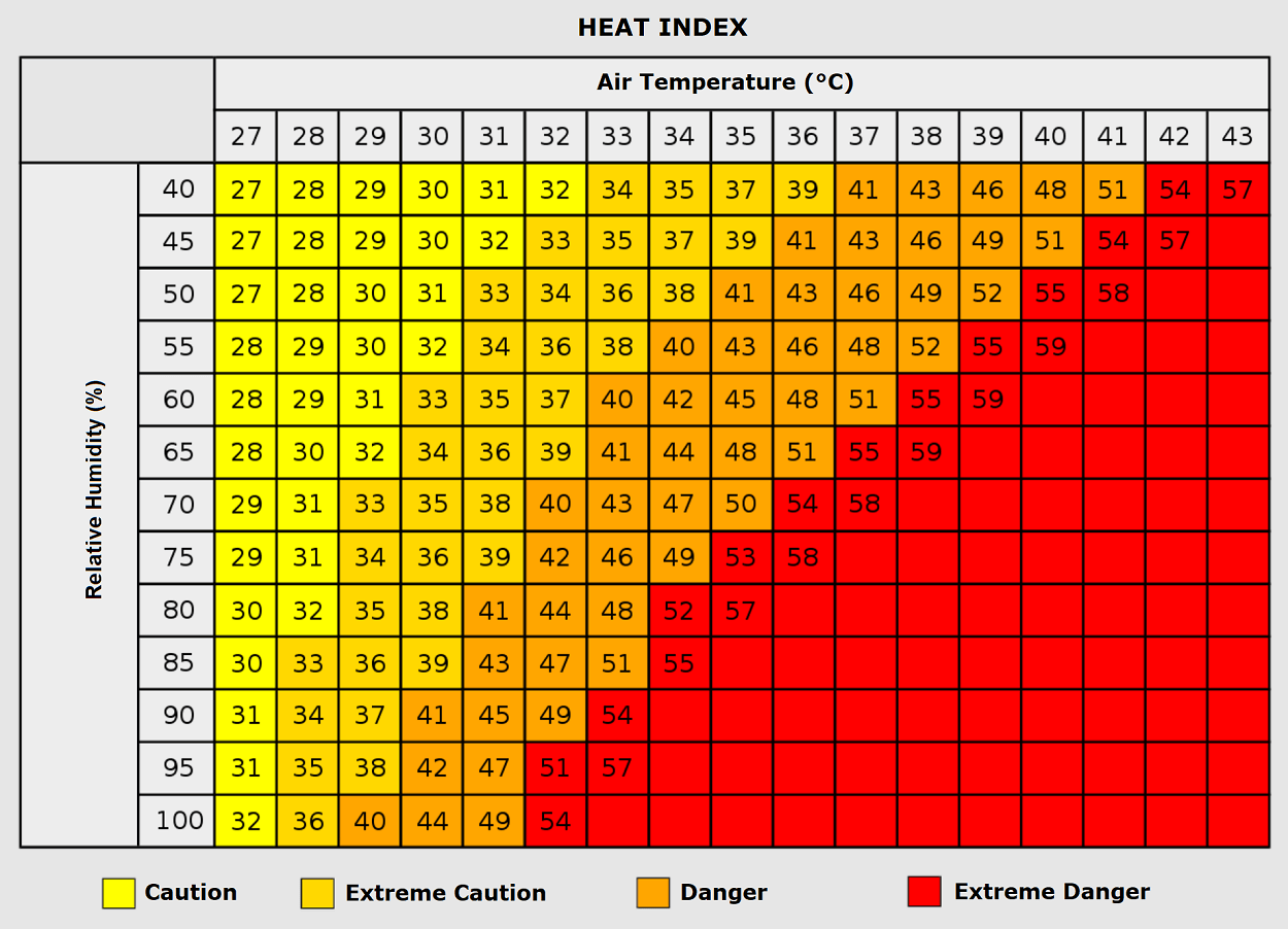
When the air mass has a temperature around +35 °C, humidity below 60 percent is much less challenging than when the humidity is very high, e.g., above 80 %. Thus, the actual feel temperature would be near 50 degrees Celsius.
Heat waves have also been associated with increased rates of heart attacks, strokes, and respiratory illnesses.
Our additional article, “Health risks during a heatwave and sweltering hot weather,” provides further details on the health risks.
The Heat Dome re-establishes, igniting another intense heatwave in Europe
Based on the latest global weather model guidance, the heat dome will gradually strengthen from the southwestern into western, central, and eastern Europe in the following 4-7 days, potentially extending into mid-August.
After mid-week, the heat dome’s center will first re-establish in western Europe, extending extreme heat over Spain and Portugal towards France, developing an intense heatwave after Thursday. Then, the heatwave will gradually expand east towards the following weekend.
Strengthening the heat dome will release a significantly warm air mass plume into western Europe by Friday and Saturday. The most intense heat will be across Iberia, France, Benelux, and western Germany.
Temperatures will also gradually increase across central Europe after Friday, as a heat dome and significant heating will occur.
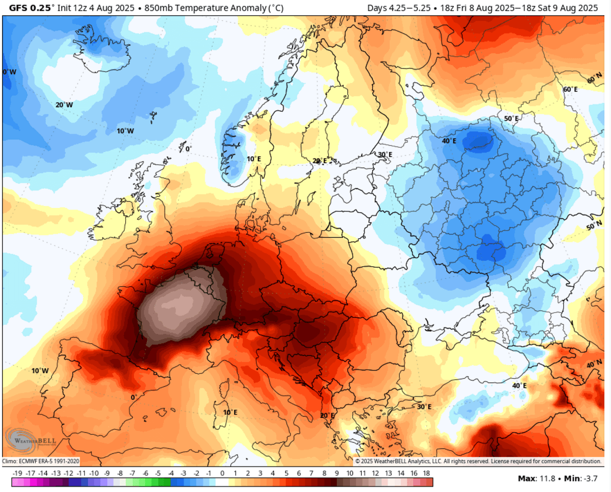
Extremely high mid-level temperatures will translate into the lowlands, pushing France into 12-14 °C above the average for early August.
Elsewhere across western and central Europe, temperatures will also be 6-10 °C warmer than usual.
Only a few areas on the continent are forecast to have near-normal or below-average temperatures over the following weekend. As we enter mid-August, a heat wave will dominate the general weather.
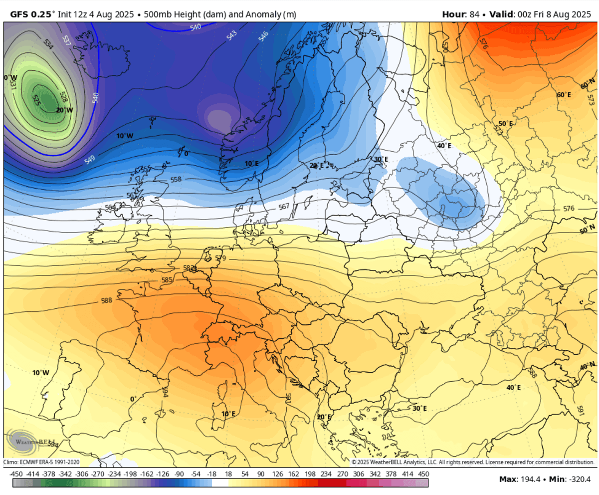
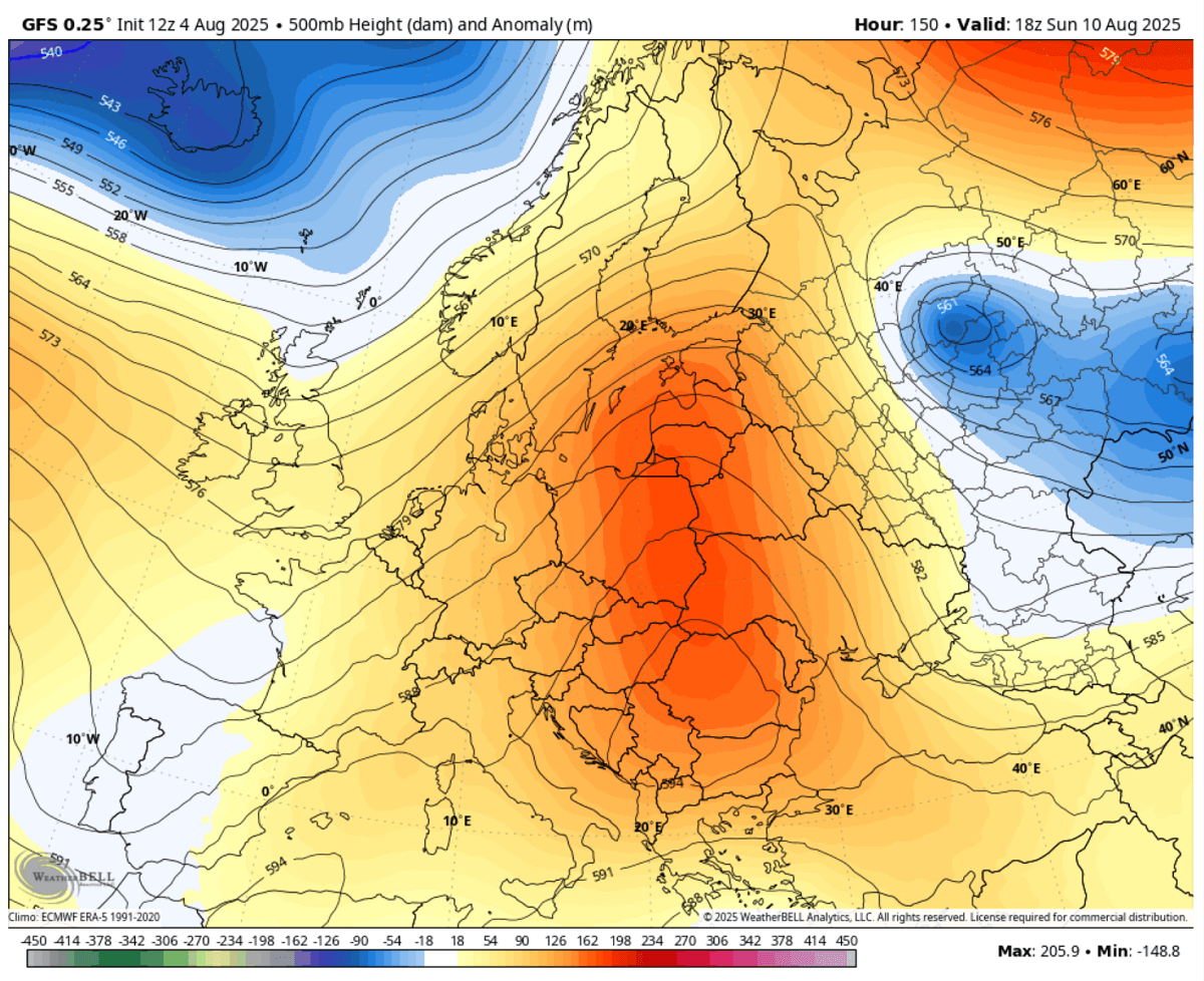
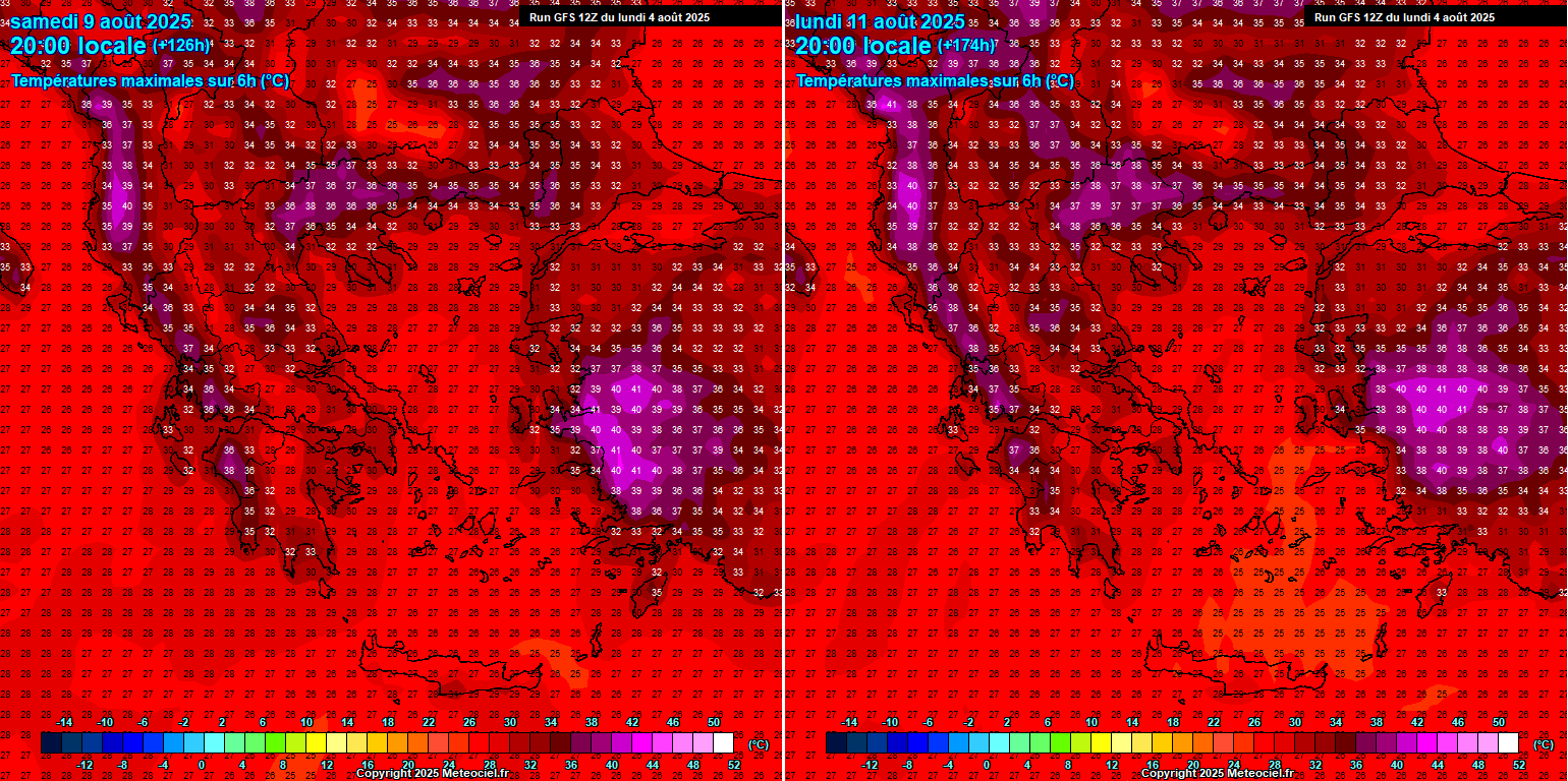
By Monday, the heat dome shifts eastward, with its core over central and eastern Europe. Therefore, heat intensifies significantly for the countries below.
The 850mbar temperature anomaly hints at this anomalous air mass, which baked the Balkans, Panonian plains, Slovakia, and Poland into extreme heat on Monday.
Temperatures will be 12-14 °C above the average on those days.
Therefore, the lowlands will also experience extreme heat, with an 8-12 °C warmer air mass moving from Germany to Poland, Italy, and most of the Balkans.
The highest anomalies will be underneath the core of the heat, over Hungary, Croatia, and Serbia. Temperatures around 15 °C above normal are possible.
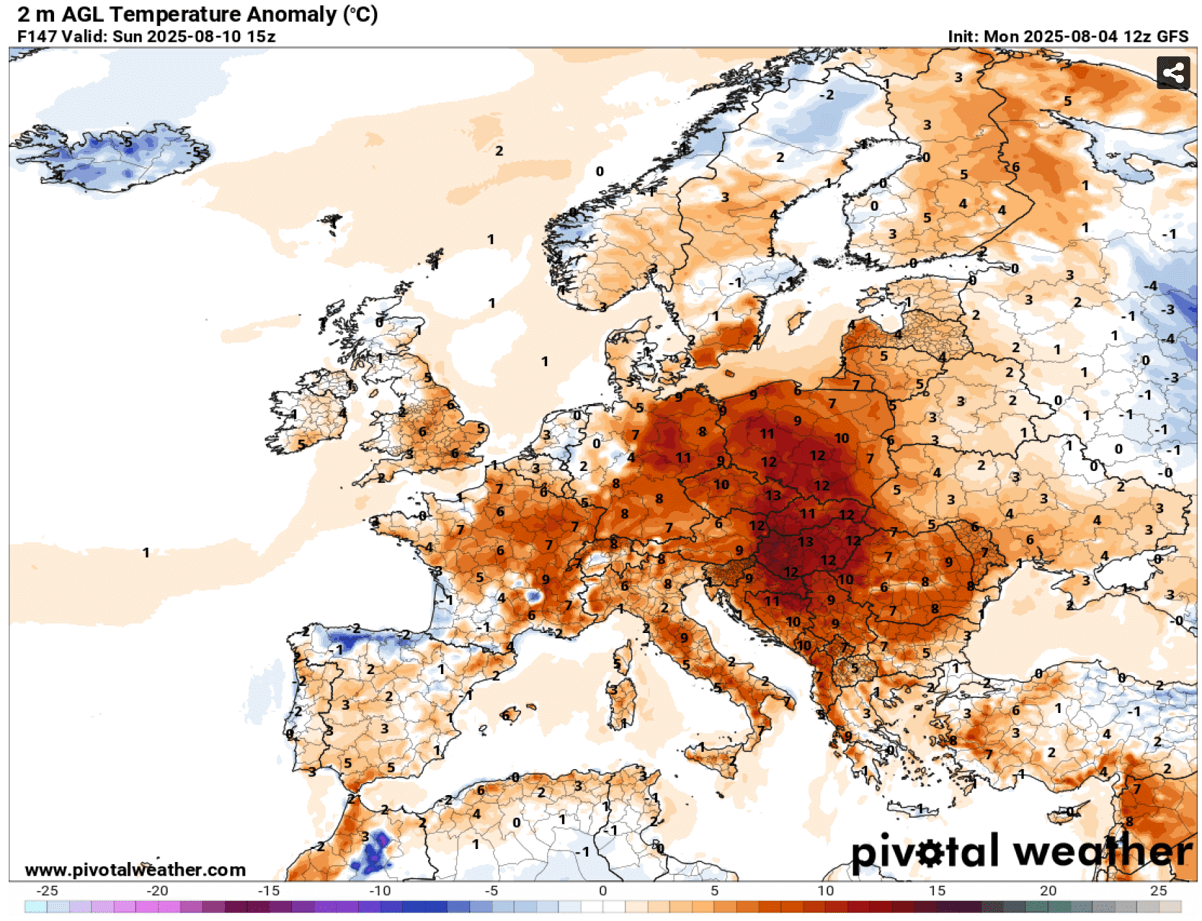
The extreme heat will persist for days, quickly drying out the soil as the air mass becomes dry. Despite rainy periods in recent weeks, the threat of wildfires will gradually increase again.
Extreme heat develops, Iberia remains in the low 40s the whole week; France, Italy, and the Balkans follow
As mentioned above, with a heat dome again this month as the dominant feature, the effect of subsiding air mass warms and dries up the lower levels as the air mass sinks towards the ground.
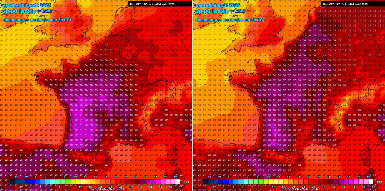
France will reach 40-42 °C in the south and west plains on Friday, with the upper 30s across central parts. The heat will continue into the weekend, with mid- to upper-30s expanding into northern France and Benelux by Saturday.
Spain and Portugal will see no big difference. The significant heatwave will continue for at least another week. From Tuesday through Friday, peak temperatures will range from 38 to 43 °C in most regions in both countries.
As usual, the most significant temperatures were in central Portugal and south-southwestern Spain, with daily maximum temperatures around 41-43 °C.
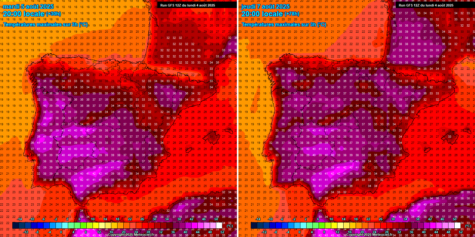
There are hints of some refreshment after the weekend. Still, it depends on the Atlantic dynamic trough if it penetrates east enough to disturb the warm plume over the southern European continent.
Central Europe, Italy, and the Balkan countries will see a rapid increase in temperatures after Thursday, reaching 37-41 °C from Friday through Tuesday next week. The highest temperatures could again reach around 43 °C over the Balkans, especially across eastern Croatia, Hungary, and Serbia.
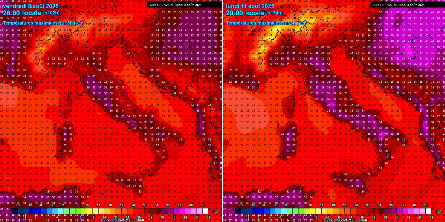
Similar, but a tad less intense across the southern Balkans, with temperatures back into the upper 30s after Friday and Saturday.
Western Turkey will continue to bake in the low 40s, with temperatures up to 42 °C forecast most days.
Ireland and the UK will not experience significant heat this time. Temperatures over southern England will push back into the upper 20s, but 30s are unlikely.
Ireland and Scotland will remain at 18-22 °C at most over the weekend.
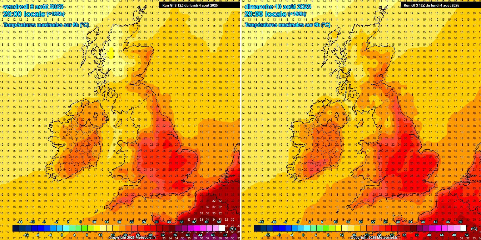
Similar conditions to those over the weekend are forecast to extend into at least the early days of next week, possibly longer in most affected areas.
Mid-range trends suggest that the heatwave may extend into mid-August 2025
Although this is quite a long way off, the short-term 10-day temperature forecast by the general global weather model GFS, and the ECMWF agree that further persistent heat waves are possible.
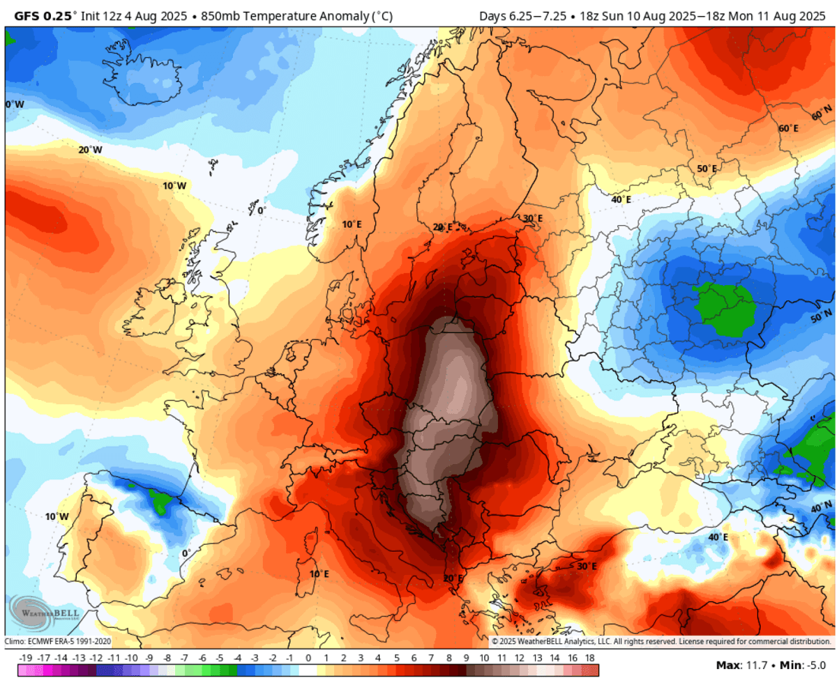
The below 850mbar temperature anomaly chart hints at more heat forecast, with similar areas affected by extreme heat: the Iberian Peninsula, western and central Europe, including the Balkans and Italy.
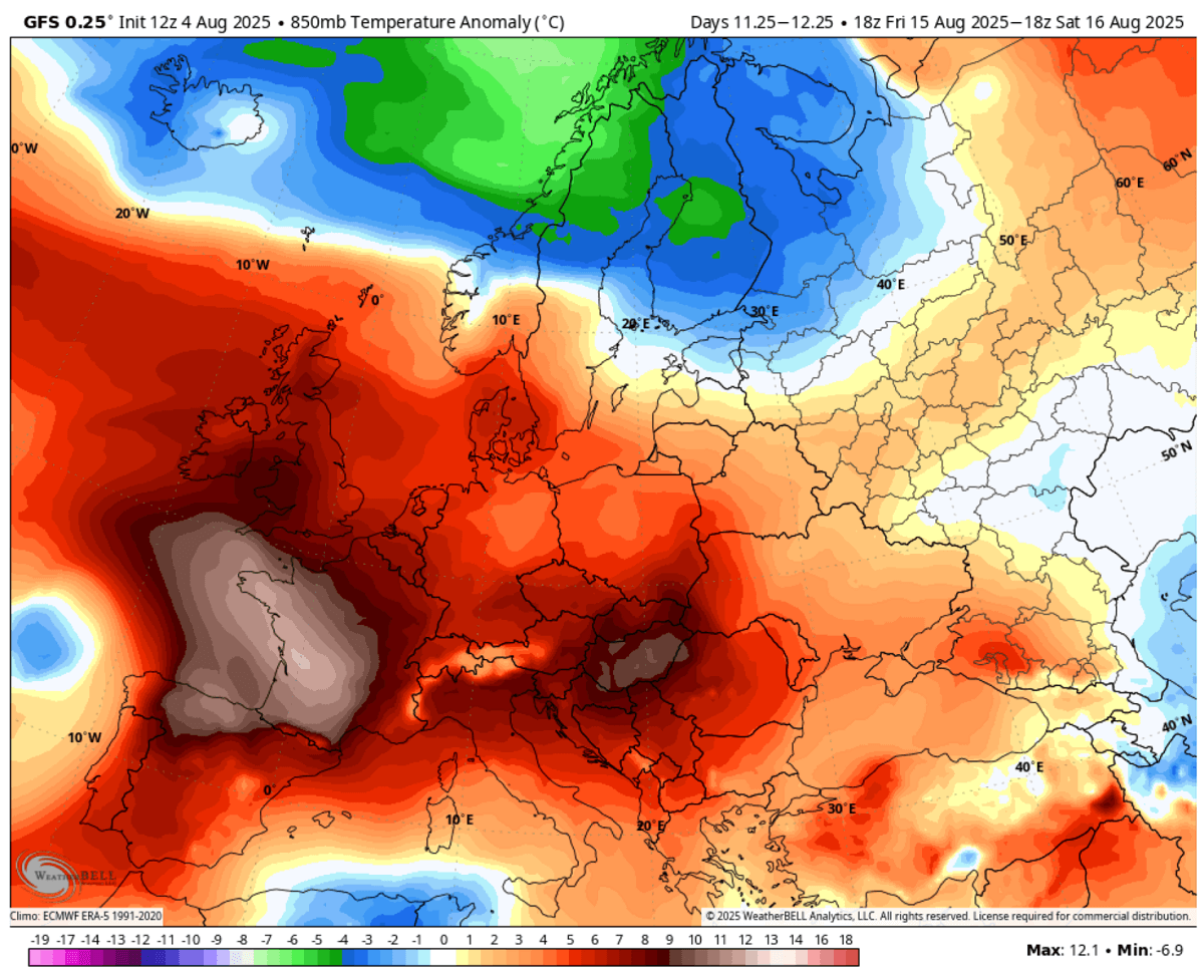
Further, some weather model forecasts suggest the heat may also push into the UK through mid-August. We will continue to monitor the evolution of the weather pattern and update the estimates accordingly. Stay tuned.
** With the return of much hotter weather, we advise everyone to be cautious when using an open fire while camping during the holidays. Monitor the local countries that already have alerts on this matter, and some of them are also forbidding the use of fire due to the extreme drought underway. **
Wxcharts, WeatherBell, and Wetterzentrale provided images for use in this article.