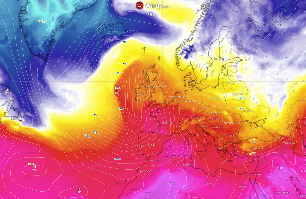
Thanks to an intense storm Benjamin moving into Western Europe, it has been quite a week across parts of Europe, ejecting the active frontal system towards the Alps on Thursday. As we head into the final week of October, the dipole weather pattern leads to more dynamic sending deep waves with unsettled conditions over the continent.
Over the weekend, the wave responsible for storm Benjamin will deepen over the continent’s northern half while blocking High builds up over the Atlantic. This is a temporal change in the wave pattern, soon to be replaced by a huge dipole between the Atlantic and the European continent.
A typical autumn season pattern will develop—a large upper trough on the west, sending vast moisture and warmth onto the continent—establishing a long period of unsettled weather with rainy periods and increasing flooding potential as we head towards November.
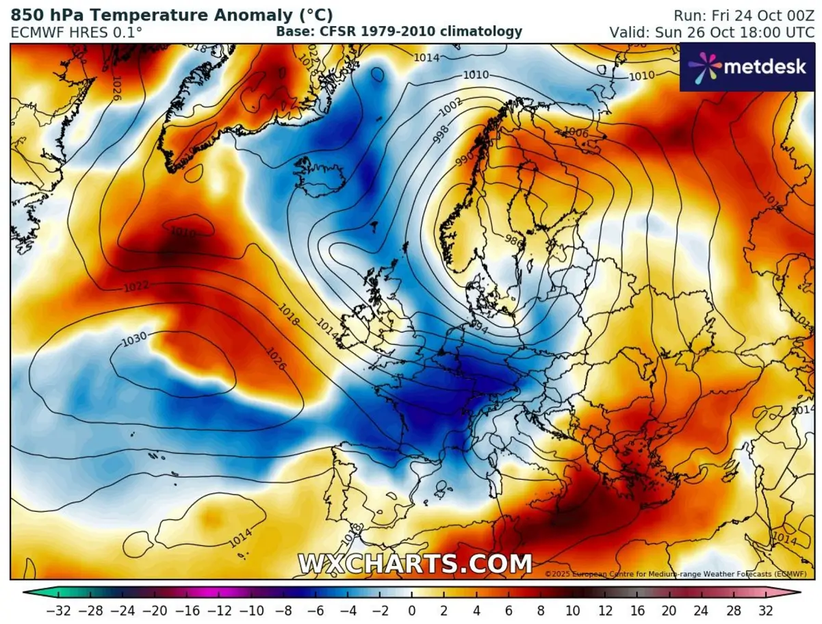
This is how those typical, significant rainfall events follow for the Mediterranean region in autumn. With all the warmth left from the summer months, the sea waters around Europe are still well above the normal temperatures.
In general, waters are 1.5 to 3 °C warmer than usual in many places, especially in the west-central Mediterranean, where the main source of moisture is located.
Here is a quick video overview of the dynamic weather pattern over Europe during the final days of October and into early November, with textbook setups for significant autumn rainfall events.
The persistent, strong southwesterly flow will push high moisture and a warmer air mass across much of the continent.
Let’s explore the evolution of the patterns over Europe and the North Atlantic over the following 10 days. We are gradually shifting into a rainy period with multiple deep waves and frontal systems, making weather forecasts more challenging.
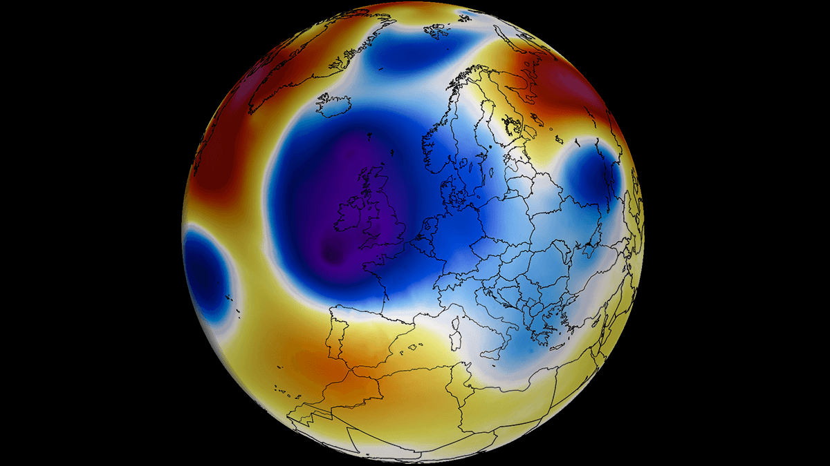
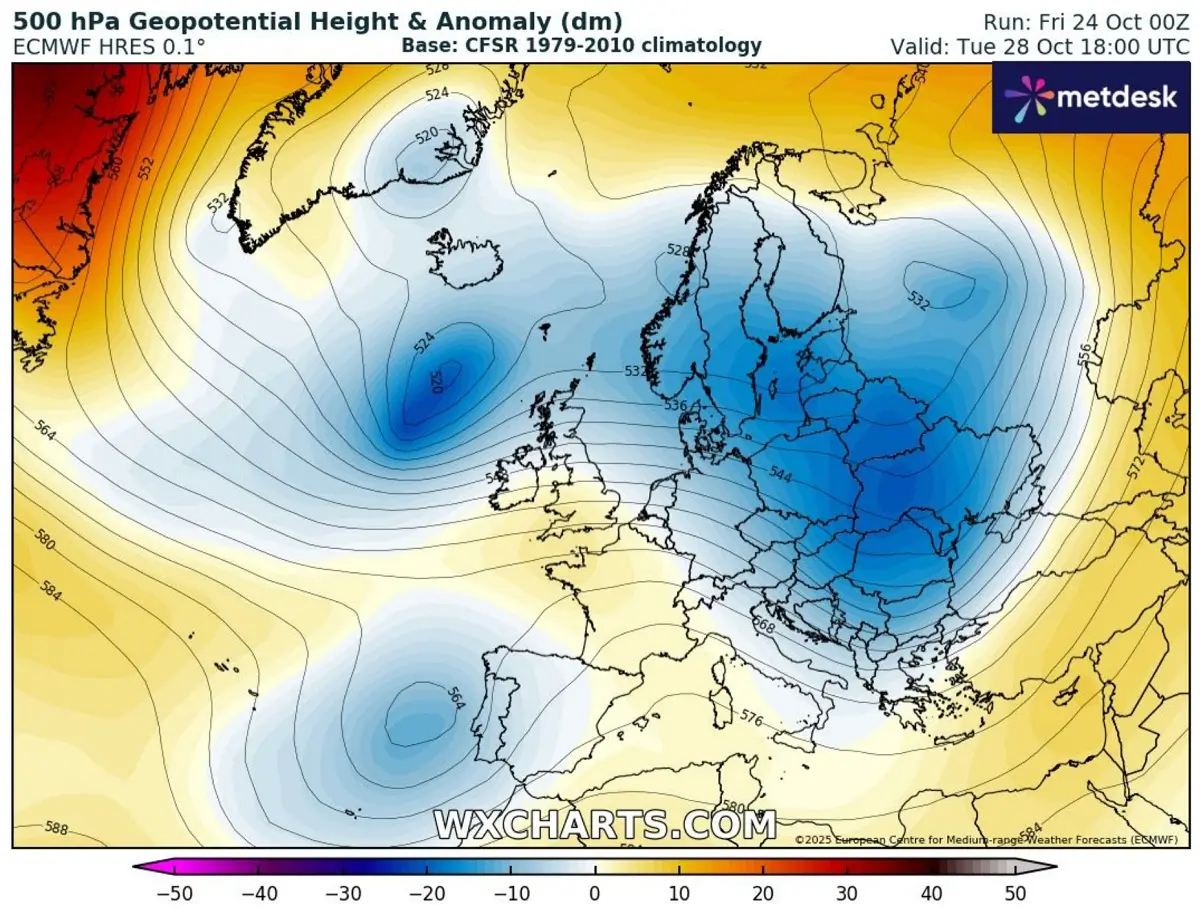
Temporal dipole pattern develops, a deep low over Europe with a blocking High over the North Atlantic
Over the North Atlantic, a strong blocking High is building up, strengthening the pressure gradient against the trough over Europe. This leads to a temporal deepening of the wave as a colder air mass arrives.
A textbook dipole weather pattern establishes and extends into the early days of next week.
So, the surface pressure over the northern half of Europe will drop further over the weekend in response to the strengthening of the wave aloft. For several days, the well-developed frontal system will wobble over Scandinavia, Denmark, the North Sea, and northern Germany.
Further west, the Azoric High surface pressure system strengthens and expands north, underneath a building ridge.
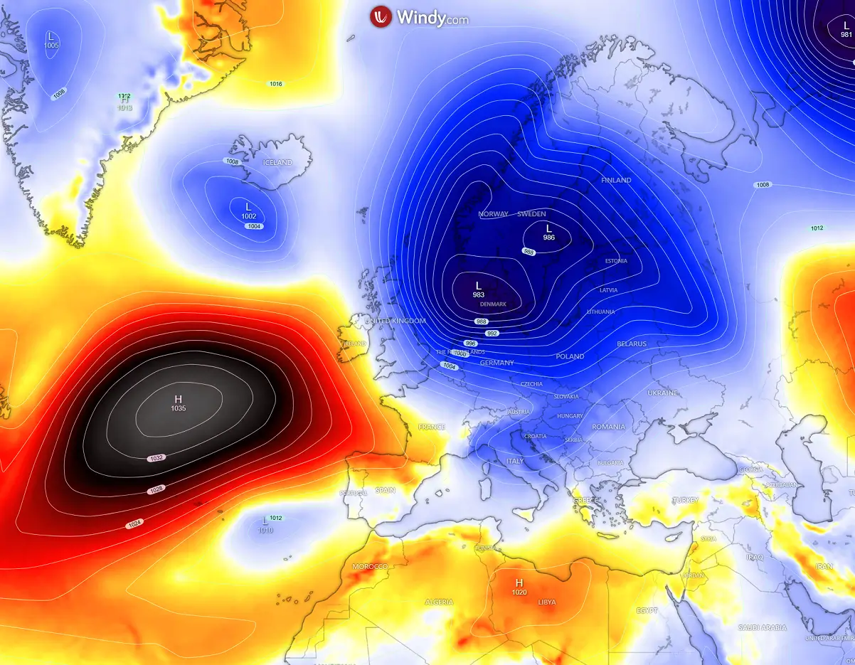
The positions of the blocking High on the west and deep trough on the east support northwesterly flow in between, therefore helping the maritime air mass from the North Atlantic to penetrate deep into western Europe and towards the central part of the continent.
While temperatures will not be particularly cold, it will be a classic refreshment behind an intense wave that will reach the Alpine region and northern Mediterranean by Sunday and Monday.
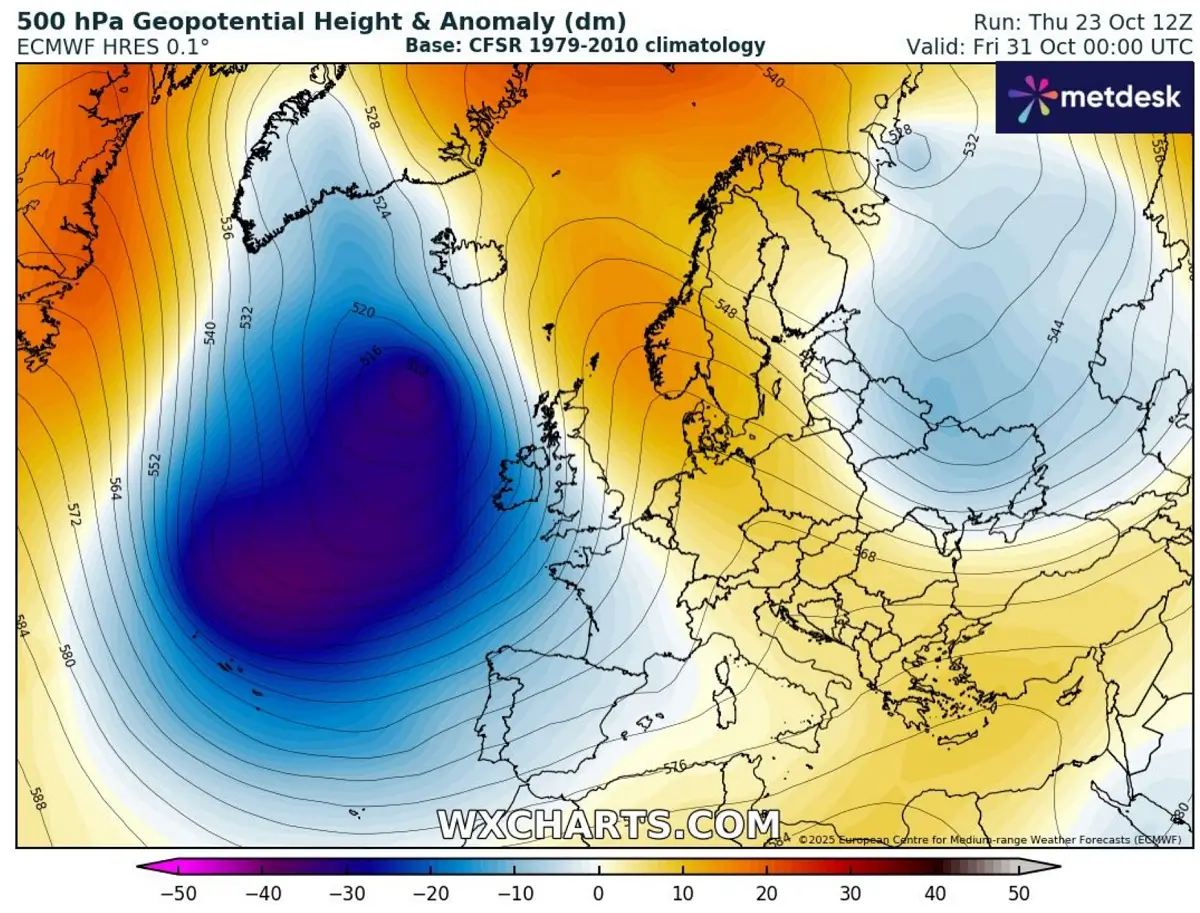
Towards mid-next week, the upper wave over Europe begins its weakening phase and accelerates towards the east, while the ridge over the North Atlantic finally collapses.
The pattern then begins to invert back, with blocking High building up over the continent and deep troughs coming back over the North Atlantic.
So, the final days of October 2025 bring back the typical zonal flow across the North Atlantic towards Europe. The deepening in the far North Atlantic allows the polar air mass from Greenland to drag south with time.
The weather pattern is about to flip sharply, allowing the establishment of deep troughs again. The general hint for the end of the month shows large, deep waves dominating the North Atlantic. A warmer air mass is spread onto the continent ahead of it as the southwesterly flow re-establishes.
The trends suggest that the typical autumn weather pattern will expand into early November. From past experiences, we know these patterns lead to multiple frontal waves crashing across Europe from west to east, bringing periods of excessive rainfall and increasing the flood risk.
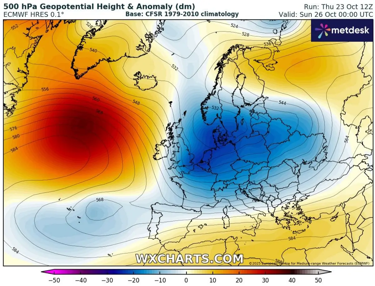
Mid-next week pattern flip – A deepening upper wave over the European continent
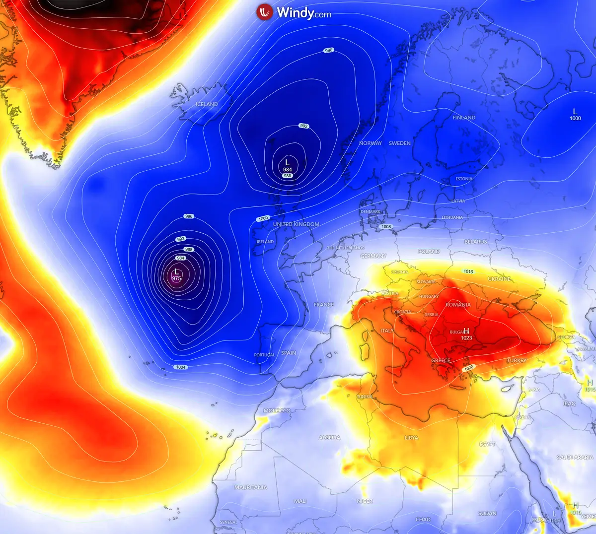
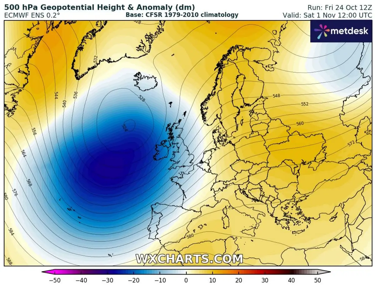
As trends for the final week of October suggest, a significant deepening of the geopotential heights will follow over the North Atlantic. Colder upper levels will translate towards the surface, developing intense surface lows.
These lows will move along the waves that’d eject towards the continent.
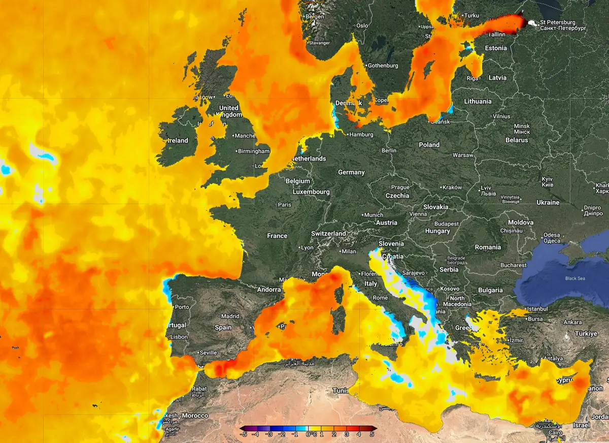
Intense and persistent warm advection will develop over the continent ahead of the deep troughs over the Atlantic. Most of continental Europe will see average temperatures above normal, which could locally become extremely warm for early November.
The most significant warm plumes will follow ahead of each frontal system that develops and ejects off the main large Atlantic wave. Nonetheless, the warmest air mass is forecast across the south, southwest, west, and central Europe.
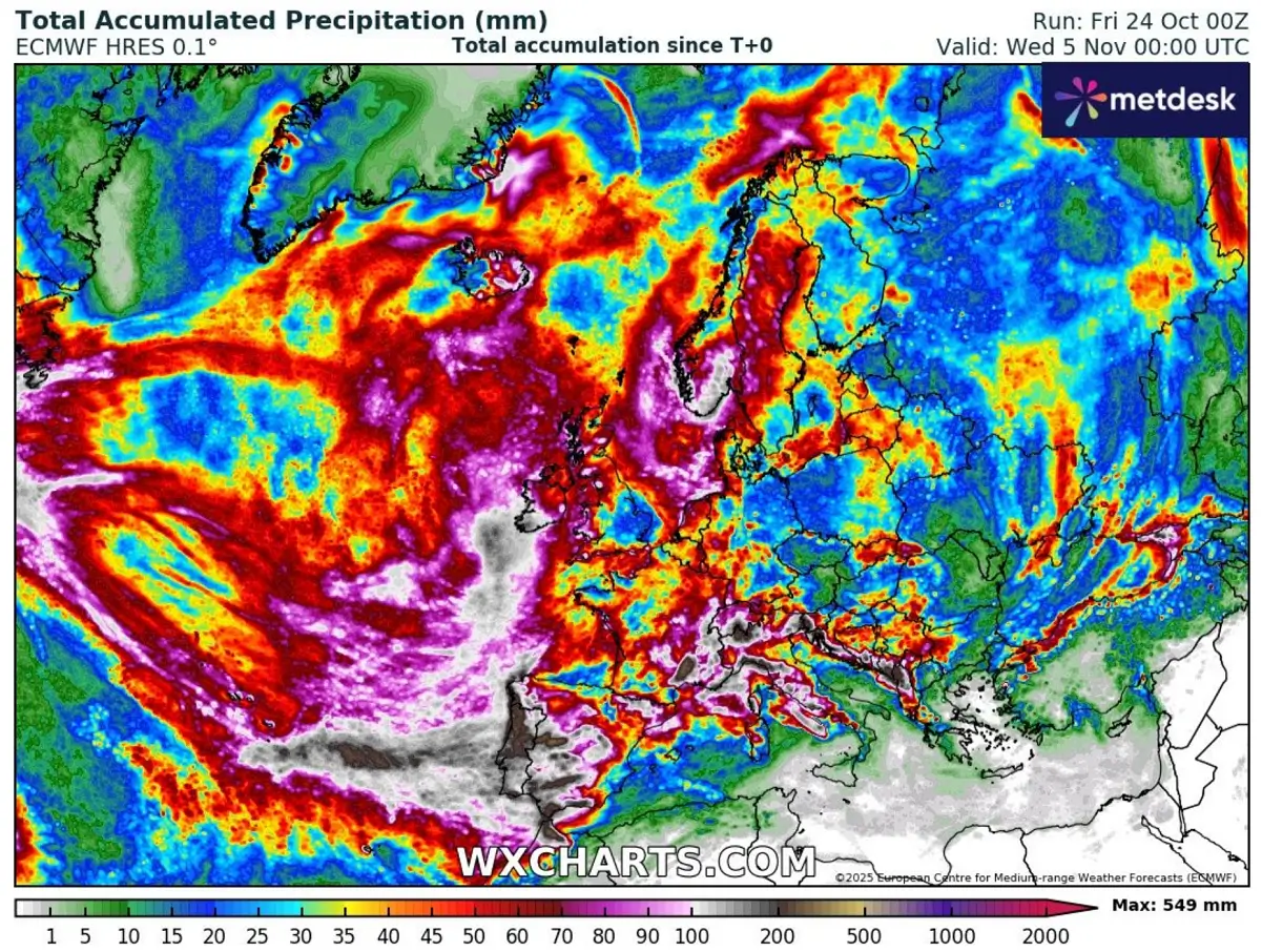
The upper wave and ridge to its east typically bring a powerful zonal flow rounding the deep troughs over the Atlantic. This results in excessive daily rainfall, especially where orographic precipitation has the most effect.
This means along the south-southwest slopes of mountain ranges, such as the Pyrenees, the Alps, the Apennines, the Dinaric Alps, the Scottish Highlands, and western Iberia.
While details regarding the exact amount of rain over the next 10 to 14 days are impossible to predict, the high potential is established given the favorable pattern shaping up. Rainfall accumulations will reach 100s of millimeters in some regions, leading to a risk of flooding.
So, to conclude, if we look closely at the final days of October and early November, the agreement of the ensemble model forecast is quite good. On the large scale, a major upper-level wave is increasingly likely to form over the Atlantic and spread a warm and moist air mass onto the continent.
What typically occurs with these types of autumn patterns is the secondary waves ejecting off the main large wave, spreading well-developed frontal systems across the continent. So, the rainfall event may not occur every day, but multiple lows with fronts are likely to cross west to east over the next 10 days.
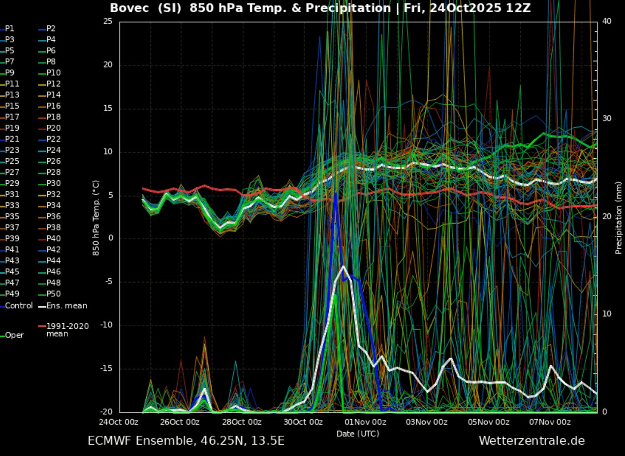
Here is an EPS (ensemble ECMWF weather model) meteogram forecast for the southern Alps, specifically for Bovec in northwest Slovenia. This is a classic region where excessive orographic rainfall develops in situations like the one we are facing.
Temperatures will remain near or slightly above the long-term average, meaning warm advection will be significant and persistent. The bottom part of the chart represents precipitation, and the upcoming period could become extreme with abundant rain to follow.
In the coming days, we will provide further updates on the pattern’s evolution and these potentially dangerous weather trends, so stay tuned for the latest forecasts.
Wxcharts and WeatherBell provided images for this article.
See also:
A rapidly developing low moves across southern England on Wednesday night