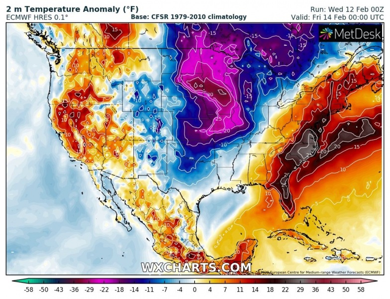
Quite significant Arctic cold outbreak is foreseen across southern Canada into the northern half of US, starting today and gradually spreading across the Great Lakes into the northeast US by Saturday. Some snow will also occur across the Great Lakes and Ohio valley, but nothing too significant.
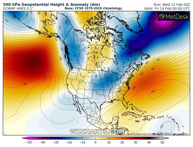
The current pattern across the North American continent indicates strong ridging over the North Pacific and east of the US. In between, the upper long-wave trough is located across the CONUS and will result in the Arctic blast from Canada into north and the northeast US.
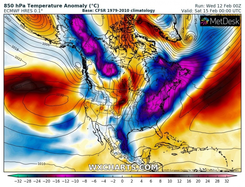
We can see the airmass is delivered directly from Arctic Canada far south across the US, partly even reaching the Gulf of Mexico, indeed not too strong there. The main core remains over the Great Lakes region. The Arctic outbreak will be gradually spreading east, delivering very cold airmass into north and then into the northeast US.
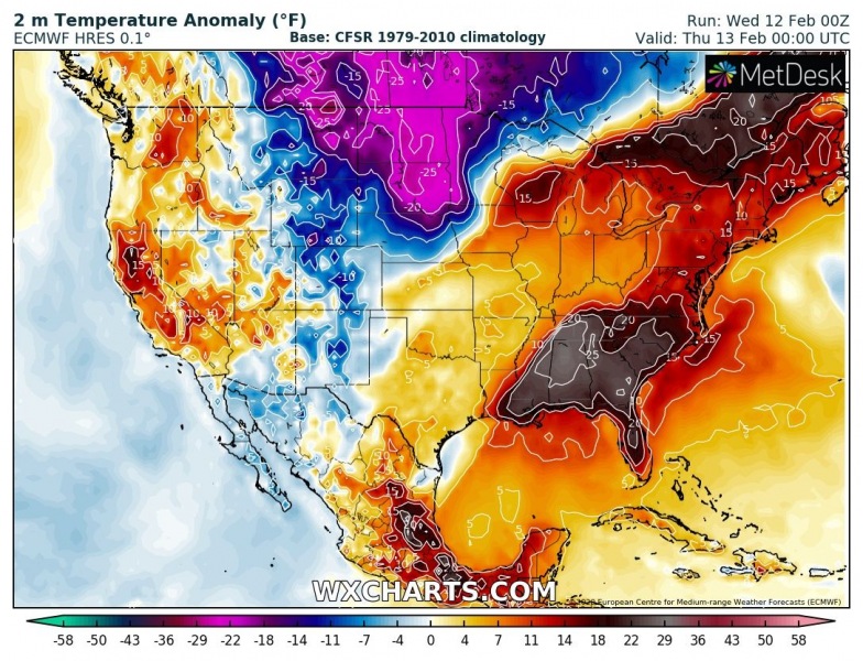
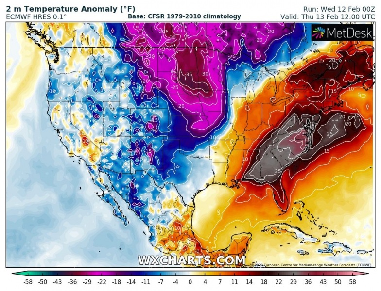
Near surface temperature will be much colder than normal for mid-February, models are hinting even more than 30 °F colder than average during the peak Arctic blast. Here is the 2m temperature anomaly from today through Saturday across the CONUS. Extreme anomaly is expected across Dakotas, likely pushing temperatures below -20 °F / -30 °C in the morning hours!
Close-up view of the 2m temperatures across the north US on Thursday and Friday:
Close-up view of the 2m temperatures across northeast US from Thursday through Saturday:
Some snow is also expected across parts of Midwest, Ohio valley into the northeast US, although no significant amounts are expected.
Meanwhile in the Atlantic… a very powerful extra-tropical cyclone is developing tonight:
Here is the animation of wind gusts by ICON-EU model, with violent winds expected across the North Atlantic in the coming days.

