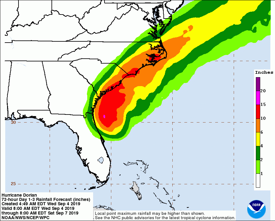
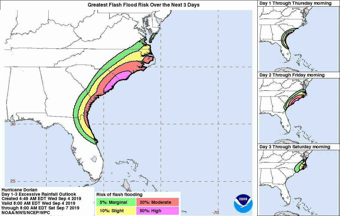
Hurricane Dorian continues tracking north, just east of Florida peninsula while its convective rain bands are resulting in tropical storm force winds along portions of the northeast coast of Florida. Dorian will gradually move north through the next 24 hours and will likely closely approach the coast of South Carolina tomorrow evening.
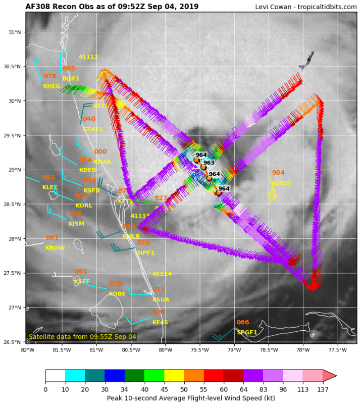
The latest satellite animation indicates still healthy bursts of deep convection around the eye while the latest NOAA Hurricane Hunters data confirms Dorian remains a powerful system with around 105 mph winds and central pressure leveled off near 963 mbar.
#hurricane #Dorian early this morning still has an impressive structure despite the eyewall looking less organized. Bursts of deep convection are visible in all quadrants. It continues moving north towards the Carolinas. Stay tuned for an updated forecast soon. @tropicaltidbits pic.twitter.com/TnoRYxOqQK
— severe-weather.EU (@severeweatherEU) September 4, 2019
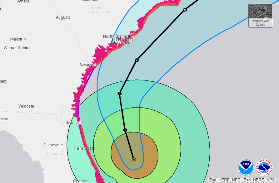
Here is the forecast track until Friday, indicating Dorian’s track will be very near the coast of South Carolina tomorrow (Thursday) evening, meaning the hurricane-force winds will likely be pushed ashore. It is not clear yet if Dorian will make landfall or will be traveling just offshore with its center. This option would actually create even higher risk as the hurricane would remain stronger than it’d be after making landfall.
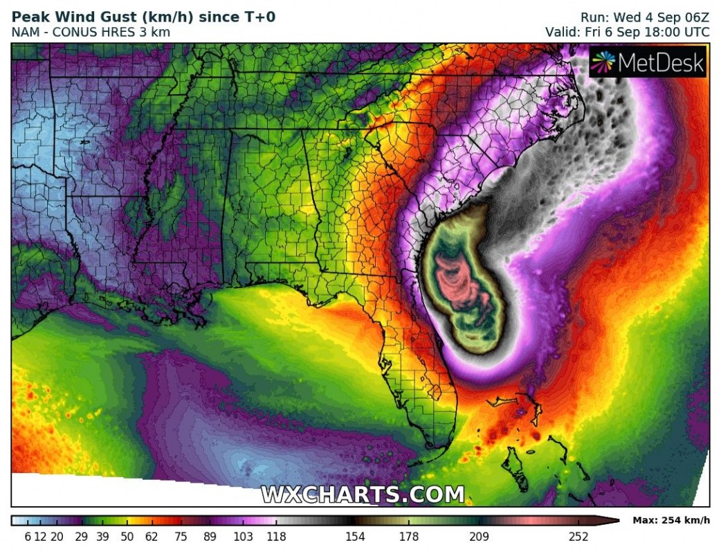
Peak winds are expected to gradually continue as a CAT 3 strength, however, some models are hinting some intensification of Dorian before it nears South Carolina tomorrow evening local time.
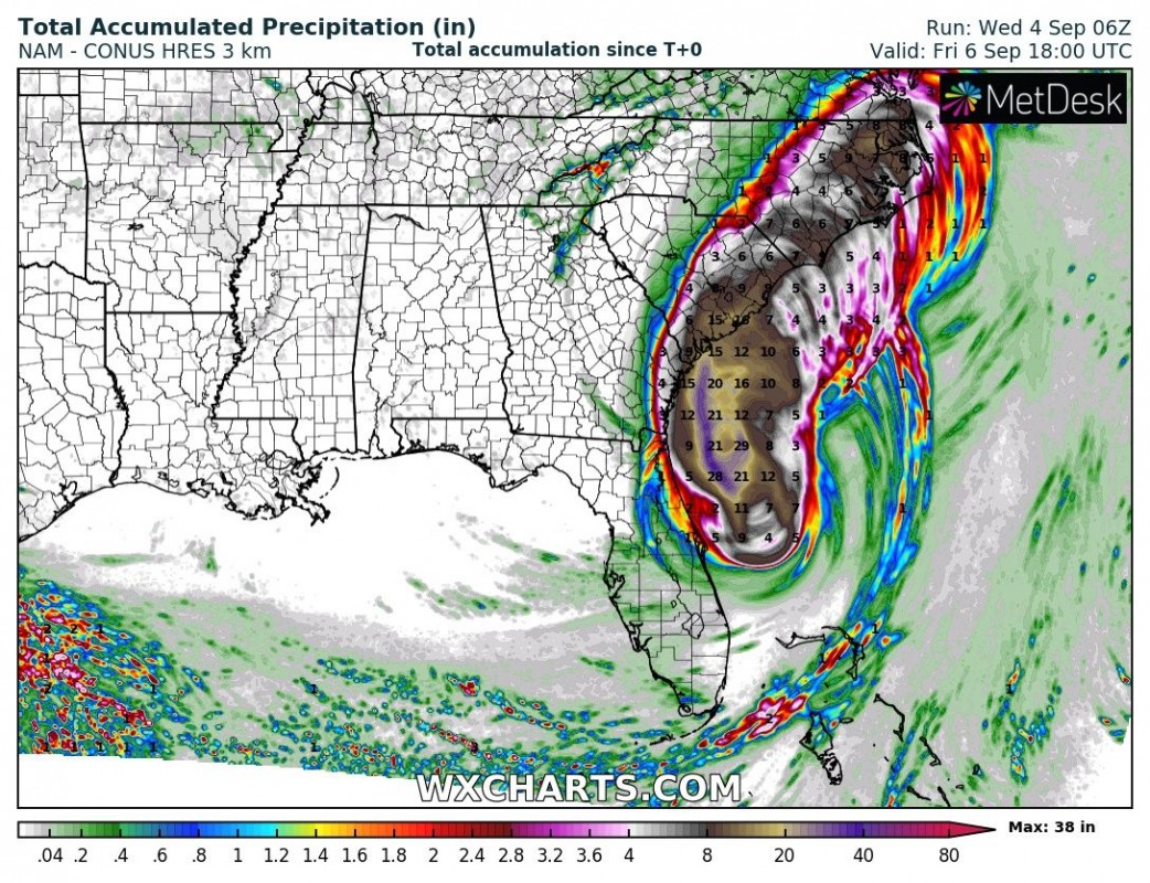
Huge amounts of rainfall will likely result in coastal areas of both Carolinas, 15-20 inches or locally even more! A significant risk of flash floods is expected.
We continue monitoring Dorian’s evolution and will be posting updates later today – stay tuned!
