SYNOPSIS
A powerful upper ridge (Omega blocking pattern) dominates west-central Europe, resulting in a record-breaking heat wave over France. A deep upper low is located just W of Iberia, while a deep trough with a surface front is moving across W Russia and E Europe.
DISCUSSION
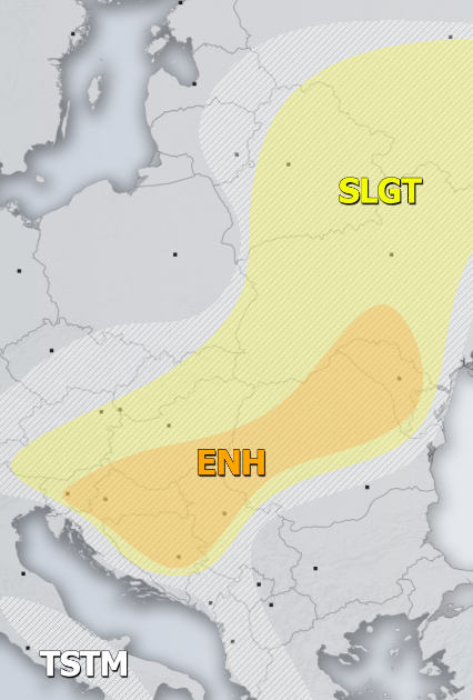
ENH / SLGT risks have been issued for north-central Balkan peninsula into Ukraine, Belarus and W Russia with threat for severe storms, capable of producing severe winds, large to very large hail and torrential rainfall. Scattered convective activity is expected along the cold front moving across the eastern half of Europe, fueled by strong to extreme instability under weakly to moderate shear. Supercells are likely as well, posing threat for locally very large hail. Clustering of cells is also possible in the evening hours with mainly severe damaging winds threat.
SLGT risk has been issued for Georgia and NE Turkey with threat for severe storms, capable of producing severe winds, torrential rainfall and marginally large hail.
TSTM risk areas have been placed where convective storms are likely to occur but should remain sub-severe.

