VALID FOR 12-10-2018
SYNOPSIS
An extensive ridge dominates eastern and northern Europe while a deep long-wave trough is located over the north Atlantic ocean. An intense vorticity maximum / deep low is embedded in the eastern side of the trough and rapidly moves north just west of the British Isles and Ireland on Friday. At surface level, a rapidly deepening cyclone is associated with the upper low and develops a powerful windstorm on its front side.
DISCUSSION
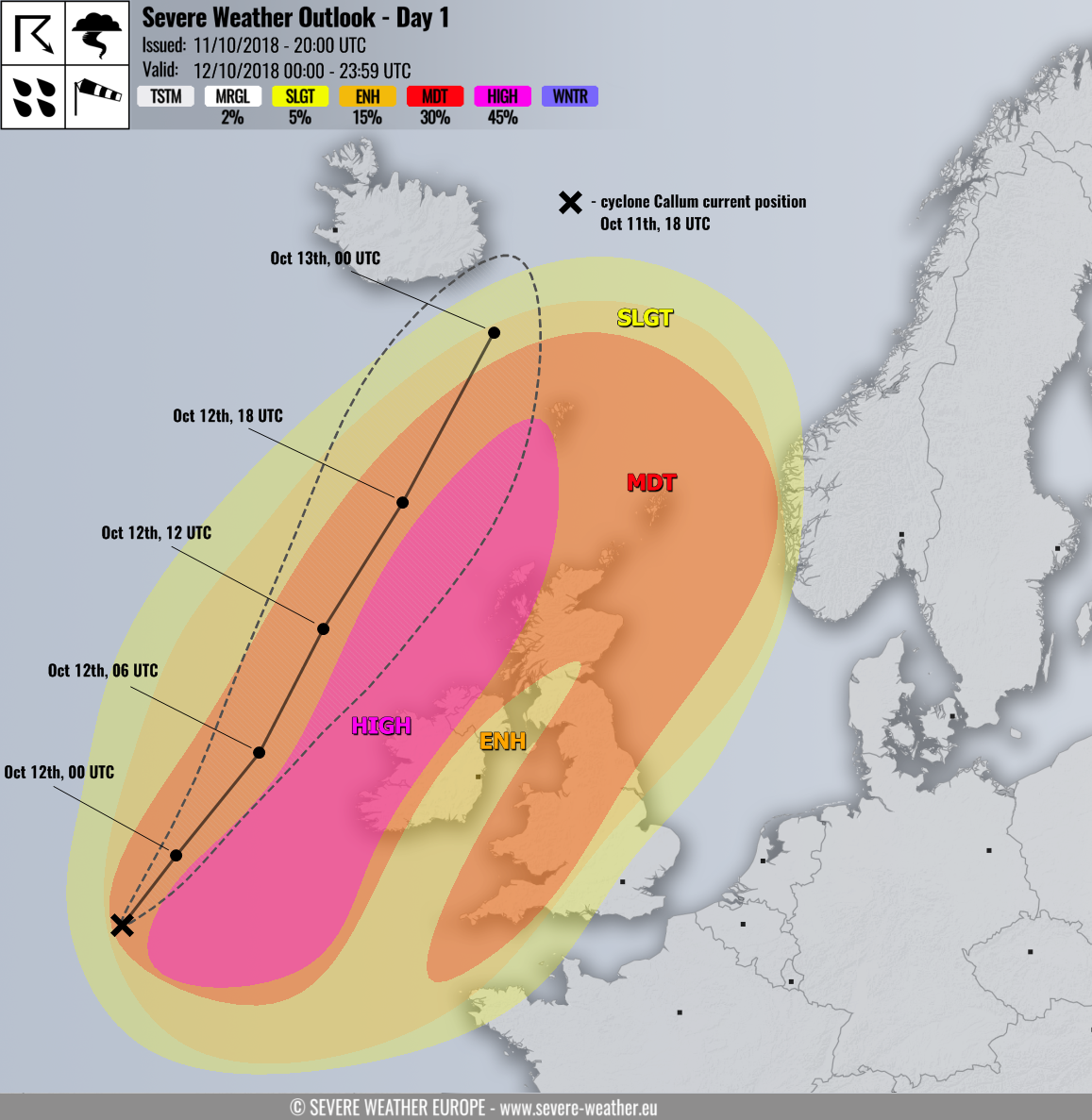
HIGH risk has been issued for western half of Ireland, western Northern Ireland, extreme western Scotland and westwards into the north Atlantic region with threat for extremely severe winds in excess of 140 km/h. A very powerful windstorm associated with cyclone Callum is expected and it could bring locally destructive winds. While the cyclone’s center is expected to remain far from the land areas, there is a quite high probability of ‘sting jet’ development from the early morning into the midday hours. These jets often bring much more intense peak gusts than usually expected by such cyclones, so gusts up to and even above 150 km/h cannot be ruled out. Note that higher elevations should experience the strongest winds and could locally reach 180-200 km/h peak gusts (e.g. Cairngorm in Scottish Higlands).
MDT risk has been issued for areas surrounding the HIGH risk including west-central Ireland and North Ireland, north Atlantic, most of Scotland, Faroe islands as well as north England and Wales with threats for severe to extremely severe winds with peak gusts up to 120 km/h. While the western and northern part of MDT risk get the main activity during the cyclone’s passage, the area across England receives another wind maximum during the afternoon hours, extending into the North Sea as well towards the evening.
ENH/SLGT risks have been issued for areas surrounding the HIGH/MDT areas with threat to severe winds which could locally bring guts up to near 100 km/h on the most exposed locations.
Please refer to the mesoscale discussion for more details: