SYNOPSIS
A large deep low is located over WSW Europe, with a shallow upper low over E Mediterranean and Turkey. Strong ridge persists across ENE Europe.
DISCUSSION
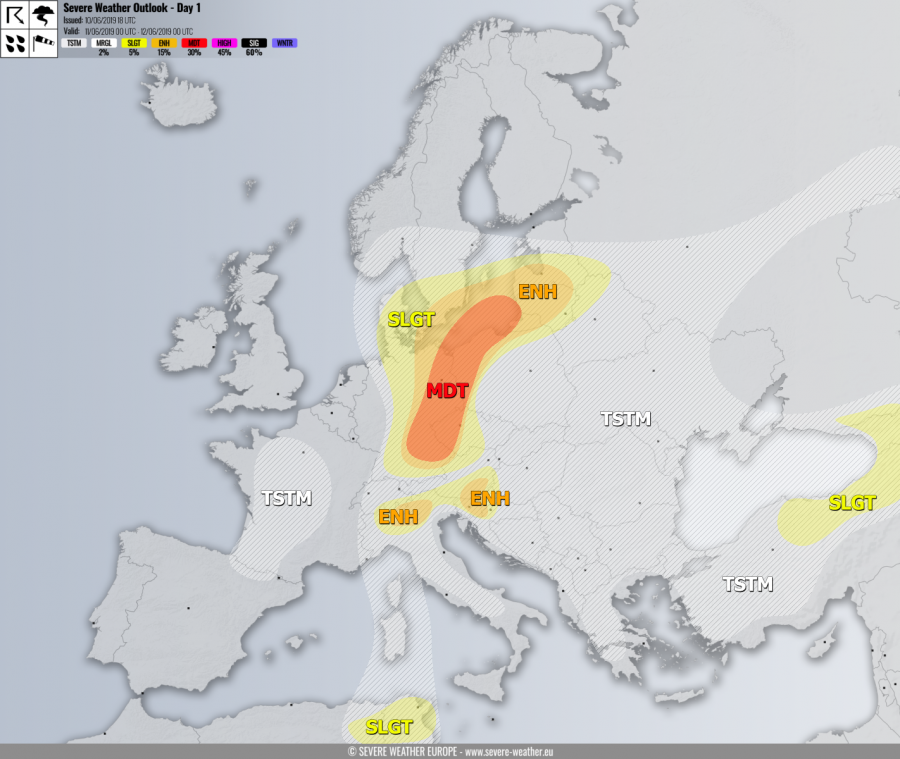
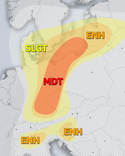
MDT / ENH / SLGT risks have been issued for E half of Germany, extreme S Sweden, W-CNTRL Czech Republic, N Austria into W/N Poland and Baltic states with threat for severe storms, capable of producing severe winds, torrential rainfall, large to very large hail and tornadoes. While tornado threat seems mostly limited to the northern half of the risk areas where E-SE-erly LL wind profiles are better defined for enhanced SR helicity, very large hail will be the primary threat further south and west with discrete supercell storms. Some clustering into MCS or two seems likely again in the evening hours across NE Germany and towards the Baltic region.
ENH / SLGT risks have been issued for N Italy, S Austria, E-CNTRL Slovenia and N Croatia with threat for severe storms, capable of producing large to very large hail, severe winds and torrential rainfall. Mostly isolated organized storms are expected to develop by mid-afternoon within strongly unstable and moderately sheared environment. Supercells with very large hail are likely. The eastern half of the risks should see slow-moving storms, so flash floods threat will locally develop as well. Upslope flow over N Italy could also enhance excessive rainfall threat.
SLGT risk has been issued for N Tunisia with threat for isolated severe storms, capable of producing large hail, severe winds and torrential rainfall.
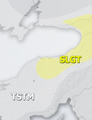
SLGT risk has been issued for NNE Turkey into Georgia with threat for severe storms, capable of producing large hail, severe winds and torrential rainfall.
TSTM risk areas have been placed where convective storms are likely to occur but should remain sub-severe.


