VALID FOR 07-03-2017
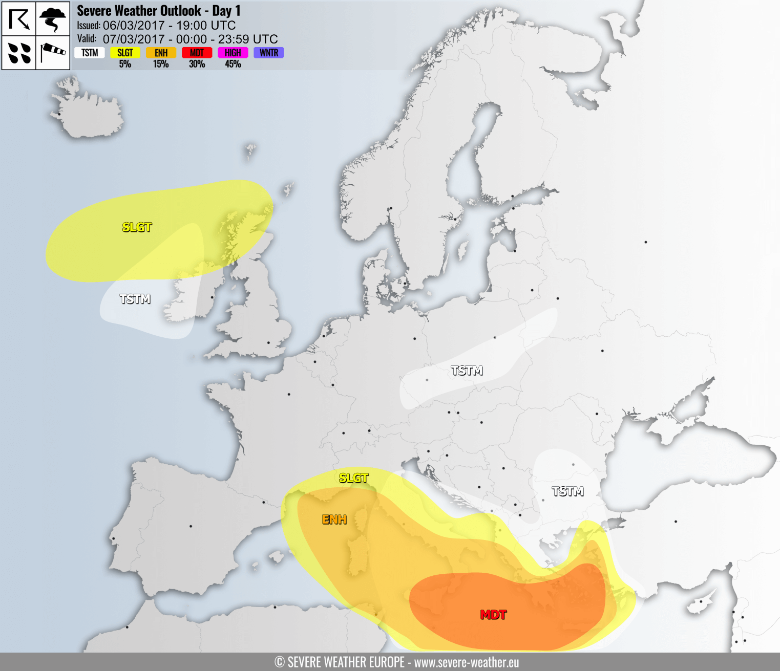
The deep low pushes across the N-CNTRL Mediterranean, with a trailing strong windstorm. Severe thunderstorms form along the frontal line crossing the central Mediterranean. A deep cyclone affects northern parts of the British Isles and Ireland with severe winds.
A MDT risk has been issued for the central Mediterranean, including parts of S Italy, Malta, S Greece, southern Aegean sea and Crete Island for severe thunderstorms, including supercells, with threats for torrential rainfall, severe winds, large hail and tornadoes. Expect significant storm coverage with a QLCS forming along the frontal line.
ENH/SLGT risk has been issued for N-CNTRL Mediterranean, Corsica, Sardinia, parts of Italy, parts of Greece, the southern Aegean sea and extreme W Turkey. The part over N Mediterranean, Corsica, Sardinia and the Tyrrhenian sea is for severe wind gusts up to 100-130 km/h. The central and eastern part of the ENH/SLGT risk areas is for thunderstorms with threats for torrential rainfall, severe winds, large hail.
A broad TSTM risk has been issued for central Mediterranean, central and southern Italy, the Aegean and part of the Balkans for thunderstorms below severe threshold. Main threats with these storms include locally strong winds and torrential rainfall.
A TSTM risk has been issued for parts of the Czech Republic, extreme SE Germany, S Poland and SW Belarus for thunderstorms below severe threshold. Main threats with these storms include locally strong winds and torrential rainfall.
A SLGT risk has been issued for northern parts of the British Isles and Ireland for severe winds gusting up to 100-120 km/h.
A TSTM risk has been issued for W Ireland.
