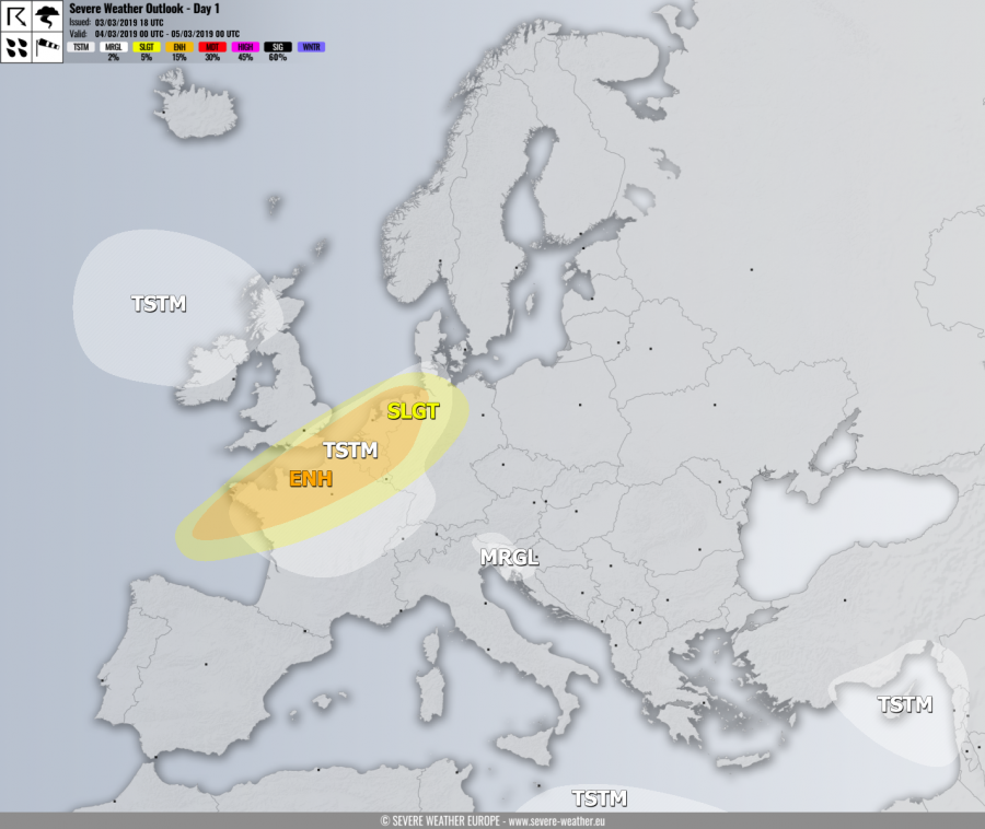
VALID FOR 04-03-2019
SYNOPSIS
The upper ridge across central Europe diminishes as a deep trough is pushed from western Europe towards the east. The ridge remains over southwestern Europe and the Mediterranean. The upper low remains over the eastern Mediterranean region and the Middle East.
DISCUSSION
ENH risk has been issued for the English Channel, north France, Benelux and northwest Germany with threat for severe storms capable of producing severe winds, marginal hail and torrential rainfall along the leading cold front through the morning hours. Peak gusts could locally reach 100-120 km/h or become extremely severe (above 120 km/h) in the northwest France. Given the strong shear and helicity in place, discrete supercell storms could support tornado risk as well.
SLGT risk has been issued for areas surrounding the ENH risk including southern England, central France and parts of west and north Germany mainly with threat for severe winds up to 100 km/h.
MRGL risk has been issued for northeast Italy, south Austria, west Slovenia into northwest Croatia with threat for isolated severe storms, capable of producing strong to severe winds and torrential rainfall. Marginal hail cannot be ruled out either.
TSTM risk areas have been placed across parts of western Europe, north Atlantic and eastern Mediterranean where storms are likely to occur, but should remain sub-severe.
