GFS and ECMWF model guidance are currently in good agreement on the new tropical depression that may affect the British Isles and Ireland. Invest 92L, as the depression is currently designated, may strengthen into a strong storm to hurricane force cyclone as it crosses the Atlantic and approaches Ireland and UK.
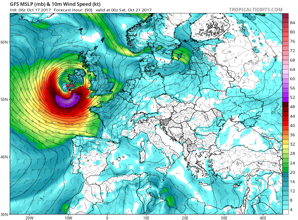
GFS model guidance for mean sea level pressure and peak wind gusts late Friday/early Saturday. Map: TropicalTidbits.com.
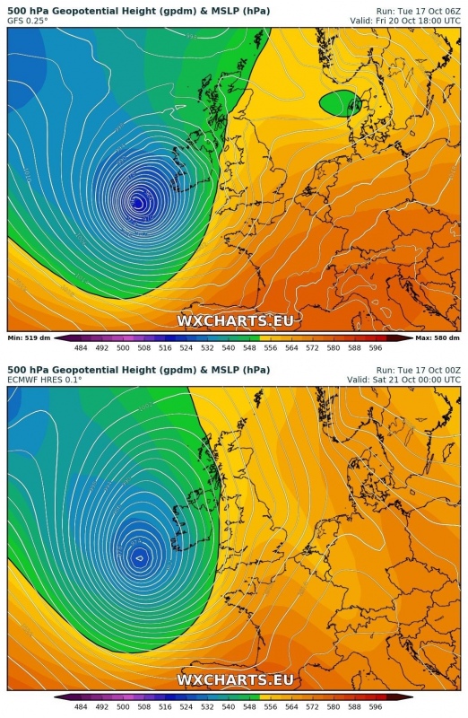
At this time, GFS model guidance indicates a very deep cyclone with central pressure approaching 960 mbar and peak wind gusts of 120-130 km/h around potential landfall. ECMWF indicates an only slightly weaker system at 970 mbar central pressure.
Comparison between GFS and ECMWF model guidance in mean sea level pressure. Maps: Wxcharts.eu.
GFS model guidance for peak wind gusts as the system develops. Maps: Wxcharts.eu.
Currently it is too early for detailed forecasts regarding the exact path of this potentially intense windstorm and future model runs may change significantly, but the system definitely warrants monitoring. Below is the ensemble forecast from the GEFS model for the next 5 days where trends are towards the direct hit for the British Isles where cyclone could move into Ireland or SW England. Stay tuned for further updates.
GEFS model ensembles forecast for the next 5 days. Maps: Tropicaltidbits.com.


