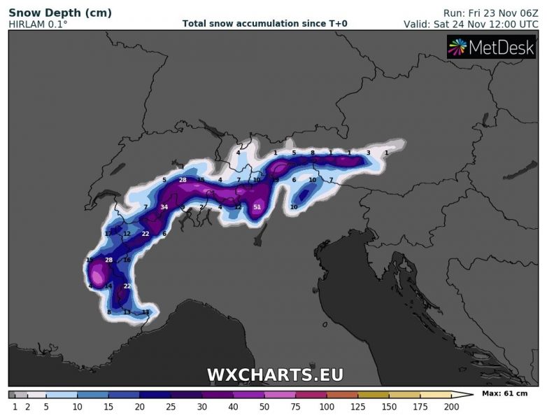
A new round of snow is coming for parts of the Alps on Friday and early on Saturday. Western Alps get the most snow, locally over 50 cm at higher altitudes, and progressively less further to the east. We take a closer look.
Strong snowfall is already ongoing across the Alps of NW Italy and will be moving progressively eastwards through the day and early tomorrow, while gradually diminishing. The snow limit will be at about 1200-1400 m elevation across the SW Alps and significantly higher, around 2000 m or even higher in the southern Alps of N-NW Italy and NW Slovenia. A total of up to about 50 cm of fresh snow is expected at higher elevations in NW and N Italy. Consult the maps below for details.
Snow depth early afternoon on Saturday. ARPEGE model guidance. Map: Wxcharts.eu.
Snow depth early afternoon on Saturday. HIRLAM model guidance. Map: Wxcharts.eu.
Snow depth early afternoon on Saturday. AROME model guidance. Map: Wxcharts.eu.
See also:
https://www.severe-weather.eu/calendar-2019/
Torrential rainfall, severe thunderstorms for parts of NW Italy today – November 23, 2018


