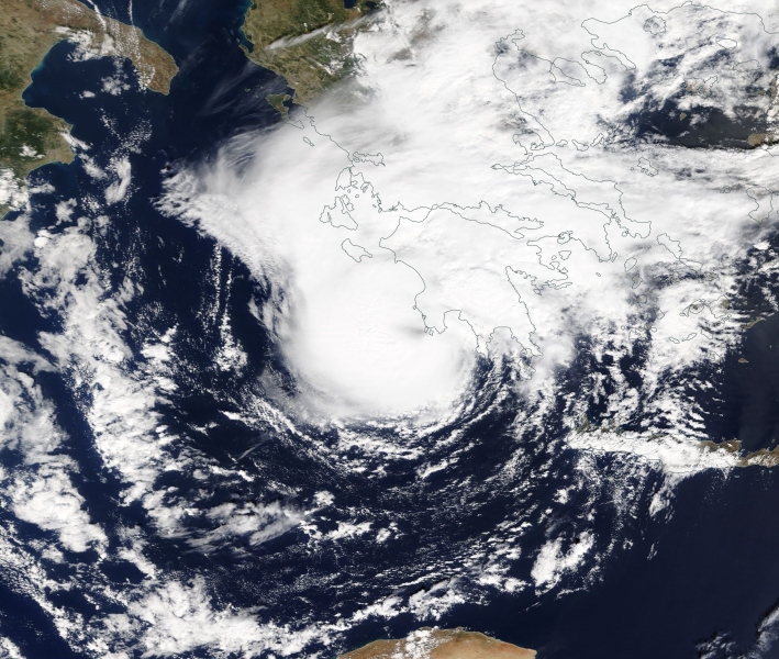
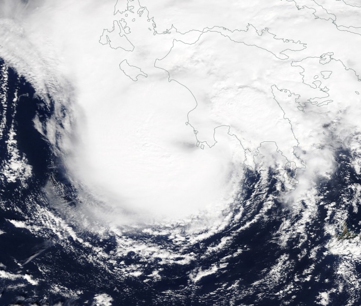
As expected, the Medicane is making an intense landfall in SW Peloponnese right now, its centre is just west of the Kalamata city. A very impressive satellite presentation reveals an intense ongoing inner core deep convection. The cyclone does show tropical characteristics – a warm core, intense convection around the centre and cirrus outflow in the upper levels! Just an incredible evolution of this cyclone! Its future track is mostly on track with previous thinking – medicane will travel ENE until late evening today and cross just south of Athens and north of Cyclades islands before it enters the western Aegean sea and turns NE towards extreme NW Turkey. Threats for severe damaging winds, high waves and torrential rainfall with intense flash floods remain in place.
Midday visible satellite image – notice the exceptionally impressive structure with an intense inner core deep convection. The system shows tropical characteristics – a warm core, intense convection around the centre and cirrus outflow in the upper levels!
https://www.facebook.com/severeweatherEU/videos/313358652579910/
Surface pressure analysis reveals a likely mean sea level pressure of slightly below 991 mbar in centre of the Medicane, confirmed also by weather stations in the city of Kalamata, with Greece SYNOP data at 10 UTC timeframe, 12:00h local time indicating – Temperature 21 °C, Relative humidity 83%, sustained winds of 35 km/h, gusts 65 km/h from SE direction, pressure 996 mbar. Steep pressure gradient to the eye of the system!
The future track remains almost the same as based on the evening updates yesterday, please refer to our detailed forecast there and a special outlook – a HIGH risk has been issued for the region due to expected high threat for dangerous flash floods!
Evening update on the Medicane: landfall in Peloponnese tomorrow afternoon, Sept 29th
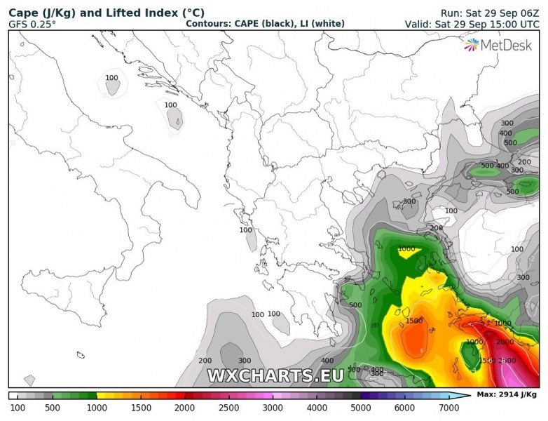
Instability ahead of the low across the Aegean sea suggests the deep convection will be maintained through the day. Isolated severe thunderstorms, including supercells could develop. The strongly enhanced wind field with curved low-level hodographs could support tornadic storms!
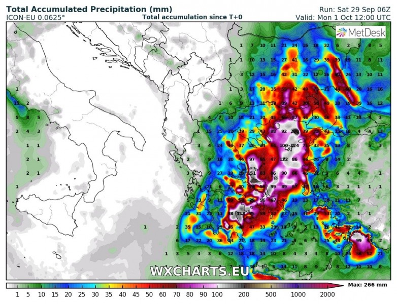
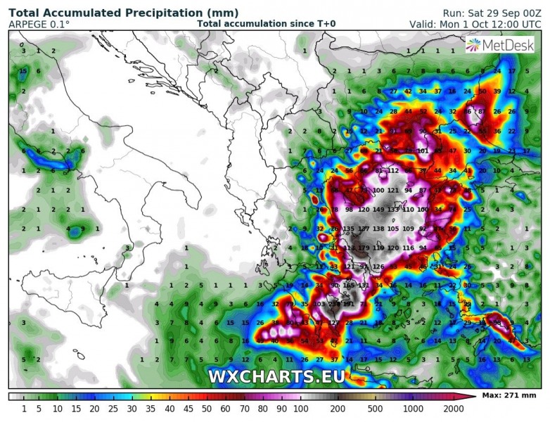
Rainfall amounts are expected to bring widespread flash floods as 250-300 mm total rainfall remains increasingly likely until tomorrow evening (36-hour period) in some areas.
We will continue monitoring this system throughout the day and tomorrow – stay tuned!
