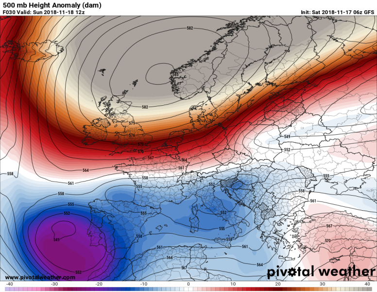
A deep cutoff upper low will make its way across the SW part of the Iberian peninsula, bringing unsettled weather with rain showers and thunderstorms to the region. Locally intense storms will produce persistent torrential rainfall, resulting in locally 100+ mm of rainfall over the next 48-72 hours.
Major cutoff low over extreme SW Europe at noon on Sunday. Map: PivotalWeather.
The cutoff low moves from its current position west of the Iberian peninsula across its southwestern part into the western Mediterranean and extreme northern Africa (N Morroco, NW Algeria). Persistent westerly flow will advect moist, warm airmass into the coastal area of Spain and SW France, producing combined convective and orographic rainfall. Further intense rainfall is expected with frontal storms as the system moves across the region.
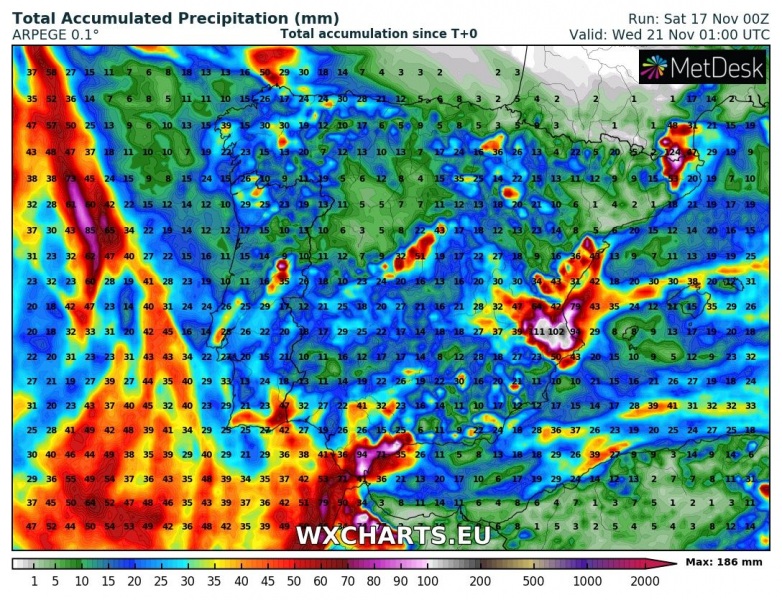
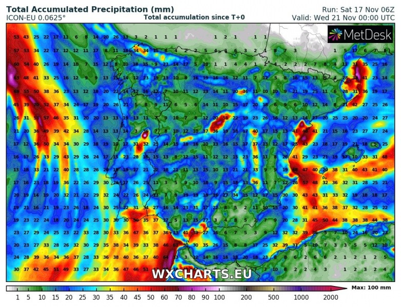
Locally up to 150-200 mm of rainfall is expected in parts of Spain and extreme SW France. These high values will be localized and much of the region will likely see much less rainfall. In places where these high rainfall totals happen, significant flooding is expected.
Rainfall totals until early on Wednesday. ARPEGE model guidance. Map: Wxcharts.eu.
Rainfall totals until early on Wednesday. ICON-EU model guidance. Map: Wxcharts.eu.
Rainfall totals until mid-afternoon on Sunday. AROME model guidance. Map: Wxcharts.eu.


