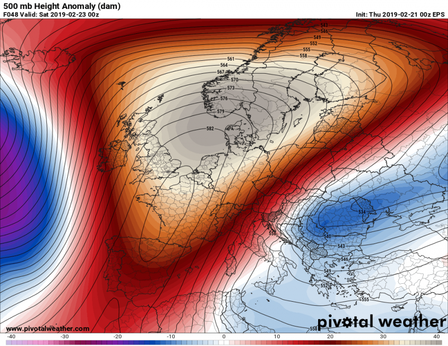
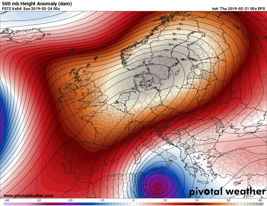
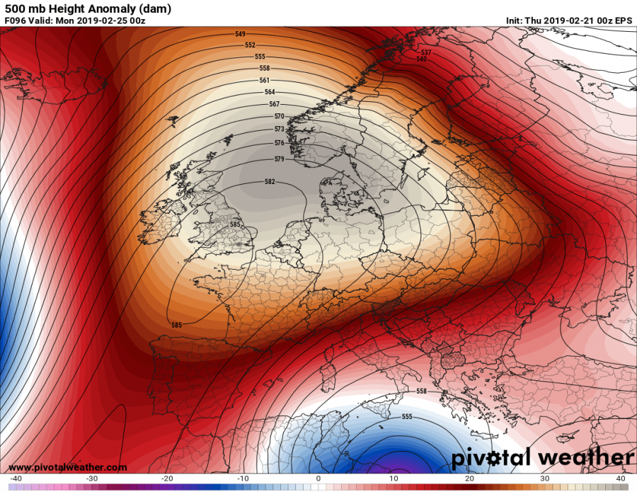
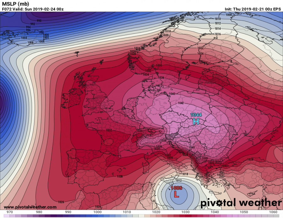
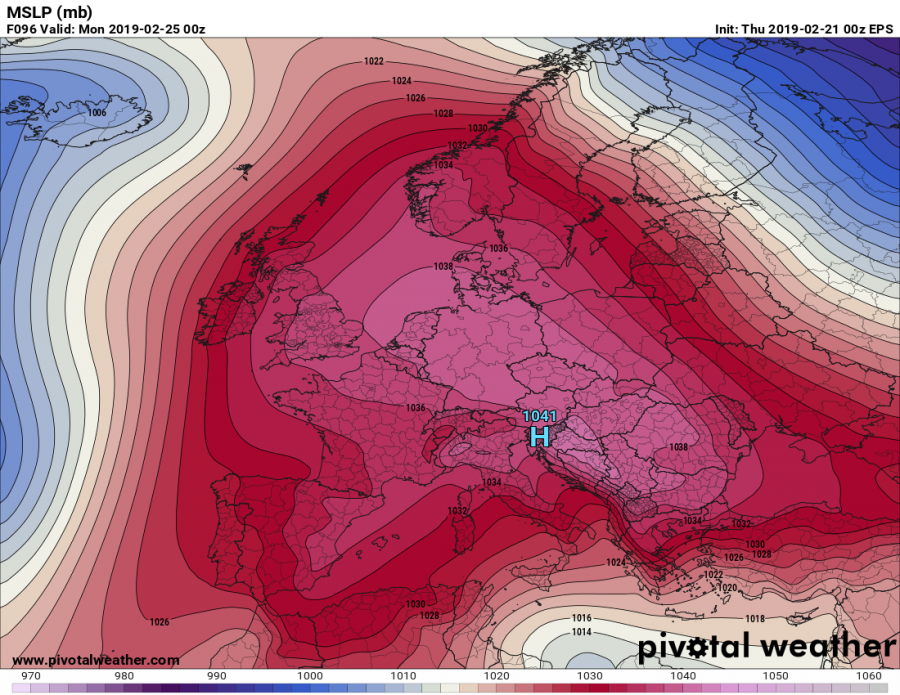
The extensive upper ridge across Europe will strengthen this weekend and result in a very powerful high pressure system. Surface pressure readings should exceed 1045 mbar in parts of eastern and northeastern Europe!
Analyzing the 500 mbar charts, we can notice a very strong upper ridge with geopotential heights much above normal. Subsidence within the ridge causes the surface pressure rising and therefore it could develop a very strong high pressure system at the surface.
no images were found
An extensive high pressure system will develop this Friday when the ridge begins strengthening and peaks on Saturday. Surface pressure should well exceed 1040 mbar across east/northeast Europe with its center near 1047 mbar over Poland on Saturday, spreading south towards the Balkan peninsula on Sunday and gradually weakening on Monday.
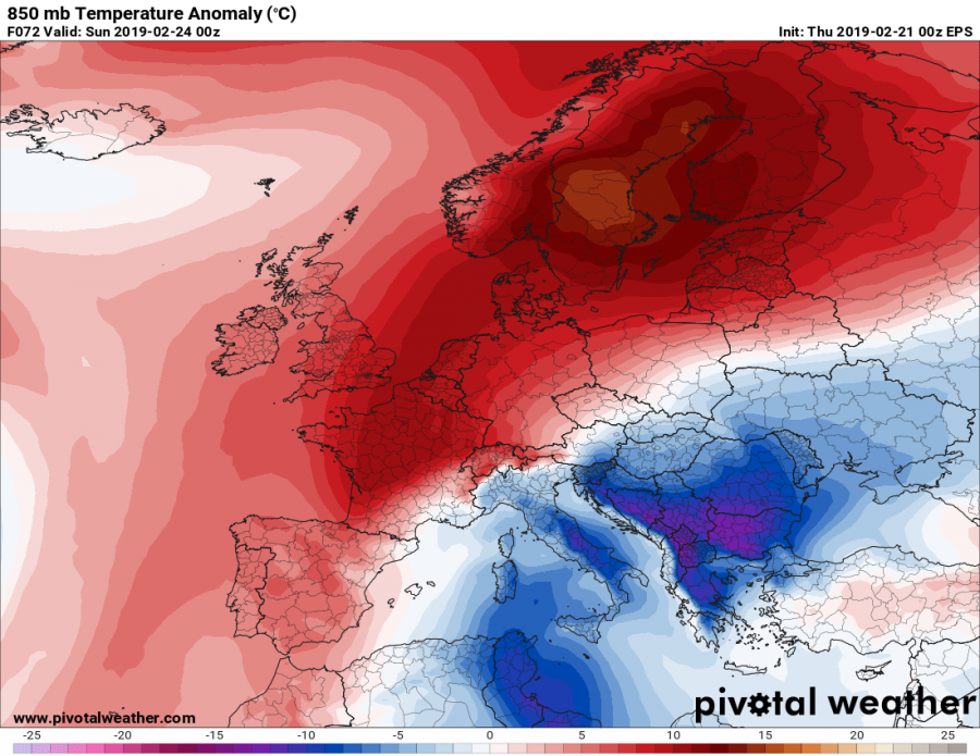
Indeed, subsiding airmass also causes the warming of air parcels which can be very well visible in the 850 mbar temperature maps. The warmest airmass is expected across the Arctic region, but also across northern and western Europe. Notice also the cold advection across SE Europe, drifting south along the eastern flank of the ridge / high pressure system – a significant cold outbreak develops there.
See also:
Strong warm advection across the Arctic region and northern Europe this weekend, Feb 22-24th
